

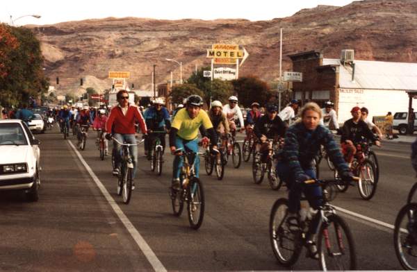
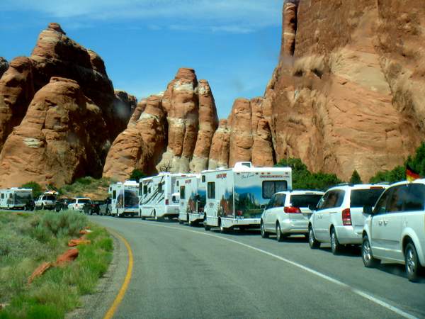
By April 1st tourist season in Moab is in full swing. With Easter as early as it can get this year the season starts off with a roar during March with a series of smaller weekend events and then the mother of all events, Easter Jeep Safari.
It’s a tired old joke I first heard in 1992 or so:
“How do you know it’s spring in Moab?”
“The license plates turn green”
This joke made me groan then, and I groan now, though for slightly different reasons. And living in downtown Moab I can say it never slowed down much this past winter, especially for a winter when the ski resorts were open and skiing was good.
With fuel at under $2 a gallon (even in Moab) I suspect this year we’ll have a doozy of a season. And with parking and lanes restricted on Main Street just north of 100 North, traffic downtown is going to be interesting come spring break and Memorial Day weekend.
Federal overreach, or an effort to cope with insane visitor numbers?
Impacts of a busy tourist season reach far outside Moab City and Spanish Valley limits. For the next few months I’ll be focusing outside Moab and Spanish Valley looking at land management topics and challenges, and how the changes in visitor numbers and use patterns have dramatically changed over the last 20 years.
 A series of new restrictions have been published in the Federal Register that impact users near Moab and Monticello. These rules were outlined in the 2008 Resource Management Plan (RMP) for this area, and were finally published on 02/25/2016 as official rules related to the Moab and Monticello Field Offices that go into effect on March 28th. Social media backlash to the Federal Register Notice was fast and furious with comments claiming that these rules would have negative impacts on everyone who uses federal lands in the Moab and Monticello areas – and disallow all kinds of legal activities and hurt small businesses, dog walkers and ATV users alike.
The Federal Register Notice can be found at https://www.gpo.gov/fdsys/pkg/FR-2016-02-25/pdf/2016-04065.pdf. It is 8 pages long, and outlines the planning process and public input process that led to these rules. The public process was not a short one. My primary complaint is that the scoping and public input all occurred in 2003 through 2007, with a final proposed Resource Management Plan provided for final public input in 2008; it is now 8 years after the RMP was approved, and only now are these rules are being adopted. It has taken over 10 years to tackle the massive increase in visitor numbers and the recreation impacts on the land around Moab. I understand that public participatory processes require time, but over 13 years from initial scoping to final rules seems a little longer than is necessary.
There are a few area wide rules, but most of the rules for the Moab Area related to camping, campfires, human waste and wood gathering are primarily focused on the extremely high use areas of the River Road (Hwy 128), Hwy 313 (the entrance road to Dead Horse Point and Island In the Sky), the Powerdam area of Mill Creek and a few other specified areas that are to be signed.
The “short” version of the rules and the areas that they apply is as follows. I have taken this directly from the Federal Register Notice Final Supplementary Rules for Public Lands Managed by the Moab and Monticello Field Offices in Grand and San Juan Counties, UT. I have simplified some of the area descriptions by removing references to township range and section for readability.
1) You must not burn wood pallets
2) You must not camp in archeological sites posted as closed to camping
3) You must not camp in historic sites posted as closed to camping
4) You must not operate a motorized vehicle or mechanized vehicle on any route, trail or area not designative as open to such use by a BLM sign, a BLM map or the Moab Field Office Travel Management Plan.
5) You must not gather petrified wood in the following two areas: i) The Colorado Riverway SRMA; and ii) High visitation sites within the Labyrinth/Gemini Bridges SRMA
6) You must not possess or use glass beverage containers in the following areas: i) Moab Canyon Sand Hill ….; and ii) Powerhouse Lane Trailhead, Lower Mill Creek and the North Fork of Mill Creek for a distance of one mile from the trailhead…
Arches. Memorial Day.
Rules 7 – 10 apply to the following areas:
- i) Utah Highway 313;
- ii) The Island in the Sky entrance road between …313 and Canyonlands;
iii)The Gemini Bridges Route (Grand Co Road No 118) and the spur route into Bride Canyon…;
iv)The Kane Springs Creek Canyon Rim route from US Highways 191 to where it crosses the eastern boundary of section 20, Township 27 S, Range 22 E, Salt Lake Meridian, exclusive of the State and private land west of Blue Hill in Sections 25,26,35 and 36;
- v) Lands within Long Canyon (Grand Co Road 135)…;
- vi) Lands along other sites of the US Highways 191 bounded by Arches National Park….
vii) Lands located between the upper end of the Nefertiti Rapid Parking area ….This includes all public lands between Nefertiti and Swaseys along Grand Co Road 154;
viii) Lands including Castle Rock, Ida Gulch, Professor Valley, Mary Jane Canyon, and the upper Onion Creek areas that are south of the Colorado Riverway SRMA, below the rims of Adobe and Fisher Mesas, and west of the private land in Fisher Valley;
- ix) Lands along the Potash Trail…;
- x) Lands located at the southern end of Spanish Valley located on the east and west sites of Us Highway 191 to the rim of the valley, south of the San Juan County Line to the Kane Springs Creek Canyon Rim Road;
- xi) Lands within the Mill Creek Canyon ACEC and Wilderness Study Area. Backpack type camping within the Mill Creek ACEC and WSA is allows at sites ¼ mile or farther from designated roads and greater than 100’ from Mill Creek and archeological sites;
xii) Lands within Desert Bighorn Sheep laming areas (46,319 acres) as shown on May 9 of the Approved Moab RMP.
7) You must not camp in a non-designated site
8) You must not ignite or maintain a campfire at a non-designated site
9) You must not dispose of human waste in any container other than a portable toilet
10) You must not gather wood
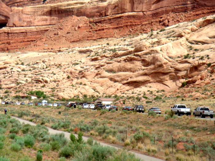
Most of the new rules only apply to specific areas where “an estimated 90% of the 1.8 million visitors to the Moab Field Office” end up. Furthermore, “Public lands that do not receive intense visitation and are not listed in this notice and the 2008 RMP/EIS will not be affected by the final camping rules”. The notice goes on to outline the reasons for these rules. Basic things like: no pallet burning because nails are left behind that “can cause physical injury to people and animals and property damage to vehicles” (especially since pallet fires usually are not confined in a fire ring or fire pan); not camping in archeologic and historic sites is important to protect these sites. These rules sound pretty basic and unnecessary to me, but seeing the immense increase in visitor numbers, and understanding that for many of these people they have no context for what is common sense to most of us who live here, these rules are unfortunately necessary.
Arches. Devils Garden Campground Road. 2015
Over 20 years ago, when I was a caretaker at Horsethief Ranch, the Mineral Bottom Road was well used compared to other routes out by Dubinky Well and 10 Mile, but not the super highway it is today. A couple came to stay at the ranch in July. They slept in until around 11 am, and right when I was wrapping up the outdoor chores for the day and starting to think about settling in for some indoor/shade tasks and an afternoon nap. They headed out the kitchen door and announced they were going for a run. I mentioned that it was the heat of the day and that they should take care to bring water and not go far, and proceeded to finish fixing lunch, eat it and lie down for a rest on the front porch. I also suggested they take the dogs for company, and that they could always follow them home. The couple rejected the suggestion to bring water, but the dogs didn’t give them much choice but to take them along.
Around 2 pm I woke to a wet nose in my face, followed by a lick and whine. I sat up, realized that the couple had not returned with Jade and Jazz, but the dogs has sensibly returned home. I put out water for the dogs, and then got into the Jeep and took off down the road, hoping that I’d find the couple soon.
I picked them up a couple miles out from the ranch – they had gotten lost, saying that there were no landmarks and they got confused as to which direction to go to find the ranch house. By this point it was well over 100F on the mesa, and they had no water and had been out for over 3 hours. The Book Cliffs to the north, Cleopatra’s Chair to the SW, Beehive Butte with the La Sals behind it, and the road down the center of the 1 – 2 mile wide mesa top can be a pretty big place in July with no water and nearly no shade.
Later that summer I was out looking for the horses – there were only two permanent horses on the Horsethief Point Range that summer. I drove towards the Mineral Bottom switchbacks and found Blackie and Shasta with their noses in orange Gott coolers busily slurping. After checking that the coolers held water rather than Gatorade, I chatted with the van full of people. They were amazed to find the horses and had given them the last of their water. I explained that there were several springs on the mesa, and the horses lived here and didn’t need water. However with 10 more miles of dirt, followed by 20 miles of pavement to town I hoped they had at least a quart or two per person in case they got a flat or the van broke down. They looked at me rather blankly.
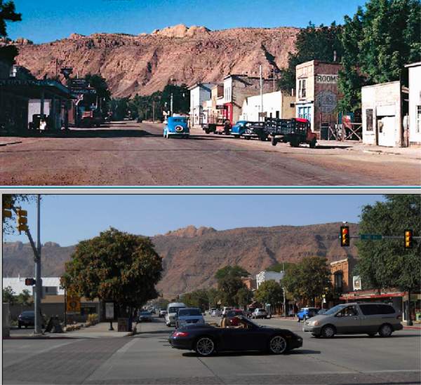
Downtown Moab. 1950 & 2015
I don’t spend much time out Horsethief Point/Mineral Bottom way anymore because it is too busy and not the place I used to love to get lost in, but for work I do drive the River Road (Hwy 128) regularly. In the early 1990s there were no designated campgrounds, and no toilets and it certainly looked a lot wilder and more “welcoming”. That is until you got closer, and found human waste and toilet paper flowers decorating flat spots near the roadway or down by the river. It has been a shame to watch these high use areas get transformed into developed campgrounds – but the fact that they are full to overflowing most weekends from mid-March through June, and throughout the fall means toilet facilities are necessary and need maintenance.
Unfortunately we need these rules for the high use areas near Moab, the sheer volume of campers means that dispersed camping is impossible in this zones. What seems silly and unnecessary to those of us adapted to living in the desert is not common sense to those coming from big cities, or places with soil and rain. The sheer distance between towns makes places that really aren’t that remote feel miles and miles away, and as if your actions couldn’t possibly bother anyone else. These rules certainly won’t prevent me from doing what I want to do when I am out and about in the desert – especially since I tend to avoid these high use areas as much as possible. At least the rules, while over 10 years in the making, still are relevant, perhaps even more so than when they were initially drafted during the scoping process for the RMP.
What does Federal Land Management have to do with Gun Control?
At the start of 2016 activity in Oregon at the Malheur Wildlife Refuge caught and held my attention for most of January, and it has continued to interest to me. I have noticed that most of my friends and family who live in larger cities in the West or in the Mid-West heard little about it, proving to me I was obsessed. Living in a part of the country where approximately 63%-70% (depending on how the land is counted) of the land is owned by the federal government, and around 7% is owned by the state, the implications of federal land ownership are not insignificant. While estimates of the percentage of Utah that is managed by the Federal Government vary a bit, no matter how it’s counted Utah ranks 3rd, behind Nevada and Alaska, for the smallest amount of private land in the country. Especially with populations growing, Utah residents perhaps understandably feel hemmed in and surrounded, with economic opportunities reduced or outright thwarted by rules that don’t generally apply to private property. Public land ownership requires collaborative management – something that is a challenge in the best of circumstances, and is usually bound to leave someone feeling the decision is inadequate or wrong.
At the very start of what became a standoff in January, the occupiers stated that they would leave if the Sheriff told them to go. As I watched the events unfold, I wondered why the Sheriff’s directive mattered more than other law enforcement. I have had little interaction with law enforcement, and so I assumed there is a lot I don’t know about law enforcement organizational structure and I started looking into it. My research eventually led me to the Constitutional Sheriff and Peace Officers Association (http://cspoa.org) and a philosophy about the role of the County Sheriff that I had not heard about before.
A Sagebrush (or Constitutional) Sheriff subscribes to the idea that the Federal Government has no authority in the County, but that the County Sheriff is the highest authority. According to the Constitutional Sheriff and Peace Officers Association (CSPOA) website, Richard Mack, the founder of the CSPOA, began his career in law enforcement in Provo Utah. He returned to his childhood home in Arizona in 1988, was elected sheriff, and served two terms. During this time, Sheriff Mack challenged the constitutionality of the Brady Bill, and in 1997 a Supreme Court decision ruled in favor of Sheriff Mack that the federal government could not force county law enforcement to run background checks at the county expense.
According to Mr. Mack the 1878 Posse Comitatus Act, which limits the powers of the federal government to use the military (specifically the Army) to enforce domestic policies, also means that agents of the federal government may not enforce local laws or laws in local areas, only the elected County Sheriff can do that. In other words, the federal government can make laws, but the County Sheriff is able to pick and choose which of these federal laws he chooses to enforce. A Denver Post article dated February 2, 2012, Emerging movement encourages sheriffs to act as shield against federal tyranny, reports on the inaugural convention of the CSPOA and highlights significant differences in opinions of sheriffs attending the meeting. According to the article, Sheriff Mack asserted “that sheriffs have the supreme law enforcement power in their counties under the Constitution and the 10th Amendment. Much of what federal agents are doing in counties is unconstitutional, he wrote. Federal agents have no authority beyond policing treason, piracy, treaty violations and counterfeiting.”
Learning about Sagebrush Sheriffs provided some interesting context to the events this past January, as well as other recent confrontations between federal land managers and public land permit holders: April 2014 the events near Bunkerville NV attempting to enforce federal grazing rules; May 2015’s Recapture Protest San Juan County Utah; April 2015’s lesser publicized confrontation between BLM and mining claim holders occurred in Oregon at the Sugar Pine Mine; the Malheur Refuge Occupation in January and February of 2016; and February 2016’s assertion by the Paiute County Sheriff at the Utah Rural Caucus on February 12th that he will “deputize every man, woman and child in the county to stop what’s going on.” (http://fox13now.com/2016/02/23/piute-county-sheriff-threatens-arrest-of-forest-service-personnel/#).
The Sugar Pine Mine confrontation in 2015 ended more swiftly and with less press than some of the other recent confrontations in part due to the choice of the Josephine County Sheriff, Dave Daniel, to act as a mediator between the BLM and the miners. The Sheriff of Harney County chose a similar approach to Sheriff Daniel’s when the protest of the federal government treatment of the Hammonds, ranchers near the Malheur Refuge, turned into an occupation of the Refuge itself. Some reports state that Sheriff Ward did not support the way the federal government and the courts handled the Hammond case, however he separated his personal opinion from his role as a local law enforcement officer. The situation in Oregon this past winter is complex, as are all the land management actions and protests that have occurred over the past several years. What is interesting to note is that the dynamic between the local Sheriff and the federal land management agencies and law enforcement officers is a critical factor in how rapidly and peacefully these increasingly armed confrontations end. Resolution of the issues leading to the confrontations requires communication and mediation, and unfortunately likely requires lengthy legal battles in the courts.
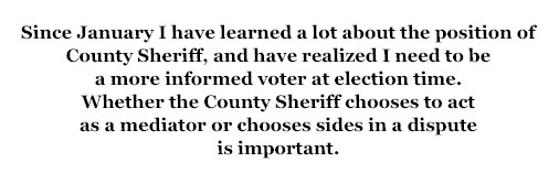
Since January I have learned a lot about the position of County Sheriff, and have realized I need to be a more informed voter at election time. Whether the County Sheriff chooses to act as a mediator or chooses sides in a dispute is important. Recently I had a closer interaction with our local Sheriff’s Deputies than I have ever had with law enforcement in my entire life. I was impressed with how they listened to both sides of what was going on, and in a potentially volatile situation treated everyone with respect, patience and integrity. I will admit to being nervous when they had to be called to help – but after the situation was over and the Deputies took the time to explain options, implications and possible next steps I was much relieved. Through listening and evaluating what laws had been violated and taking the time to inform those involved about the local laws and implications of pursuing enforcement the situation did not escalate.
I realize that the federal government is a much more powerful adversary than an individual usually is, but I would hope that a County Sheriff could refrain from taking sides in a conflict involving Federal Land Managers as much as they did in the small situation that I witnessed. Federal and State Land Managers are in an unenviable position of having to balance vastly different ideas of appropriate use. As the tourist season progresses I’ll be looking at how recreation has changed in SE Utah as well as at the legal constraints of land ownership and management throughout the west. The role of the County Sheriff in federal and state land management is greater than I previously understood.
Kara Dohrenwend is a regular contributor to the Zephyr. She lives in Moab, Utah.
To read the PDF version of this article, click here.
To comment, scroll to the bottom of the page.
Don’t forget the Zephyr ads! All links are hot!


scary. interesting, of course. “topical”. tho’ seemingly @ a snail’s pace, the rules-‘n’ regs try to keep up, maybe staving off a future minor apocalypse. Moab area has often reminded me of Mad Max. and when the seemingly inevitable collapse of civility occurs …
good stuff, your article. my wife and i love(d) Moab, but quit visiting in the middle 1990’s, for reasons you might agree with. we mountain bike outside of Green River ( ! ) now.