
NOTE: When I posted last week’s story about Arches in the 1950s, I had not intended to do a “part 2.” But later I remembered hearing Lloyd talk about the substantial role he and superintendent Bates Wilson played in laying out the new road alignment. And it reminded me of the black and white aerial photos I found in a trash can at the Arches visitor center in 1977. The NPS had just received a new set of color high resolution images of the park, and considered the old ones to be worthless. I fished them out of the can and even checked with my boss, to be sure they no longer wanted them. Like so many other artifacts I have from my days at Arches, from weather reports to wildlife observation cards, even to the old wooden signs, one agency’s trash was my treasure, I’m glad I have kept these historical remembrances all these years…JS
In the Spring of 1957, as ranger Edward Abbey was returning to his beloved trailer outpost at Arches National Monument, he already recognized the uniqueness of this moment. Whether it occurred to him that the stories he was collecting in his head would lead to “Desert Solitaire,” who knows. But by April 1957, the new proposed “improved” paved highway was a ‘done deal.’ It would change the character of this remote, rarely visited national monument forever. The Mission 66 program injected millions and millions of dollars into the “modernization” National Park Service administered lands from coast to coast. It was all part of the post-war boom—after a decade of the Great Depression and four years of global war, Americans had the resources and the burning desire to “hit the road.”
At Arches, a 23 mile strip of asphalt would ultimately abandon most of the old road alignment completely. A new modern visitor center was built at the beginning of the new road. By 1963, even the Devils Garden Campground was complete, or to be precise, the proposed “A Loop” was open for business. A second “B Loop” had been planned and would have added another 30 sites. B Loop would have turned north between sites 9 and 10. In the 1980s, the survey stakes were still there. But it never happened.
Still the changes were dramatic and within a few years, monument visitation jumped from 30,000 a year to 100,000. There were celebrations all around. Outliers like Abbey objected, but as his boss noted years later, “It was inevitable,” Chief Ranger Pierson once said. The post-war boom made it impossible to stop. It was the spirit of that era. Progress. Grow. Improve!
The NPS survey teams to lay out the alignment and Abbey’s famous tale of pulling up their stakes in the pale moonlight after the surveyors had left, are probably true. But even Abbey would note that it was nothing more than a symbolic gesture. An “exercise in futility.” Even his novel, “The Monkey Wrench Gang,” was written with the same motivation…if he could vent and sell some books at the same time, why not? I’m not sure he anticipated the response from some of his more loyal and literal readers.
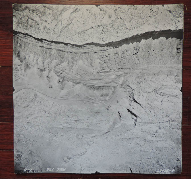
But back to the road. Before the surveyors could begin, they needed a route to follow. The Monument contacted Continental Engineers, a company on Colfax in Denver, and arranged for a series of high resolution black and white photos to be shot of the monument along the proposed new road alignment.
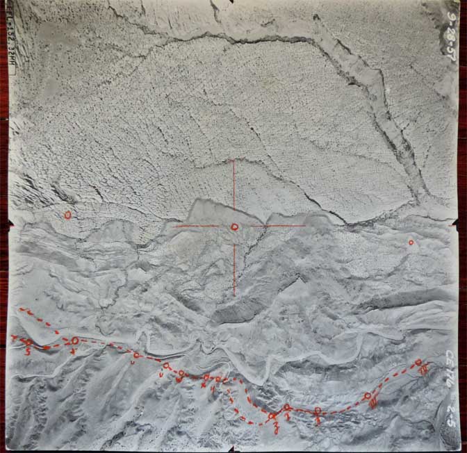
Phase One of the project was shot on April 27, 1957. The photos covered the proposed alignment as far as The Windows and Balanced Rock. That was as far as the first road building was to go by 1958. But it was not the end. Plans to build a new road to the Devils Garden via the Fiery Furnace were already on the drawing boards. NPS planners and managers expected the entire road to be finished by 1963.
So Continental Engineering came back later that year, on September 28, 1957, and finished the job. Within weeks, The Arches Staff, i.e Superintendent Bates Wilson and Chief Ranger Lloyd Pierson had their maps.
Incredibly in 1957, Bates convinced his bosses that he and Lloyd knew the terrain better than anyone, including NPS engineers from far away cities who had never even seen Arches. Bates was a very persuasive man, in the most down home charming way one can imagine. His personality was downright disarming. The NPS mucky-mucks relented— Bates and Lloyd would lay out the road alignment, and based on their recommendations, that’s where the road would mostly go.
*****
Most likely, sometime in May, Bates and Lloyd went to work. The idea of a new entrance road starting where it is now, had been in the works for almost 20 years. In fact, a CCC crew had started construction on on those switchbacks above the current visitor center as far back as 1940. But then World War II came along, and all work stopped. It wasn’t until the Mission 66 program was passed by Congress that the millions of dollars needed to build a road like this would become available.
Bates and Lloyd were able to use the park jeep for some of the work, but it’s clear from the photographs that much of their work was done on foot. Armed with their photos and an orange crayon, which they probably kept in their standard issue NPS satchels, they began laying out the new road
(NOTE) Those satchels were used by the NPS well into the 1980s, when they were finally discarded. Like so many other abandoned NPS mementos and artifacts. I grabbed a couple for myself.
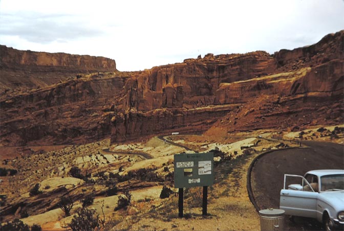
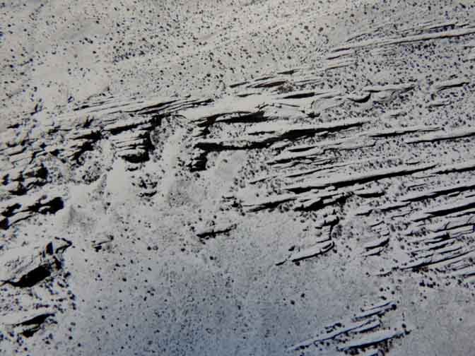
Overall the aerial photos included about 50 images of the monument and sometimes went far outside the proposed road alignment. In this installment, I’ll stick to the road. (I’m not even sure how many of these photos I can load without blowing out our bandwidth limits…also note that WordPress does NOT allow me to post these images at a resolution I would like—I’m limited to 96 dpi… So this is an experiment but my fingers are crossed that there will be sufficient detail to make it worth a look. In a couple cases I have zoomed in on features of special interest and posted them separately—like Abbey’s trailer and what was then called Turnbow Cabin. It’s interesting to see that even in 1957, there was some kind of walking bridge across Salt Wash. Whether it’s the original swing bridge, I can’t say…
In any case, here is a bird’s eye view of Arches National Monument from April and September 1957…This is just a sampling of the images; I’ve tried to post the pictures that follow the new road alignment…Enjoy the flight.
—Jim Stiles
THE FIRST AERIAL PHOTOGRAPHIC SHOOTS—APRIL 27 & SEPTEMBER 28, 1957
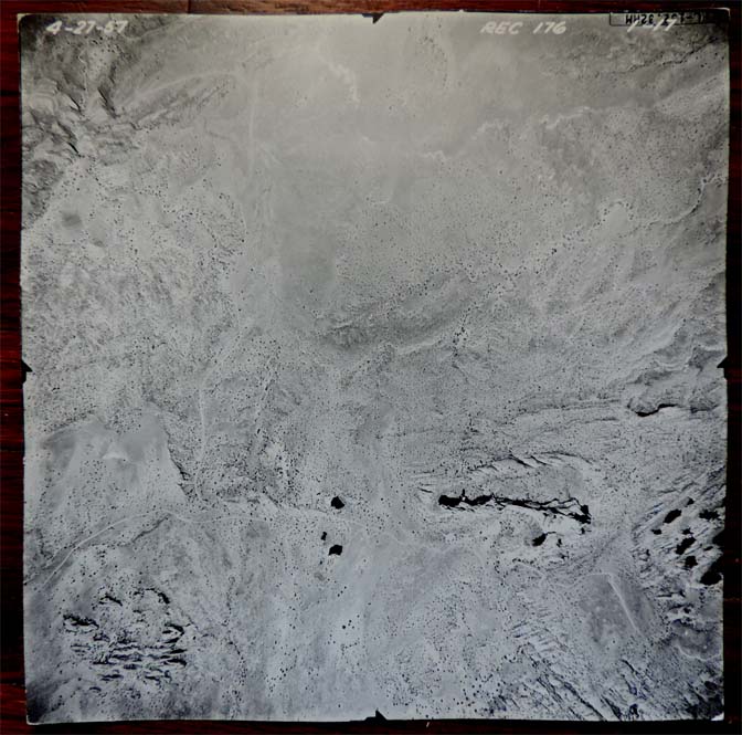
In this photo you can see the old US 160 (now US 191) moving from left to right, and near the right center of the picture is the turnoff to park headquarters. The superintendent’s “rock house,” built in 1940, can be located by the elm trees that were planted at the same time. The new road would switchback up the Navajo sandstone to the plateau above. As noted, the old Civilian Conservation Corps (CCC) had begun that work in 1940. Now, almost 20 years later,
the job was about to be completed.
The highway is still barely visible at the extreme top of this image. The new road
would top out and pass the future parking lot for “Park Avenue.”
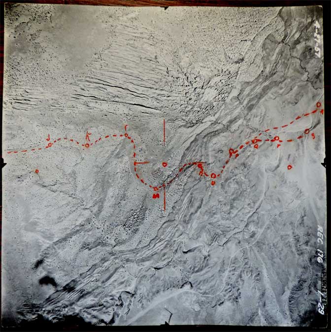
The new road would wrap around the base of the towering cliffs, and then turn north, weaving its way through the Courthouse Towers, between the Tower of Babel and The Organ on its right, the Three Gossips on the left. At the far upper right is Courthouse Wash, at the point where a new bridge would be built. The highway would then climb another four miles to Balanced Rock, with The Petrified Dunes to the right of the highway and the Great Wall on the left. Until this section of road was completed in 1958, this section of the monument was one of the most inaccessible,
despite its proximity to US 160.
The new highway crossed Courthouse Wash at the upper center of this photo
and ran parallel to the Great Wall, that just comes into view here.
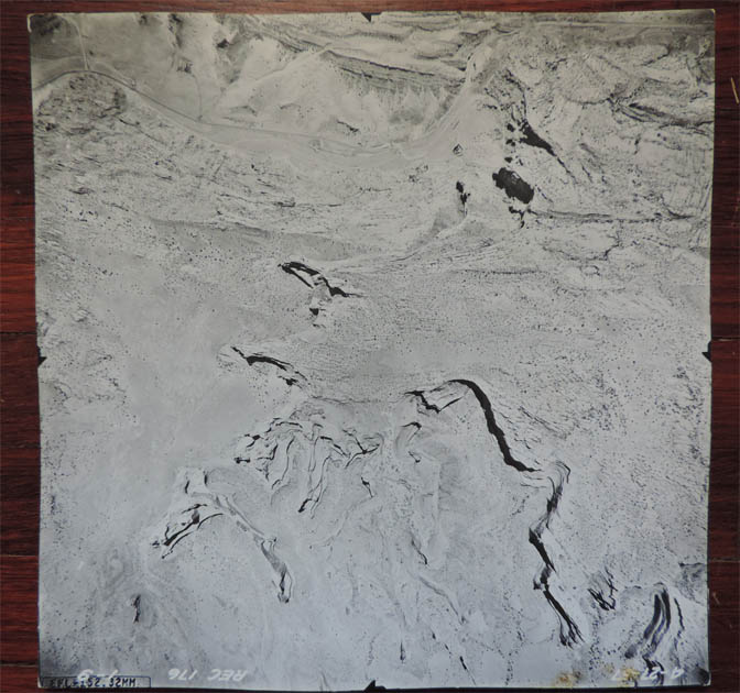
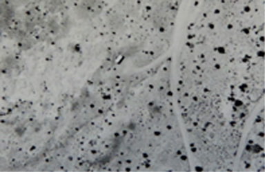
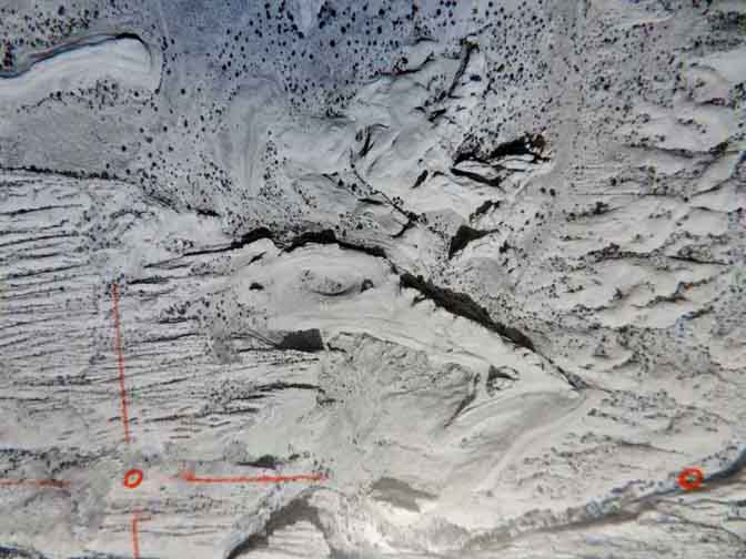
The new highway would approach Balanced Rock from the bottom of this photograph and continue in almost a straight line to the top of this image. There’s so much to see in this picture. For the first time, you can spot the original “Willow Springs” entrance road come into view at the left of this photo, and its junction with the road that would take visitors to the Devils Garden. In this photo, if you look closely, you can see the shadow of Balanced Rock and something else…the trailer that Ed Abbey inhabited in 1956 and 1957.
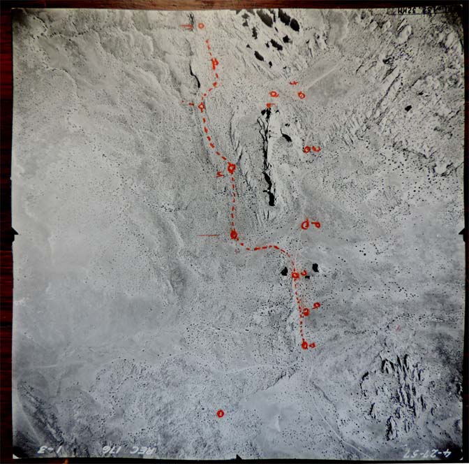
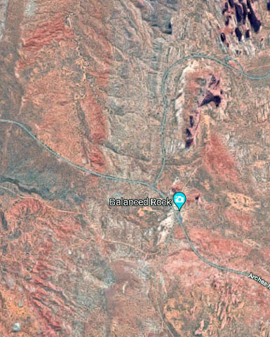
This image is aligned differently from the previous Balanced Rock view. For the first time, you can see the orange crayon routes suggested by Bates and Lloyd. Ultimately, as the new road moves toward the top of this photo toward Elephant Butte and the Windows, the final alignment took a slightly different route. For comparison, below is a Google aerial of approximately the same view…
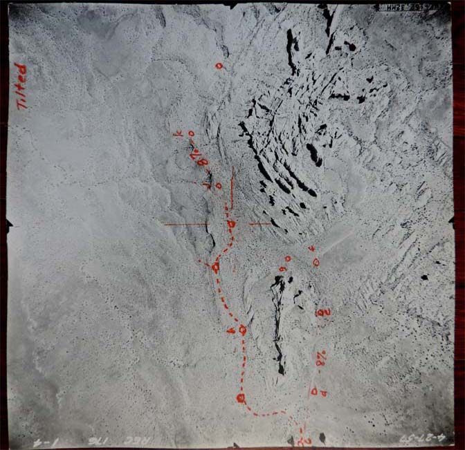
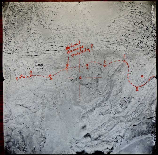
In this image, Wilson and Pierson were apparently proposing a viewpoint north of Elephant Butte. Ultimately that spur road was never built. Instead the highway stayed closer to the original dirt road and turned south to take visitors past the Garden of Eden and Owl Rock to the southern base of Elephant Butte—to Double Arch, North and South Windows and Turret Arch.
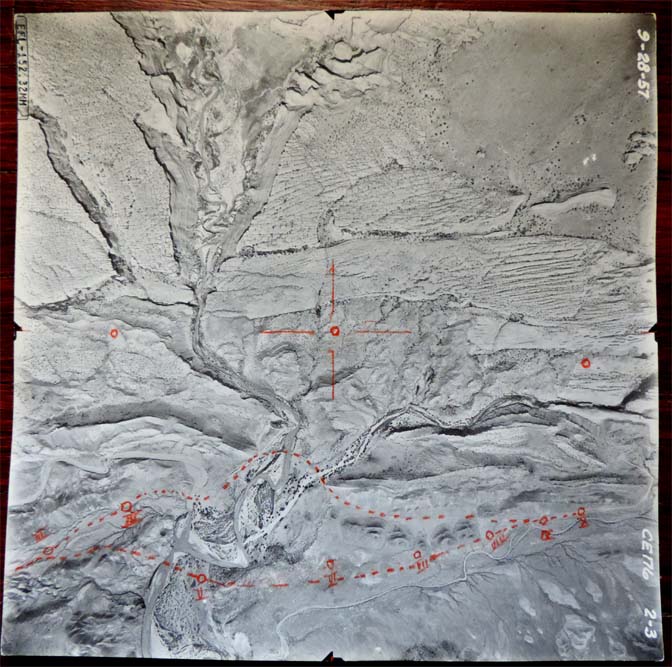
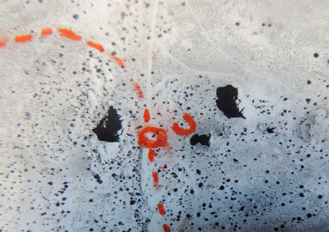
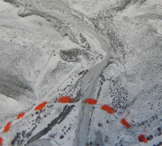
The new spur road and the proposed new route from the main highway closely followed the top set of dotted lines. Running from top to bottom of the image is Salt Wash. The cabin and a foot bridge and the Delicate Arch viewpoint crossing is in this image, but scroll down to see a closeup…
The viewpoint road continues along the original road to the viewpoint. Winter Camp Wash flows left to right and for those with a very sharp eye, you can see the shadow of Delicate Arch…
but below is a zoom view from this photo
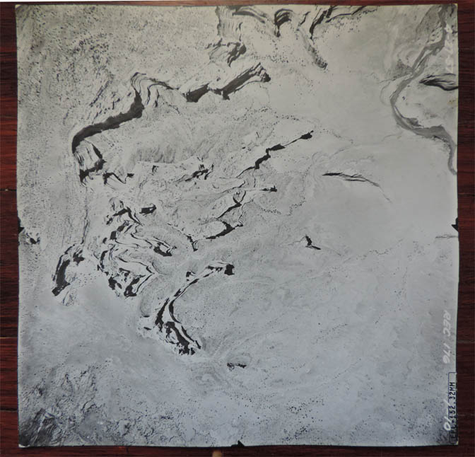
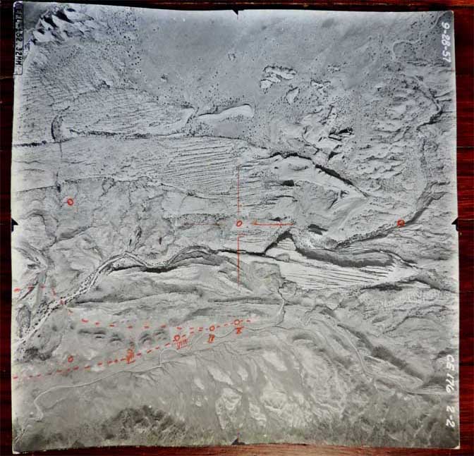
This was all new road and crossed a lot of Mancos Shale, a very difficult geological formation to build a road over. When you encounter those wavy sections of road, where you feel like you’re on a kiddies’ roller coaster, you’re riding over Mancos Shale. Just beyond this image the road will turn north and climb out of the valley toward the Fiery Furnace and the Devils Garden. The Furnace is just coming into view at the upper left corner of this image.
Again, all of this was new road. The old road to the Devils Garden reached that part of the monument where the Salt Valley turnoff is today. Thus the Fiery Furnace was also quite a distance from any road.
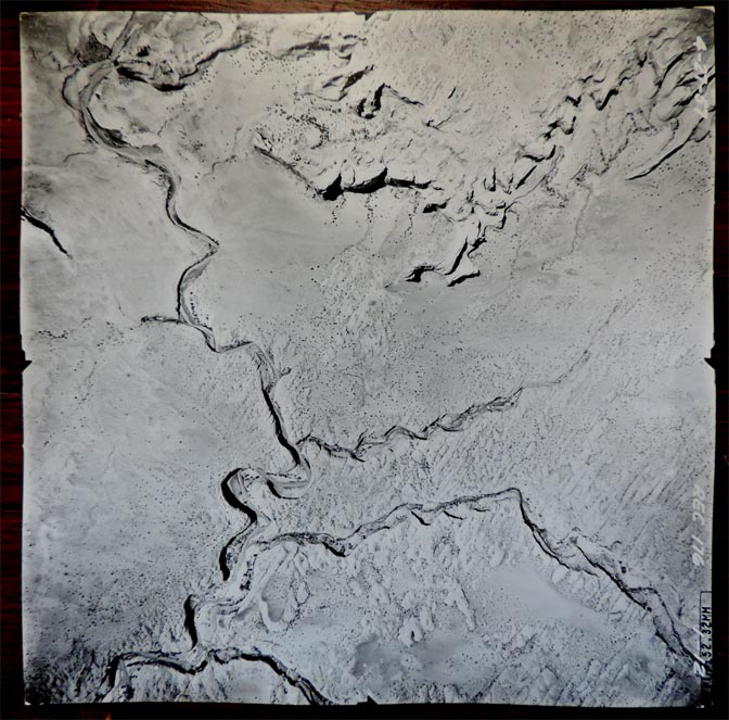
For the first time the old road to the Devils Garden appears at the far bottom right of this picture
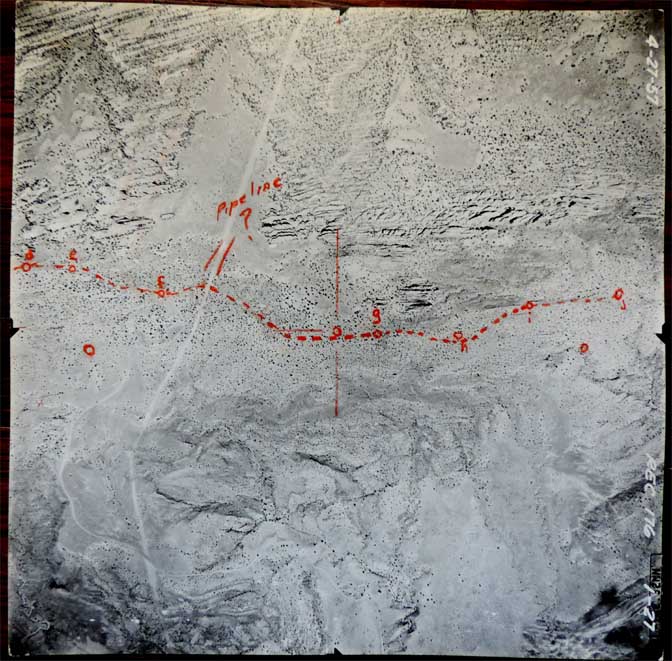
Few realize that in the 1950s, the Park Service permitted a natural gas pipeline to cross the monument. It crossed the far west side of the monument, into and across Salt Valley, then over this break in the Entrada Sandstone fins of the Devils Garden.
Ultimately the new highway would still end at the Devils Garden Trailhead.
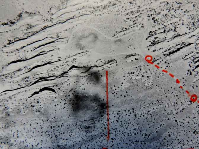
If you can’t see it, below is a closeup.
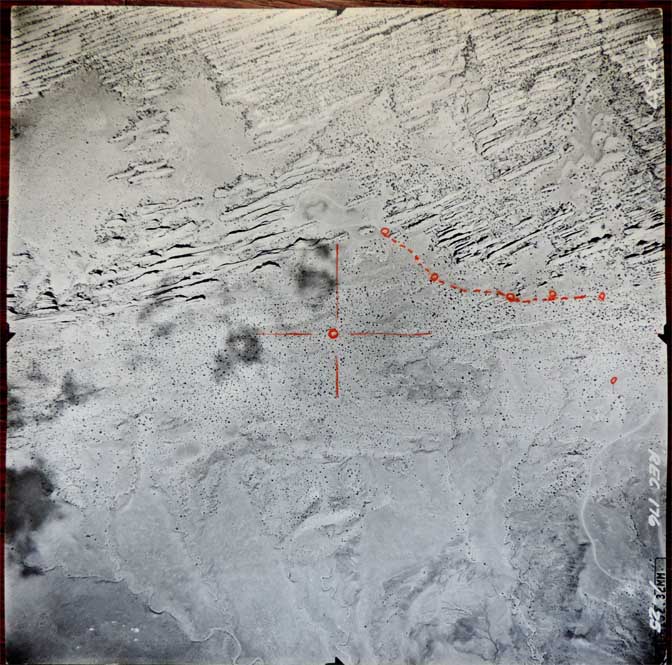
April 27, 1957…pretty quiet.
The Devils Garden and in this picture is Landscape Arch. Below is a closeup
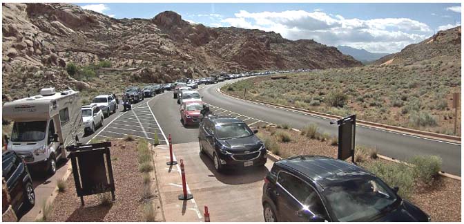
The Entrance Station at Arches NP… 2020
TO COMMENT ON THESE IMAGES AND THE STORY BEHIND THEM, PLEASE SCROLL TO THEBOTTOM OF THIS PAGE.


You can still “like” individual posts.
Why they can’t just leave the site alone is beyond me,
but that’s what Facebook likes to do.
ALSO NOTE: I post old photographs and stories from our 25 year old archives every day. Pictures from Herb Ringer, Edna Fridley, Charles Kreischer.. even a few old photos from my Dad. So if you want to stay caught up on our historic photo collections,
be sure to “follow” us on Facebook…Thanks…Jim
https://www.facebook.com/FansoftheCanyonCountryZephyr/
https://www.facebook.com/profile.php?id=100086441524150


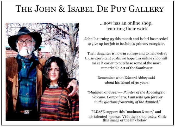
More than six years ago, The Zephyr, me & four other individuals were sued for defamation by the former Moab City Manager. Faced with mounting legal bills, my dear friends John and Isabel De Puy donated one of John’s paintings to be auctioned.
ALL the proceeds went to our defense.
Thanks to them, our bills were almost completely covered.
Now I’d like to return the favor. Check out the link below and their online shop… JS
https://www.depuygallery.com/shop.html

And check out this post about Mazza & our friend Ali Sabbah,
and the greatest of culinary honors:
https://www.saltlakemagazine.com/mazza-salt-lake-city/

https://www.canyoncountryzephyr.com/2023/04/09/hitchhiking-across-america-december-1972-a-really-dumb-idea-jim-stiles-zx57/
https://www.canyoncountryzephyr.com/2023/04/02/a-glen-canyon-album-the-nielsen-ranch-at-hite-2-zx56/
—Jim Stiles (ZX#51)
https://www.canyoncountryzephyr.com/2023/02/26/glen-canyons-nielsen-ranch-at-hite-the-untold-story-pt-1-jim-stiles-zx51/
https://www.canyoncountryzephyr.com/2023/03/26/update-the-7-4-61-dead-horse-murders-the-forgotten-victims-jim-stiles-zx55/
https://www.canyoncountryzephyr.com/2022/05/15/60-years-later-still-searching-for-dennise-sullivan-by-jim-stiles-zx8/
https://www.canyoncountryzephyr.com/2023/02/12/desolation-and-abundance-the-unexpected-comfort-of-canyon-rapids-origin-family-by-brandon-hill-zx49/
(My Recent Encounter with the Mental Health Industry) ZX#20
https://www.canyoncountryzephyr.com/2022/08/07/grief-meets-orwell-the-cuckoos-nest-by-jim-stiles-my-recent-encounter-with-the-mental-health-industry-zx20/
Somewhere in my stuff (in a box somewhere, I’m sure of it!) I have about 60 official USGS aerial photos of Cedar Mesa from the late 50’s and early 60’s. I believe they are from a photgrammetry survey used for that era’s update of the 15 minute topo quads. I also have all the topos of that era. Fascinating to see the changes that occurred between then and now. Also have a couple of the Spanish Valley I got at the same time. I suspect that you can still order them up from USGS. Since I was a little kid discovering topos, looking at maps and aerial photos has been an utter fascination. Of course, much that was in those old maps and aerial photos has been edited out – particularly native ruins. In the case of the Cedar Mesa maps, they drove me to explore that place for many decades. Thanks Jim.
“Found in a trash can”! Unbelievable! Thank you for rescuing these amazing images. Do you have any knowledge of what kind of photography equipment was used to take these jaw-dropping photos? It would be interesting to know if it was similar to the aerial spy technology of the time.
Thanks for saving those pictures and sharing them with us in a remarkable historical write-up! This is a remarkable tour. Google Earth, here I come to try and compare!
Enjoyed these old photographs. Too bad about all the paved roads! I’d have been happy to toodle along in my ’79 Corolla to get into the park on dirt. Seems like I once located old USGS topo maps at the Univ of Colorado’s Geology Department’s map library. These were older than the mid-50s maps that were updated in the 80s. So old that Grandstaff Canyon (known to me on later maps as Negro Bill’s) was literally enshrined as “N-gg-r Bill’s Canyon”. It’s still hard for me to think of it as Grandstaff, but ya gotta respect the guy that lived there. Maybe I’ll get used to it…
Thanks Jim
Very fun and interesting to peruse the old photos
kay forsythe