This is the third installment or album, courtesy of Leslie Nielsen. Her grandparents were Beth and Ruben Nielsen and iif you need to know more about this amazing couple, just click here, and here.
For Beth and Ruben Nielsen, the Hite Ferry and their little six acre farm, was all that they could have ever asked for. They had come to Hite in 1949, at the behest of the ferry owner, Arth Chaffin. Ruben worked for Chaffin maintaining the ferry and helping to run it from about 1949 to 1955 Then Ruben and Beth signed a contract with Chaffin to run the ferry themselves. But a couple years later, the Nielsens ended their collaboration with Chaffin, and Ruben went to work at the Happy Jack Mine, about 20 miles east of the ferry. Ruben was a welder and mechanic. He stayed at that job until 1963.
But they both continued to grow their crops and maintain their orchards, and truly for the love of it. According to granddaughter, Leslie (who has provided us with this extraordinary photos), the Nielsens gave all the fruits of their labor (vegetables too!) to friends and family and even passersby. Hite was the launching point for many river trips through the Glen, and the tourists often left with more fresh produce than they could have ever imagined.
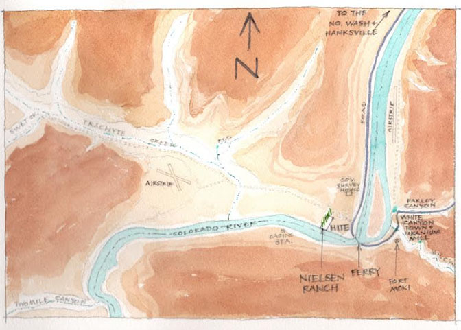
A magnificent water color ‘aerial map” of Hite and White Canyon. By Leslie Nielsen
While the Nielsens regarded Glen Canyon as the true heart of the Colorado Plateau, they also knew their “own little piece of Heaven,” was surrounded by some of the most stunning, almost surreal landscape that surrounded them for hundreds of miles. And at the time, canyon country of Southeast Utah was one of he most remote, seldom visited parts of the continental United States. It was truly the proverbial “blank spot on the map.”
Decades later, as Industrial Strength Tourism became the area’s driving industry and as environmentalists and the powerful recreation lobby pushed hard to eliminate other economic options, Tourism and the “Amenities Economy” became king. What oil and gas exploitation and uranium mining and overgrazing couldn’t accomplish, Industrial Tourism, in almost every small economically struggling community in the West beat them all —The Rural West is rapidly is experiencing the Disneyfication of half the country.
Maybe it was inevitable. Maybe this would have happened anyway with the full throated enthusiasm of the mainstream environmental community and travel councils, and chambers of commerce, large and small.
That’s what makes photographs like these so special—a moment in Time, frozen just as it was , and never will be again…JS
Below are a few more photographs of the Nielsens’ wonderful farm at Hite (Again, to access the first two installmentsm click here and here.).
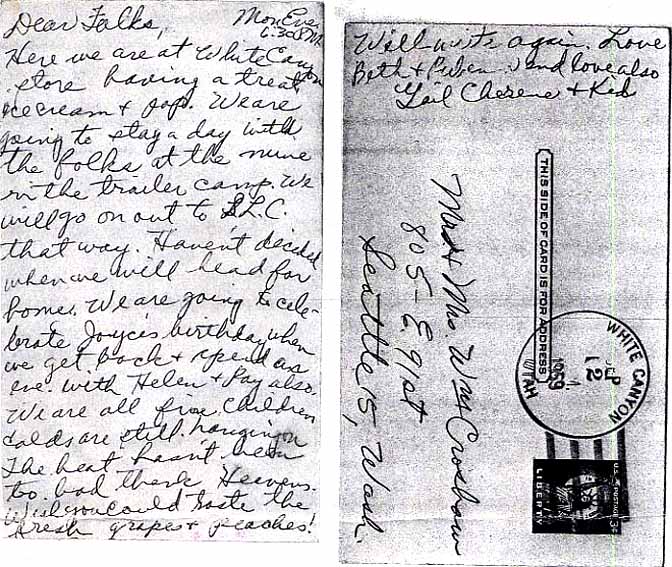
(below) A post card from “Heaven. Note that White Canyon had its own post office in 1959.
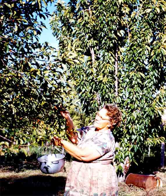
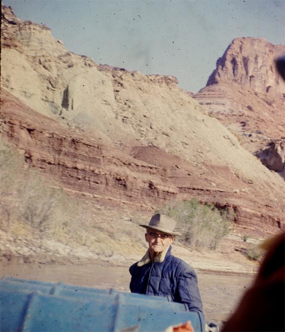
I believe Beth is picking cherries in this picture. No matter how far they wandered, this was the heart of their universe. And how could it be otherwise?
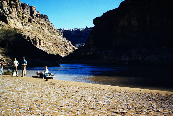
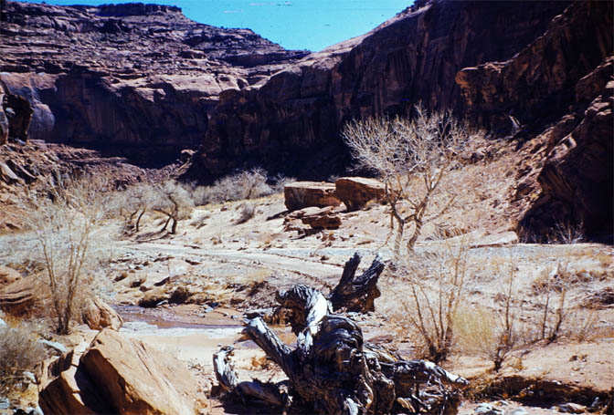
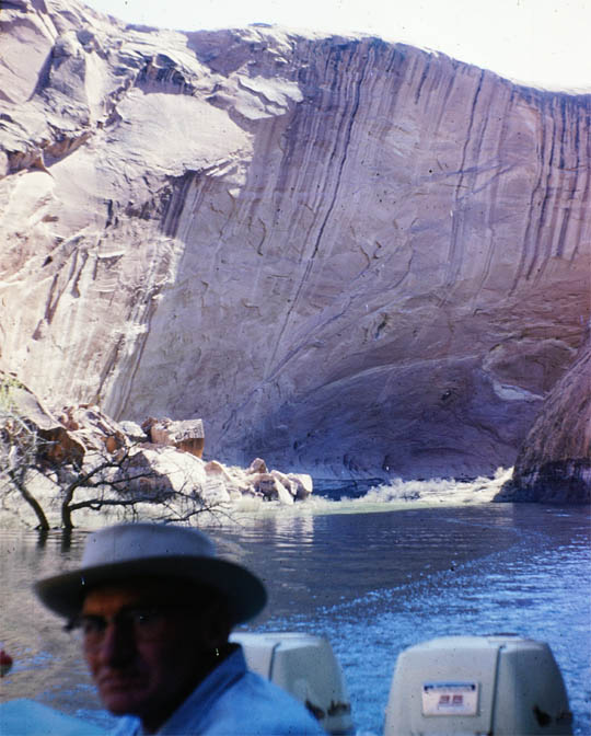
Beach at Narrows and Rock Fall Canyon. Ruben and friends, fishing. A lazy day in Glen Canyon.
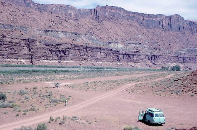
A wider view of the landing strip at White Canyon, And most likely Beth waiting to pick up the mail.
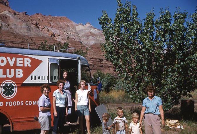
Even the Clover Club potato chips truck driver stopped at the Nielsen farm for some real food.
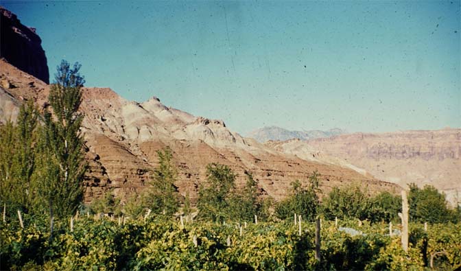
This looks to be part of their vineyard….The amount of love and care that went into this little six acre farm could never be underestimated.
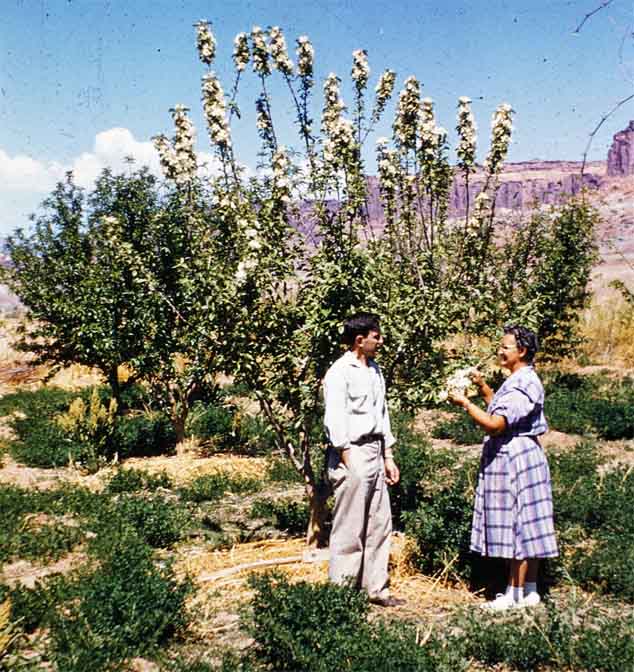
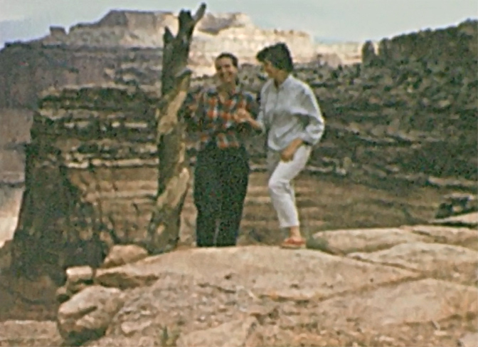
Warren and Beth examining the cherry blossoms. Spring 1956
October 1963. The last harvest. Beth examines her crops, knowing that the flood gates at Glen Canyon Dam had been closed since January, and the impounded waters were making their way slowly upstream,
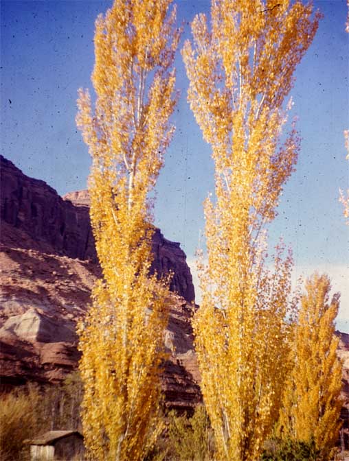
Autumn 1963. The Lombard Poplars (or Mormon Poplars) were displaying their brilliant fall colors. A year later, they would be drowned by Lake Powell.
The last winter at the Nielsen Farm. 1964
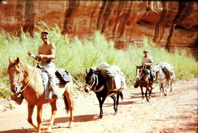
By May 1964, the lake was rising but had not quite reached Hite. One way to reach the reservoir downstream was via rubber rafts. Here they are unloading their gear in Bullfrog Creek.
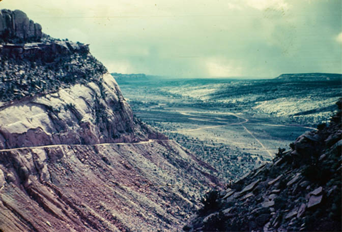
Driving up North Wash after leaving Hite. 1961
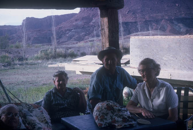
President Bowan, of the LDS English mission, came to Hite in the early 1960s. Here he visits with Beth and Wanda.
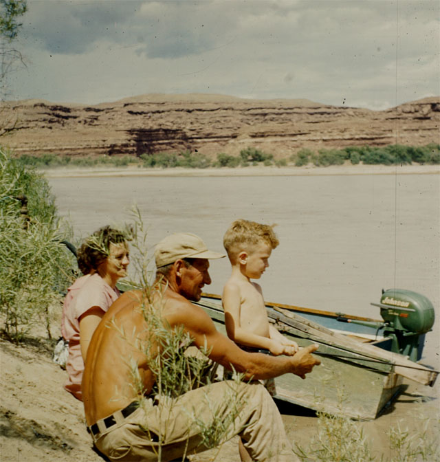
Buster and Emma Felt and a whopper of a fish. Circa 1960
Ruben joined them, waiting for the Big One to come around.
May 1964. Ruben took a trip downstream to see how far the reservoir had come. This was at Hansen Creek. You can see a drowned tree at far left.
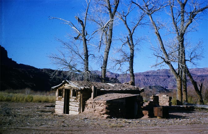
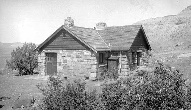
One of the last photographs of Bert Loper’s Cabin. For more on Bert, here’s Wikipedia link. He was a legend in his own time.
THE 1960 ROAD TRIP TO THE FOUR CORNERS & BEYOND
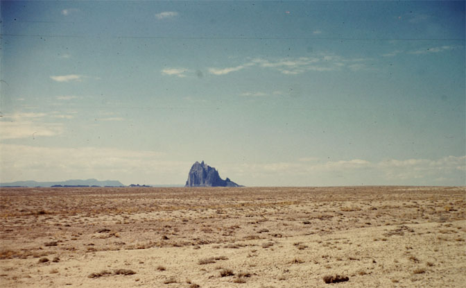
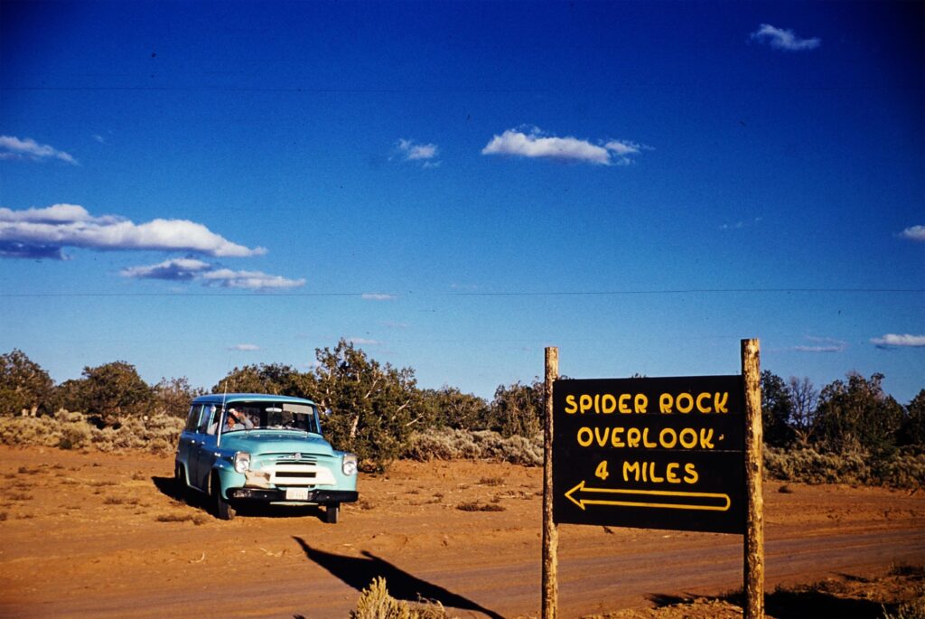
With their new blue Travel-all. and with Ruben no longer bound to maintaining or managing the ferry, the Nielsens took off to tour the Four Corners. Here, Shiprock rises above the desert. June 1960
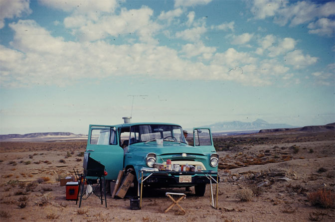
CAMP NEAR SHIPROCK: In the distance you can see the Sleeping Ute Mountain, a landmark in the Four Corners that can be seen for many miles in almost any direction. November 1960
CANYON de CHELLY. 1960
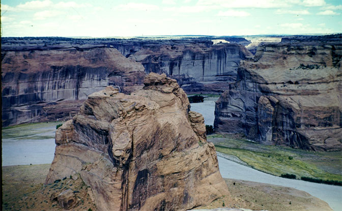
Canyon de Chelly from the rim. June 1960
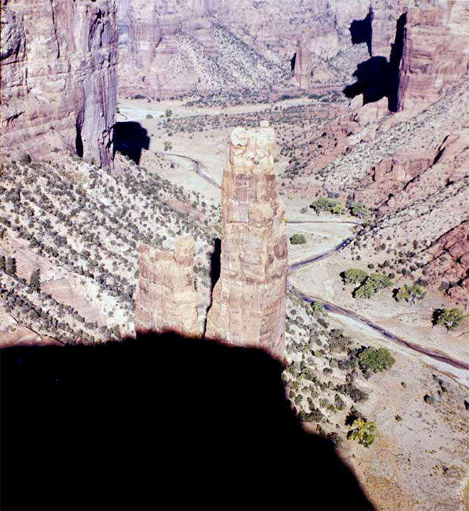
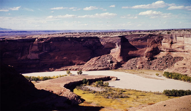
Another rim view
Looking southwest, back toward Kayenta. The formation just to the left of the road is called “Baby Rocks” (one of the figures looks like a Navajo woman carrying a baby on her back). This is maybe 10-15 miles, northeast of Kayenta (Thanks To Doug Meyer for identifying the location in this picture.)
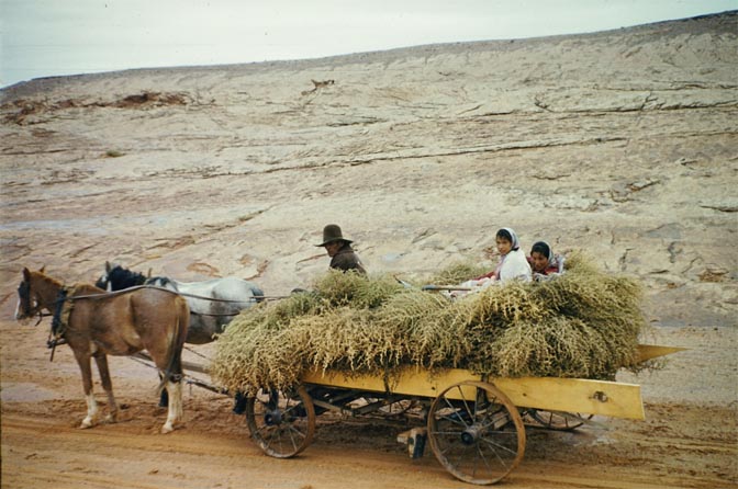
On the Navajo Nation, hauling feed in a horse drawn wagon…two horses, in fact.. 1960
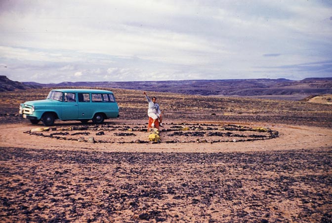
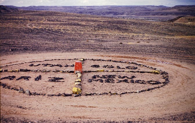
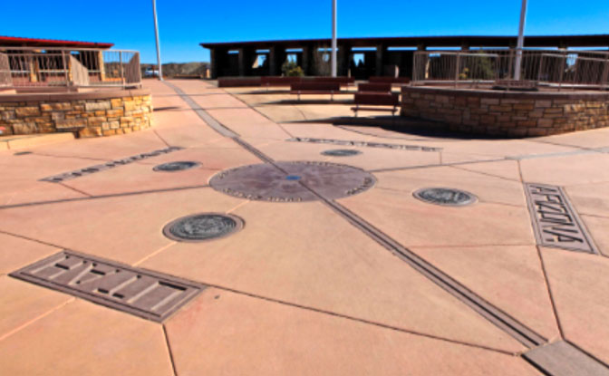
THE FOUR CORNERS MONUMENT as it looked in 1960.
Not much in the way of crowds or concrete or commercialism in those days.
The Four Corners Monument now.
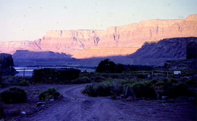
Eventually Beth and Ruben made their way to another ferry. This is the approach in 1960.
This view looks across Chinle Wash, from a location most likely north of Canyon de Chelly. At the far right in the distance is Black Mesa. 1960
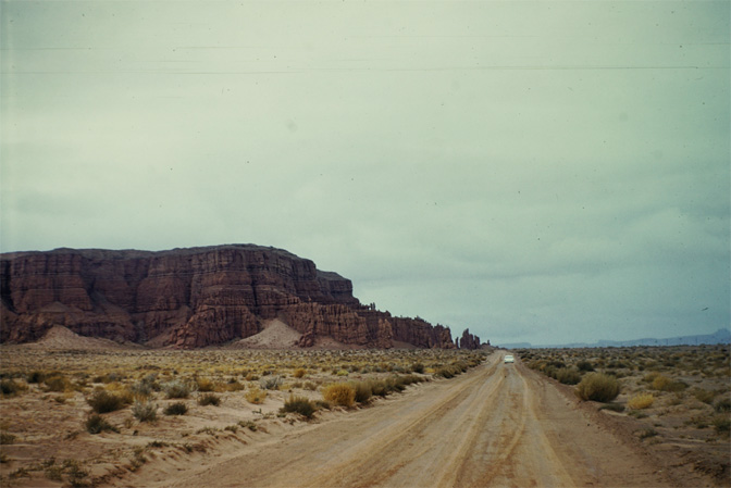
Comb Ridge and the old Dugway, on Utah Highway 95. It would remain in use during the Uranium Boom of the 1950s. A “new” paved highway was built in the Seventies that bypassed the dugway and cut through 200 feet of sandstone, a few miles south of this location.
“Looking back to see if we were looking back to see.” Beth took this shot from the top of the dugway, looking across Comb Wash to the rise of cedar Mesa. 1960
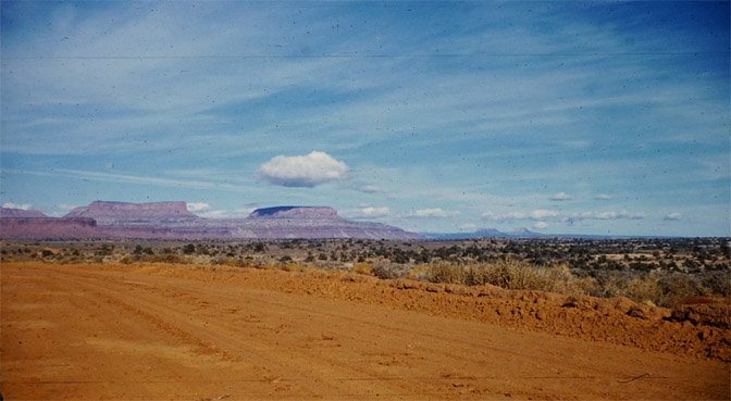
The lovely red dirt roads. At right of center you can see the Bears ears on the horizon. There once was a time when few had even heard of the Bears Ears. Now it’s the latest example of Industrial Strength Tourism. I’m guessing this is the old dirt road to Halls Crossing.
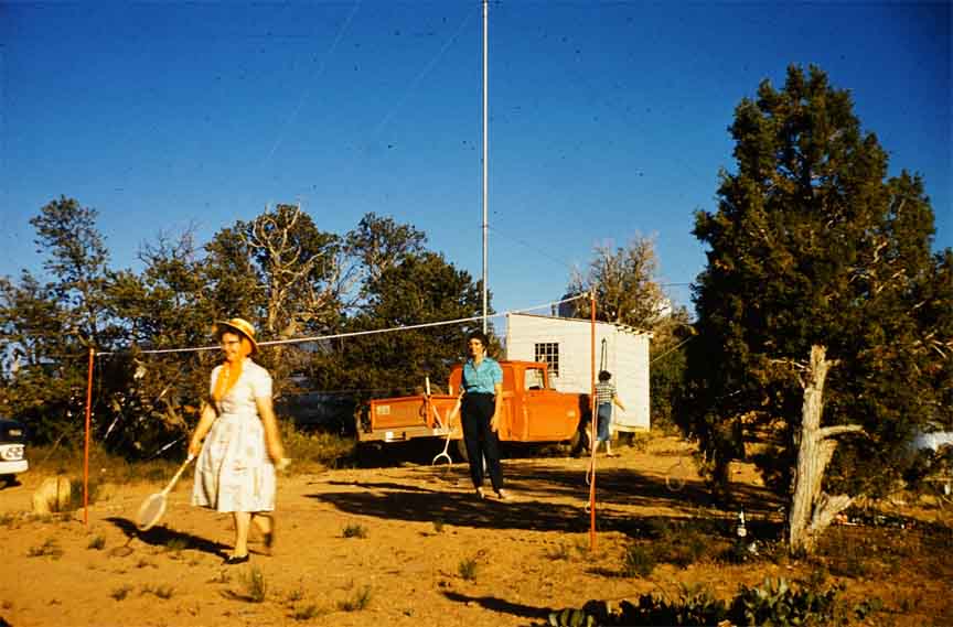
There’s always time for Badminton. The Nielsens and friends had set up camp at Natural Bridges National Monument. After a day exploring the canyon, they took time to bat the birdie..
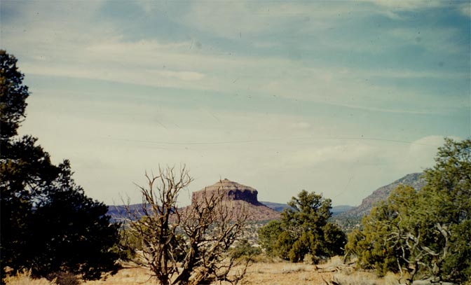
THE WEDDING CAKE…THE CHOCOLATE CAKE…or the name it has after they paved Utah 95. I have a small story to add to this picture. I first drove the old road in 1971. At the time most of the highway east of the Colorado River was unpaved. At the time I saw this beaut of a butte and along the dirt road was a sign that read, “Wedding Cake.” When UDOT started widening and paving the new road, all the informational signs were removed. But for some reason, when the highway was completed and the signs were replaced, it was no longer “The Wedding Cake.” Since 1976, it’s been called “Cheese Box Butte.” If there is anyone out there who knows the story behind the story, I’d love to hear from you…JS
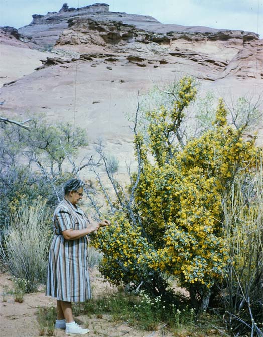
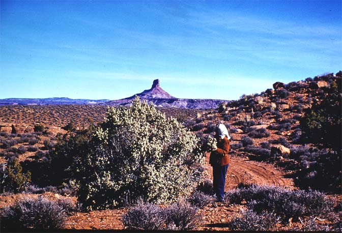
I’m guessing here. The big bush that Beth is attending to looks like Cliffrose in full bloom. When it has a good water year, the blossom are so prolific and sweet that the branches literally sag under their weight. Their fragrance is almost mesmerizing. When I worked at Arches, I could actually smell the aroma as I drove past them, from inside my car… the other possibility is that it could be a Buffalo Berry bush. It was unique to this part of the canyon country. Any botanists out there who would like to provide a more educated guess, than mine is welcomed here…JS
US 160 in the late 50s or very early 60s. The La Sal Mountains loom in the distance. Though it’s in shadow here, look at th width of the road surface…barely wide enough for two carts to pass each other. It’s been the scene of some horrific and fatal car crashes over the years. This is one location where improving ad widening the highway didn’t bother me at all….JS
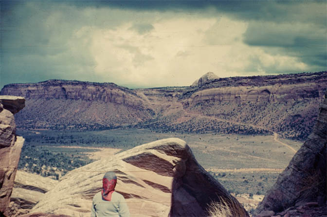
INDIAN CREEK—THE ROAD TO THE NEEEDLES & NEWSPAPER ROCK. 1960. Canyonlands National Park had not even been created yet The road is “surfaced” here, but looks more like gravel. In 1964 the park was created by an act of Congress. This scene is outside the park boundary and has become a mecca for rock climbers.
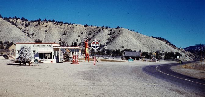
THE MYSTERY PHOTO: This is a marvelous photo of the “Big Indian” gas station. Next tit is the “Rancho Lodge.” The photo was taken about 1960 but I can’t find its location. The hills behind the station look a bit like Mancos Shale. Again, if any Zephyr readers remember this “wide spot in the road,” send me an email…JS
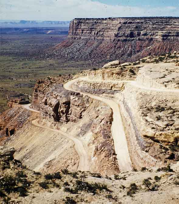
THE HAPPY JACK MINE in WHITE CANYON
THE ACCESS ROAD A& SWITCHBACKS TO THE ‘HAPPY JACK MINE.’
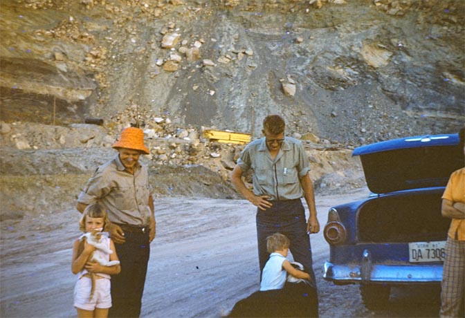
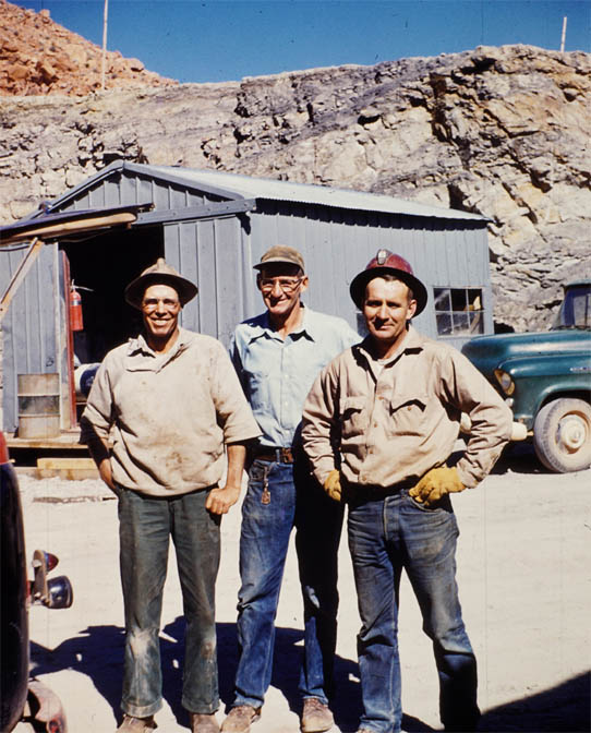
Ruben and Bud Merz. 1961
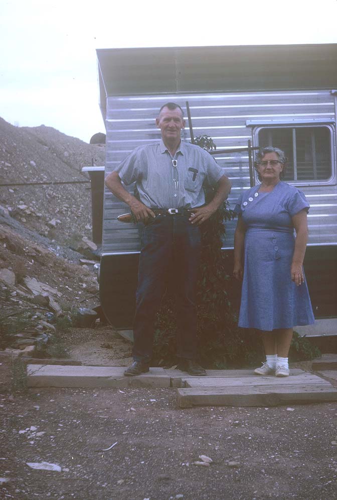
Ruben & Beth at the Happy Jack Mine.
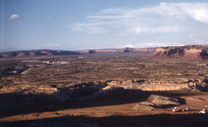
THE VIEW FROM THE MINE, LOOKING INTO WHITE CANYON. There’s a great story about the mine that I found in the Time Magazine archives. Here is an excerpt:
‘Back in 1946, young Joe Cooper and his” father-in-law, Fletcher Bronson, of Monticello, Utah, paid $1,000 for 500 acres of copper-mining property in southwestern Utah. They soon regretted the investment: the copper ore was so heavily contaminated with uranium that nobody wanted to process it. Then the atomic age got into swing, and Cooper and the Bronson family forgot all about copper. Their Happy Jack mine never had a waste dump, because every pound of rock dug up was commercial-grade ore. Last week Cooper, now 45, and the Bronsons decided that the mine was too big for them to develop with their limited resources. They sold the Happy Jack to Barlu Oil Corp. for a price, based on the mine’s production, that may eventually net them $30 million.
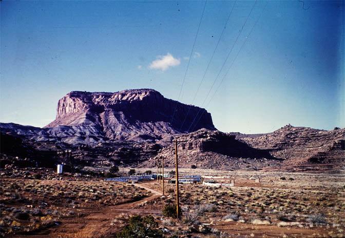
The access road to Blue Notch Gap. This photo was taken near the junction with Hwy 95. From about 1960.
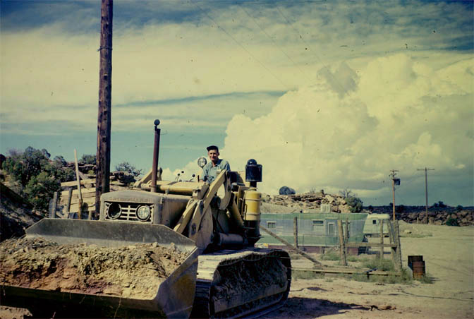
Ruben at work with the front end loader at HJM.
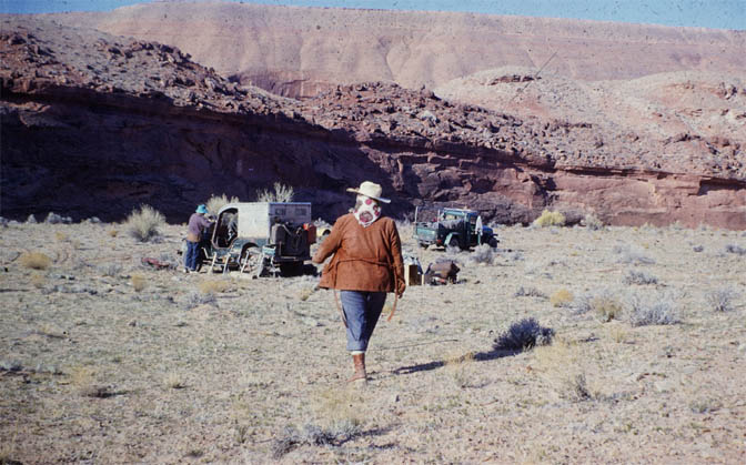
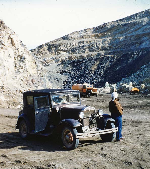
Beth drove one of their Ford Model As up the HJM to vist Ruben and check out the operation. If you like big explosions, this would have been a good day to stop by. See below.
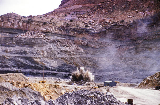
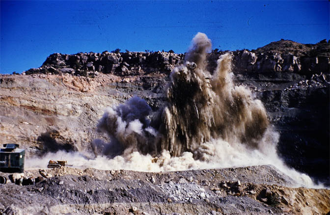
Explosion number 1
Explosion Number 2
Ruben (center) and his buddies take a break from work. October 1962
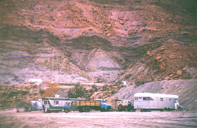
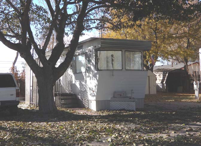
Some of the miners hauled their trailers up the switchbacks and lived on site. It definitely cut down their commute to work. For more on trailers in Moab and the canyon country, from days long gone, click here.
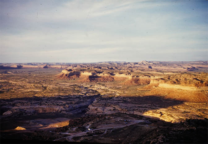
One last view of White Canyon and beyond…from above.
“BUT NO MATTER HOW FAR, OR HOW WIDE THEY ROAMED—THEY STILL CALLED ‘HITE FERRY’ HOME
Ferd and Wayne Johnson. Hite ferry. early 1960s
In the next and final installment of the Nielsen photos, they were there to watch the waters of Lake Powell inundate their Dream. Ruben and Beth documented the changes, and even tells how Ruben and Arth Chaffin tried to make the best of a bad situation with their efforts to salvage what was being left behind. The contraption they built to make their salvage operation work, is a story all by itself…JS
May 1964. Arth Chaffin. Photo by Ruben Nielsen
TO COMMENT ON THIS STORY & THESE AMAZING AND PRICELESS PHOTOGRAPHS, PLEASE SCROLL TO THE BOTTOM OF THIS PAGE. WE’D LIKE TO HEAR FROM YOU, AND ESPECIALLY IF THERE ARE THOS WHO HAVE GLEN CANYON MEMORIES OF THEIR OWN….THANKS…Jim Stiles
The Zephyr Blue Moon Extra posts weekly, usually on Monday morning. We always post the link on The Zephyr facebook page at about 7:30 AM MST and send out the link to our email list at about 7:45 AM…But occasionally I will put the new Extra on our website the night before. If you want a sneak peak, be sure to check: https://www.canyoncountryzephyr.com/.
A limited number of the first paper Zephyr, from March 14, 1989 are available. Email me for prices. Signed copies…
Actually you can “LIKE”or “FOLLOW” us on Facebook. And I encourage you to “like” & “share” individual posts. Why they can’t justleave the site alone is beyond me, but that’s whatFacebook likes to do. ALSO NOTE: I post old photographs and stories from our 25 year old archives every day. Pictures from Herb Ringer, Edna Fridley, Charles Kreischer.. even a few old photos from my Dad. So if you want to stay caught up on our historic photo collections, be sure to “follow” us on Facebook…Thanks…Jim https://www.facebook.com/FansoftheCanyonCountryZephyr/
ZEPHYR AMERICA appears exclusively on The Zephyr Facebook page, every Wednesday morning
NOTE: I’ve been contacted by several readers. I’m not ignoring you. I’m writing for an order of mailing tubes to arrive..
As many of you know, John died on March 15, 2023, 34 years and one day after the passing of his best friend Edward Abbey…Adios Amigo…
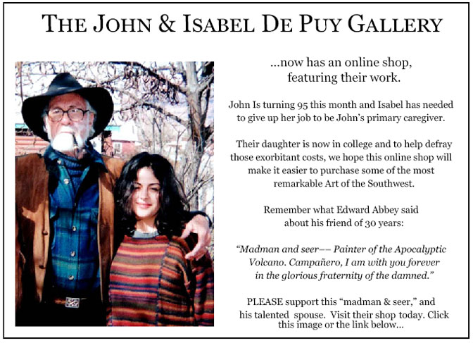
More than six years ago, The Zephyr, me & four other individuals were sued for defamation by the former Moab City Manager. Faced with mounting legal bills, my dear friends John and Isabel De Puy donated one of John’s paintings to be auctioned. ALL the proceeds went to our defense. Thanks to them, our bills were almost completely covered. Now I’d like to return the favor. Check out the link below and their online shop… JS https://www.depuygallery.com/shop.html
For hundreds of archived stories & thousands of historic images, visit our Zephyr home page and use the search bar: https://www.canyoncountryzephyr.com/
PLEASE TAKE THE TIME TO COMMENT BELOW…YOUR COMMENTS AND OBSERVATIONS ARE AS IMPORTANT AS THE STORIES THEMSELVES…OR IF YOU SEE INFORMATION THAT IS INCORRECT…I WANT TO KNOW, SO I CAN MAKE THE CORRECTIONS…THANKS TO ALL OF YOU WHO READ THE ZEPHYR—Jim Stiles
19 comments for “ROAMING GLEN CANYON & THE FOUR CORNERS w/ RUBEN & BETH NIELSEN (ZX#66)”
Donna Andress
June 11, 2023 at 8:19 pm
I remember that Indian in front of the station but so help me I cannot place it! Our adventures didn’t start until we’d traveled NV and AZ where Gail was born and my Mother and step-father lived. AZ We think these pictures of those ’60s days are priceless! History that is no longer available. Glad we have people like you to preserve them.
Donna…I heard from Leslie Nielsen last night. She thinks the Big Indian gas station and Rancho Lodge was near Orderville, Utah, not far from where they lived before the Nielsens made the move to Hite..makes sense.
Thanks Jim, I think tourism would have increased regardless as everyone has a 4X4 SUV anymore and sees their so called social media friends posting everywhere they go and everything they do.
I wonder how the Nielsons felt knowing everything they cared about would soon be under water. Progress cant be stopped it seems but much is lost along the way.
I’ll talk about that in the next installment. They were sad but from what their granddaughter has said, also rather stoic about it. Imagine, they kept tending to their garden and orchard and vineyard right through the summer of 1963, knowing that the impounded waters were headed their way…I think you’ll find the next story fascinating and heartbreaking all at once….Jim
As much as ranching and mining impacted the landscape, the customers for those products were far away, and the vendors had the towns and countryside to themselves. The big problem with industrial tourism is that customers need to visit in person. Maybe somebody could invent a way to sell the canyon country experience to people happy to stay home.
This is important history for everyone in the West. It’s easy for 2020s know-it-alls to demonize the era of mining and resource development documented in these photos and journals, but the homestead was completely in harmony with the environment and the mines were very limited in scope. Nothing was done on an industrial scale, and the folks developing local resources had to take care of the environment supplying their needs. Lake Powell, on the other hand, was created to use water passing through desert to serve the needs of highly industrialized, unnatural and expansive urban populations in the Southwest. Though hydroelectric power is an amazing means of using water and gravity to power whole cities, this level of industrialization has created both a natural and political imbalance.
The Navajo family with the buckboard full of tumbleweeds may seem odd to some, but tumbleweeds are used to this day by Navajo ranchers to feed their stock. Their tough range cattle, horses and sheep eat what’s available and tumbleweeds have always grown in profusion out here.
Thanks Alan…I just left a comment about the location. Leslie Nielsen knew where it was. Thanks for the confirmation and what a great photo…I hope everyone clicks on that picture. Jim
pretty sure your flowering shrub is roundleaf buffaloberry (Sheperdia rotundifolia). The leaves’ hairs can shine in the sunlight and look like flowers in a photo whereas the actual flowers are kind of small. THX for the old photos. Glad I got to see some of that country before it became a zoo, now I honor it by staying the hell away.
I was leaning toward Buffalo Berry myself, by the time I posted it. Especially if it was close to Cedar Mesa…And yeah, my best way of visiting my favorite places in the canyon country is via my memories.
Great photos of places that are now gone or so changed that they are today unrecognizable. I remember many of those views from when I lived in Bluff in 1965 before the hordes descended on San juan County.
Thanks!
Excellent storytelling, both in words and images.
I am looking forward to the next installment with no small amount of sadness. I can’t imagine watching your paradise be slowly inundated.
Another great trip in place and time! Thanks Jim.
Fresh out of college, I worked at Natural Bridges the summers of 1970-71. New to the region, I accepted the posted name of the “Wedding Cake” along White Canyon near Fry Canyon, as accurate. But at least one long-timer there, Carl Mahon, told me then that it’s real name was “Cheesebox”. I believe him now, and that now the original name is restored to the butte.
Thanks for another interesting, informative but ultimately depressing post, Jim.
Big thanks to Leslie for sharing her family photographs and memories with you. Her water colour of the Hite area is both stunningly beautiful and accurate. I now have an even better idea of where Fort Moki sat on its rocky outcrop.
The picture of Ruben motoring downstream in May to check out the ‘progress’ of the reservoir … well the look on his face speaks a thousand words. Powell was rising by 15 to 18 inches per day at that time and submerged the ferry landings sometime on June 5th 1964. The Nielsen farm was approximately 15-20 feet higher than the ferry and the flooding would have started to inundate their crops within the next 12 to 14 days. By the end of June those iconic poplars, vinyards and fruit trees would be swimming in ten feet of water.
BuWreck was desperate to start generating electricity at Glen Canyon Dam and by the end of August they hit the 3490 mark. The Nielsen farm was now under 25 feet of water. In a few short weeks, all traces of the thriving communities at Hite and White Canyon had been erased forever.
P.S. Jim. The picture captioned ‘The access road to Blue Notch Gap’ reminds me that I left a rather windy analysis of the location of the photographer in Picture 12 of your ‘UT Hwy 95: The Road To Glen Canyon & Hite Ferry w/ Edna Fridley & Charles Kreischer: 1959-62 (ZX#16) post’. I subsequently realised this picture was taken at the junction of 95 and Blue Notch Road looking pretty much north.
Picture 13 from your post ‘UT Hwy 95: The Road To Glen Canyon & Hite Ferry w/ Edna Fridley & Charles Kreischer: 1959-62 (ZX#16)’, ‘White Canyon and Utah Hwy 95 by Edna Fridley. 1962’ ties in with Pic 5 here, ‘A wider view of the landing strip at White Canyon …’
In 1962, Edna had driven up that track well beyond the airstrip and, when taking this photo, had a clear view of where the ‘Hite’ marina would eventually materialise. Whether that track went all the way to the area of the future marina is difficult to discern. The temporary ferry operated out of North Wash at least between early August ’64 (3489) and late September ’65 (3529) so these passengers had to exit on the left bank and make their way onwards somehow. Did this track run all the way along the left bank, through the future ‘Hite’ marina area, and then up and out to wherever? If anyone has any information on the temporary ferry at North Wash, 64-65 and possibly 66, I’d be more than grateful to read it.
These images are beyond precious. The Nielsen family lived a life in complete harmony with nature.
The photo of the Navajo family with a buckboard loaded with Russian thistle, aka tumbleweeds, may seem odd to some, but tough Navajo stock; churro sheep, cows and their rangey horses, eat what’s available on the desert, and Russian thistle grows in profusion even in drought–and it’s pretty nutritious as well.
Thank you, Jim, for keeping this history alive for us to enjoy and learn from. Would that we could return to such days of peaceful equilibrium.
I’m glad you confirmed what appeared to be in that wagon. I couldn’t imagine it was anything like alfalfa or anything grown specifically for livestock. It looked like tumbleweed but it never occurred to me that collect it for feed. Tough Navajo livestock is right. I also didn’t know it had any nutritional value. Thanks for the lesson, cowgirl


I remember that Indian in front of the station but so help me I cannot place it! Our adventures didn’t start until we’d traveled NV and AZ where Gail was born and my Mother and step-father lived. AZ We think these pictures of those ’60s days are priceless! History that is no longer available. Glad we have people like you to preserve them.
Donna…I heard from Leslie Nielsen last night. She thinks the Big Indian gas station and Rancho Lodge was near Orderville, Utah, not far from where they lived before the Nielsens made the move to Hite..makes sense.
Thanks Jim, I think tourism would have increased regardless as everyone has a 4X4 SUV anymore and sees their so called social media friends posting everywhere they go and everything they do.
I wonder how the Nielsons felt knowing everything they cared about would soon be under water. Progress cant be stopped it seems but much is lost along the way.
I’ll talk about that in the next installment. They were sad but from what their granddaughter has said, also rather stoic about it. Imagine, they kept tending to their garden and orchard and vineyard right through the summer of 1963, knowing that the impounded waters were headed their way…I think you’ll find the next story fascinating and heartbreaking all at once….Jim
As much as ranching and mining impacted the landscape, the customers for those products were far away, and the vendors had the towns and countryside to themselves. The big problem with industrial tourism is that customers need to visit in person. Maybe somebody could invent a way to sell the canyon country experience to people happy to stay home.
This is important history for everyone in the West. It’s easy for 2020s know-it-alls to demonize the era of mining and resource development documented in these photos and journals, but the homestead was completely in harmony with the environment and the mines were very limited in scope. Nothing was done on an industrial scale, and the folks developing local resources had to take care of the environment supplying their needs. Lake Powell, on the other hand, was created to use water passing through desert to serve the needs of highly industrialized, unnatural and expansive urban populations in the Southwest. Though hydroelectric power is an amazing means of using water and gravity to power whole cities, this level of industrialization has created both a natural and political imbalance.
The Navajo family with the buckboard full of tumbleweeds may seem odd to some, but tumbleweeds are used to this day by Navajo ranchers to feed their stock. Their tough range cattle, horses and sheep eat what’s available and tumbleweeds have always grown in profusion out here.
These images are beyond precious.
https://www.flickr.com/photos/michael3900/11536425334
Big Indian Gas Station, Orderville Ut.
Thanks Alan…I just left a comment about the location. Leslie Nielsen knew where it was. Thanks for the confirmation and what a great photo…I hope everyone clicks on that picture. Jim
pretty sure your flowering shrub is roundleaf buffaloberry (Sheperdia rotundifolia). The leaves’ hairs can shine in the sunlight and look like flowers in a photo whereas the actual flowers are kind of small. THX for the old photos. Glad I got to see some of that country before it became a zoo, now I honor it by staying the hell away.
I was leaning toward Buffalo Berry myself, by the time I posted it. Especially if it was close to Cedar Mesa…And yeah, my best way of visiting my favorite places in the canyon country is via my memories.
Amazing pictorial. Thanks for publishing this.
Great photos of places that are now gone or so changed that they are today unrecognizable. I remember many of those views from when I lived in Bluff in 1965 before the hordes descended on San juan County.
Thanks!
great photos–now that the lake has receded so much, has any of the old farm “re-appeared”?
I doubt it. The sediment deposited by the reservoir is up to 120 feet deep in that area.
Excellent storytelling, both in words and images.
I am looking forward to the next installment with no small amount of sadness. I can’t imagine watching your paradise be slowly inundated.
Another great trip in place and time! Thanks Jim.
Fresh out of college, I worked at Natural Bridges the summers of 1970-71. New to the region, I accepted the posted name of the “Wedding Cake” along White Canyon near Fry Canyon, as accurate. But at least one long-timer there, Carl Mahon, told me then that it’s real name was “Cheesebox”. I believe him now, and that now the original name is restored to the butte.
Thanks for another interesting, informative but ultimately depressing post, Jim.
Big thanks to Leslie for sharing her family photographs and memories with you. Her water colour of the Hite area is both stunningly beautiful and accurate. I now have an even better idea of where Fort Moki sat on its rocky outcrop.
The picture of Ruben motoring downstream in May to check out the ‘progress’ of the reservoir … well the look on his face speaks a thousand words. Powell was rising by 15 to 18 inches per day at that time and submerged the ferry landings sometime on June 5th 1964. The Nielsen farm was approximately 15-20 feet higher than the ferry and the flooding would have started to inundate their crops within the next 12 to 14 days. By the end of June those iconic poplars, vinyards and fruit trees would be swimming in ten feet of water.
BuWreck was desperate to start generating electricity at Glen Canyon Dam and by the end of August they hit the 3490 mark. The Nielsen farm was now under 25 feet of water. In a few short weeks, all traces of the thriving communities at Hite and White Canyon had been erased forever.
P.S. Jim. The picture captioned ‘The access road to Blue Notch Gap’ reminds me that I left a rather windy analysis of the location of the photographer in Picture 12 of your ‘UT Hwy 95: The Road To Glen Canyon & Hite Ferry w/ Edna Fridley & Charles Kreischer: 1959-62 (ZX#16) post’. I subsequently realised this picture was taken at the junction of 95 and Blue Notch Road looking pretty much north.
Picture 13 from your post ‘UT Hwy 95: The Road To Glen Canyon & Hite Ferry w/ Edna Fridley & Charles Kreischer: 1959-62 (ZX#16)’, ‘White Canyon and Utah Hwy 95 by Edna Fridley. 1962’ ties in with Pic 5 here, ‘A wider view of the landing strip at White Canyon …’
In 1962, Edna had driven up that track well beyond the airstrip and, when taking this photo, had a clear view of where the ‘Hite’ marina would eventually materialise. Whether that track went all the way to the area of the future marina is difficult to discern. The temporary ferry operated out of North Wash at least between early August ’64 (3489) and late September ’65 (3529) so these passengers had to exit on the left bank and make their way onwards somehow. Did this track run all the way along the left bank, through the future ‘Hite’ marina area, and then up and out to wherever? If anyone has any information on the temporary ferry at North Wash, 64-65 and possibly 66, I’d be more than grateful to read it.
Thanks, stiles 🙂
These images are beyond precious. The Nielsen family lived a life in complete harmony with nature.
The photo of the Navajo family with a buckboard loaded with Russian thistle, aka tumbleweeds, may seem odd to some, but tough Navajo stock; churro sheep, cows and their rangey horses, eat what’s available on the desert, and Russian thistle grows in profusion even in drought–and it’s pretty nutritious as well.
Thank you, Jim, for keeping this history alive for us to enjoy and learn from. Would that we could return to such days of peaceful equilibrium.
I’m glad you confirmed what appeared to be in that wagon. I couldn’t imagine it was anything like alfalfa or anything grown specifically for livestock. It looked like tumbleweed but it never occurred to me that collect it for feed. Tough Navajo livestock is right. I also didn’t know it had any nutritional value. Thanks for the lesson, cowgirl