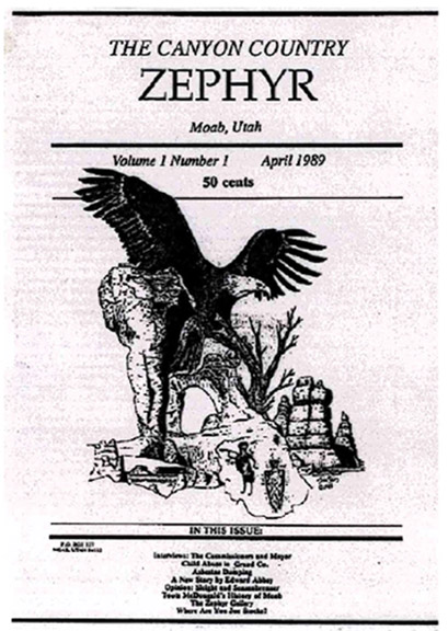
NOTE: To comment on this post and the images included in it, please scroll to the bottom of this page. And especially if you have your own memories to share, The Zephyr wants to hear them…Thanks! JS
A couple years ago, I was randomly searching Google for historical stories or images that might be related to Moab or Southeast Utah. I came across a few images, shot in the spring of 1972, and credited to the United States National Archives. I’ve posted three ort four of them, individually on the Zephyr’s Facebook page. But this week, I tried to dig a little deeper into the origin of these images and struck pay dirt. I discovered that there were far more images, just by this one photographer, than I could have imagined. Just this year, David Hiser, the photographer who shot these and at least 400 more of the American Southwest was highlighted in an updated National Archives story about the project. It was put together by NARA archives specialist Larry Shockley. All of these images are in the public domain and were taken under the auspices of the US National Archives.
According to the NARA site, “In 1972 David Hiser was one of several photographers chosen by the Environmental Protection Agency (EPA) to document locations in the United States as part of the DOCUMERICA Project. Over 460 of Hiser’s photos can now be found in the National Archives Catalog.” Hiser moved to Aspen, Colorado when he was 25 years old, and would enjoy a successful career as a photographer, including 66 contributions to National Geographic.
Here is a selection from those images that feature Moab, Utah and the Canyon Country of southeast Utah. I arrived in Moab just months after Hiser completed his photo work and have added my own commentary to his photos…JS
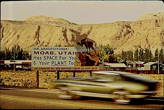
WELCOME TO MOAB, UTAH
In the early 1970s, Moab looked at tourism as a side line economy. Few thought it could sustain a 12 month economy. Oil and gas exploration, uranium mines and the Atlas processing mill comprised most of the jobs in Grand County. Since Moab was only 30 miles south of Interstate 70 and a major east-west rail line, some Moabites thought the town could attract more industry. For years there was a sewing factory in Moab that survived into the early 1980s. But soon Tourism would, for better or worse, become Moab’sfuture,
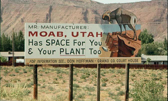
A closeup of the “Mr. Manufacturer” sign.
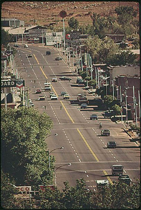
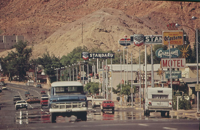
Photographer Hiser found a perfect viewpoint at the far north of town, looking south and adjacent to the Elks Club– one of Moab’s (and Charlie Steen’s) favorite watering holes. Just recently the Elks Club was torn down.
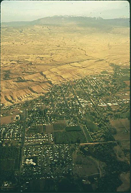
A vertical perspective of the same view. You can see many businesses that no longer exist in Moab.
Moab’s Main Street looking north. In this image, Hiser pointed his camera back toward the Elks Club, which is visible at the far upper left corner.
From atop The Portal, a sunset view of Moab, looking south toward Spanish Valley and, in the distance, the La Sal Mtns.
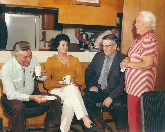
I’d love to know the backstory of this photo. At far left is Sheriff Heck Bowman and his wife. I don’t know the other couple. Any ideas?
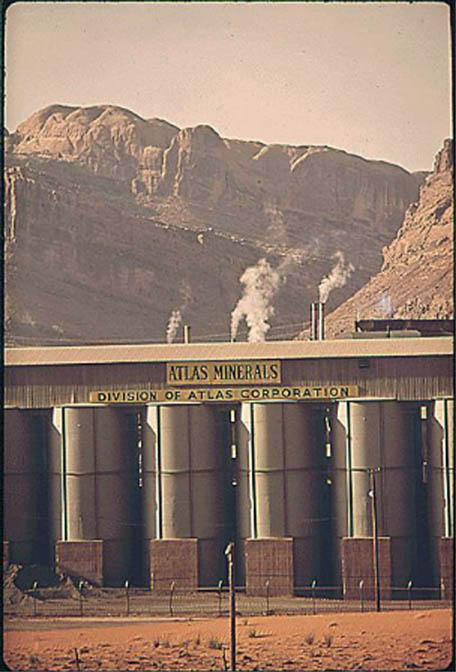
Moab’s main employer in 1972 was still the Atlas Mill, which had been founded by Steen and then sold to the Atlas Corporation.
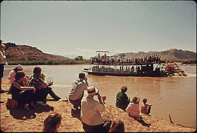
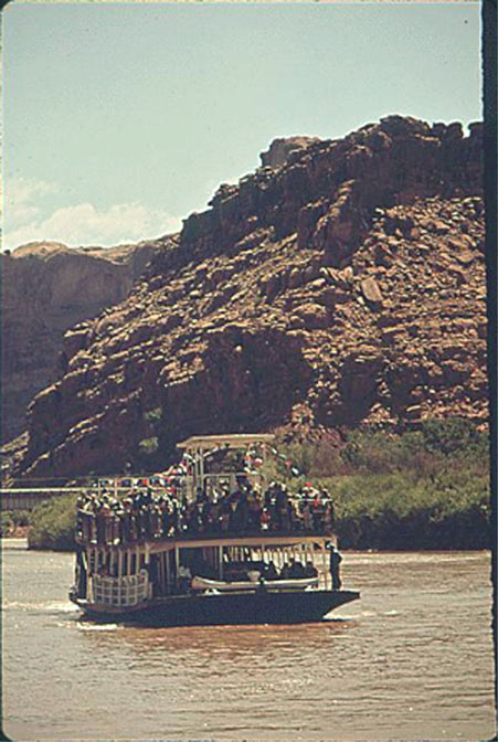
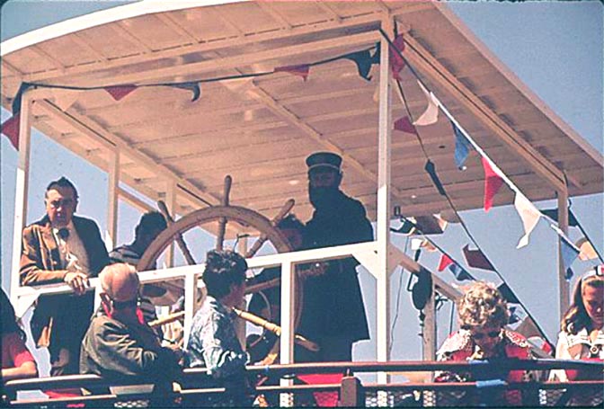
TEX McCLATCHY’S ‘CANYON KING’ STERN WHEELER
I’ve heard many stories about the premiere launch of Tex McClatchy’s “Canyon King.” I’m sure there are some Zephyr readers who can add a few details.
A vertical view of a very overloaded “Canyon King.” No wonder they ran aground on a sand bar.
This is a great image. That’s Cap’n Tex McClatchy himself at the helm. But I’m pretty sure that the man at the far left, leaning on the railing, is Utah Governor Calvin Rampton.
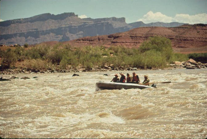
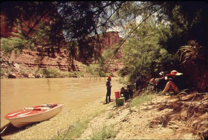
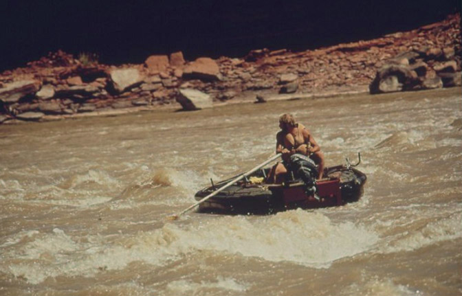
RUNNING THE DAILY ON THE COLORADO RIVER. 1972
The Colorado River was beginning to get a reputation for its ‘Daily” river cruises. Companies were already setting up shop, but there were just a few— like Jim Sarten’s North AmericanandTex’s Riverways, and Adrift… The Future was still a few years away.
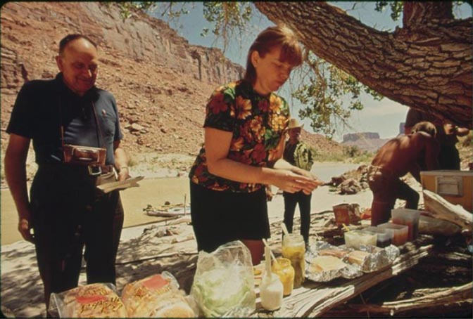
A river pause for lunchbeneath the tamarisk..
Running an easy rapid on the Colorado River.
Lunch time.
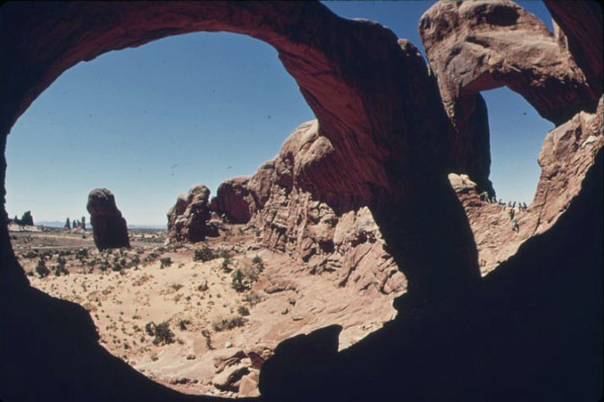
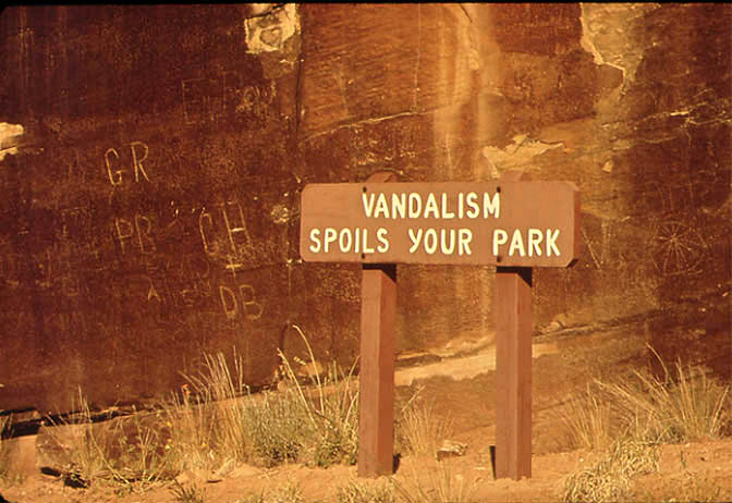
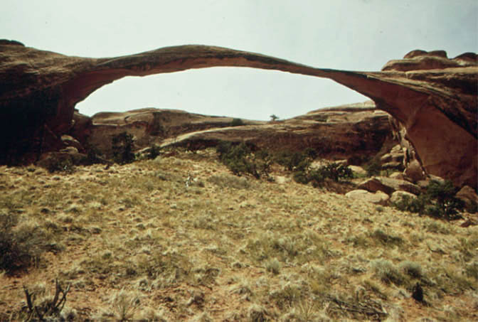
ARCHES NATIONAL PARK
Looking through The Spectacles at the Windows.
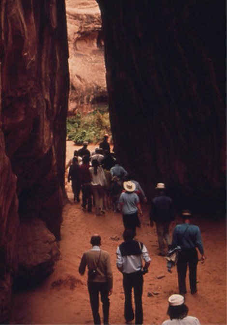
Even in 1972, crowds turned out for the Fiery Furnace ranger guided tours.
The Devils Garden Campground from the top of the loop, looking toward the La Sal Mountains.
Two young campers at the Devils Garden in 1972.
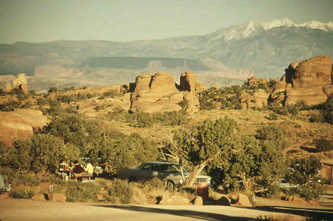
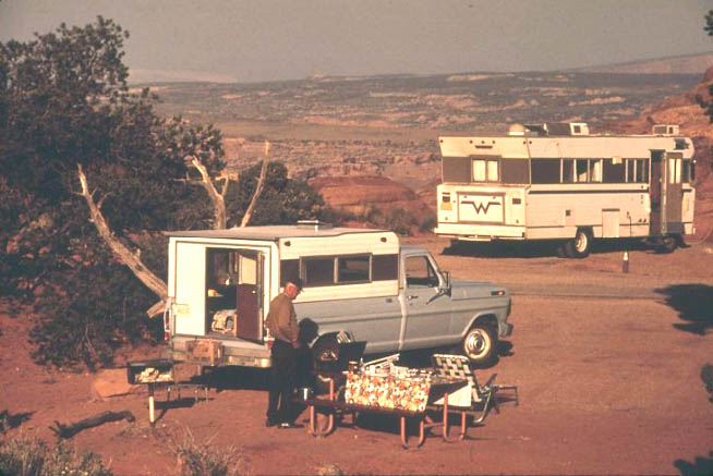
Campers at Arches, including an early day Winnabago.
Some things never change.
Landscape Arch. 1972. There were no official trails to the arch itself and many social trails started appearing in the bunch grass. In 1985, a new loop trail was built beneath the arch, but a few years later, when a slab broke loose from near the north end of the span, the trail was closed and never reopened.
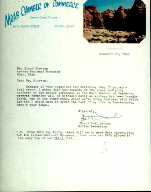
A MEMORABLE LETTER from Betty Jacobs at THE MOAB CHAMBER of COMMERCE to Chief Ranger Lloyd Pierson at Arches National Monument…written in 1960
If you knew Lloyd Pierson, you knew he was a very spirited and outspoken park ranger at Arches. He was Ed Abbey’s boss in 1957. I’d love to know the backstory behind this letter from Betty Jacobs…she was also quite “spirited!”
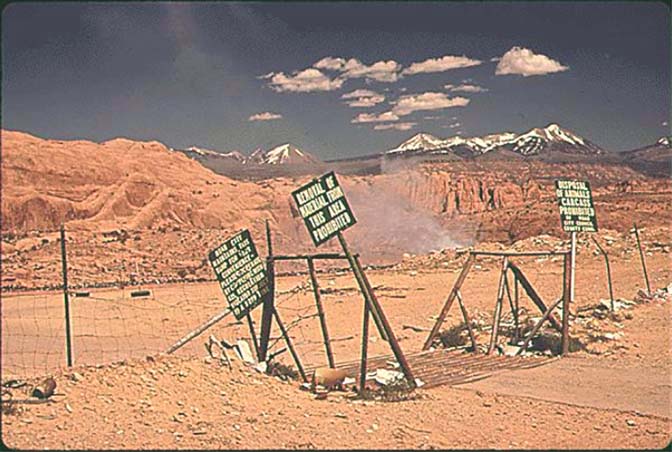
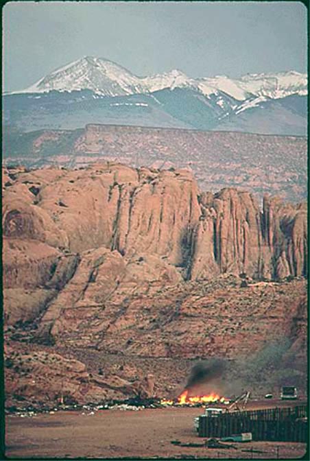
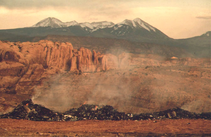
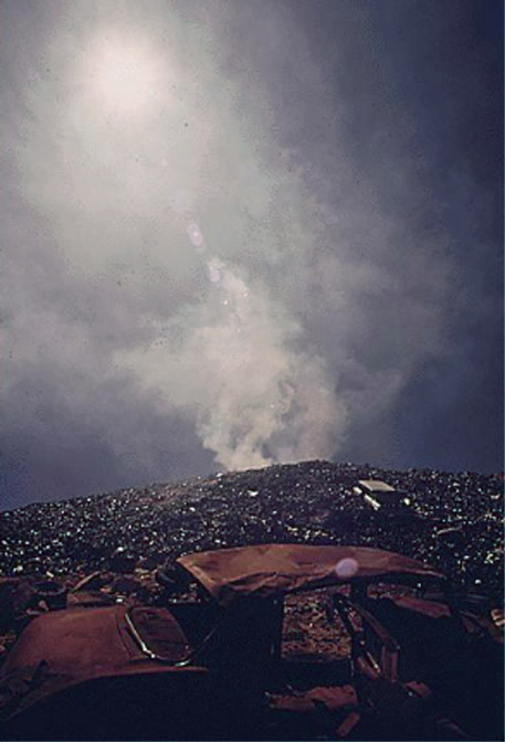
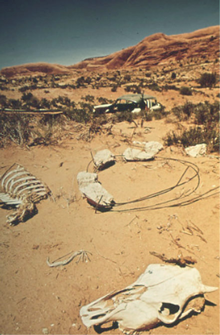
THE MOAB DUMP & LANDFILL
Years before Moab promoted its landfill as “America’s Most Scenic Dump,” photographer David Hiser was already drawn to it. Here are a series of images by Hiser…
Until the early 1980s, Moab City burned its garbage on the Sand Flats, several hundred feet above the valley floor. It was the subject of debate for years.
More burning trash with the most scenic backdrop.
Early morning sun backlights the smoke.
Hiser labeled this photo “dead cow bones near dump.”
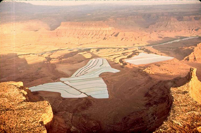
THE VIEWS FROM DEAD HORSE POINT & THE ISLAND-IN-THE-SKY
The Potash evaporation ponds below Dead Horse Point.
A telephoto shot of the Shafer Trail as it switchbacks its way to the top of Dead Horse Mesa and Island in the Sky.
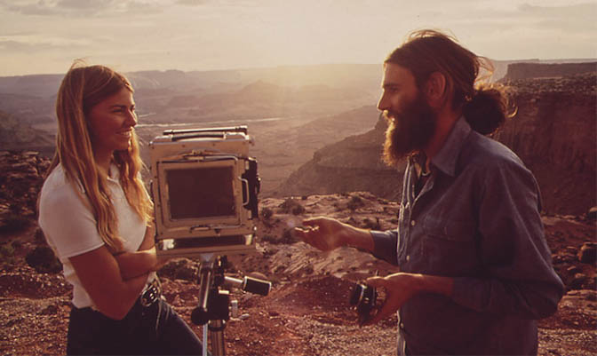
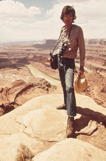
Preparing to shoot more photos for the National Archives project.
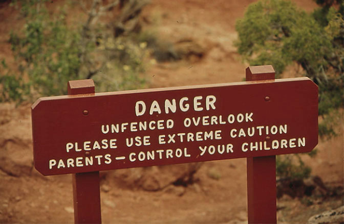
“Control your children.”
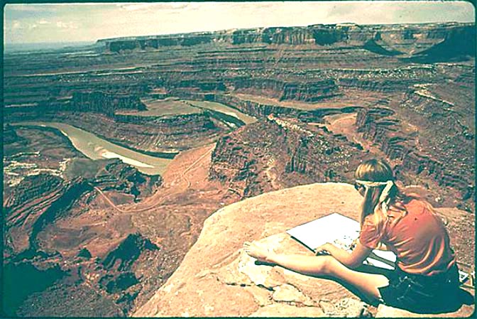
The view from Dead Horse Mesa.
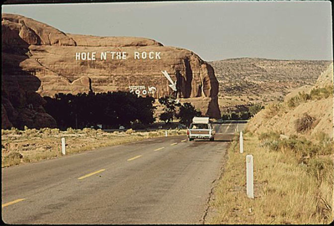
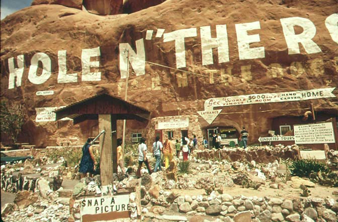
HEADING SOUTH ON WHAT WAS THEN US 160…& HOLE N” THE ROCK
Approaching Hole N” the Rock on US 160. Southbound.
The front of the Hole N” the Rock tourist attraction.
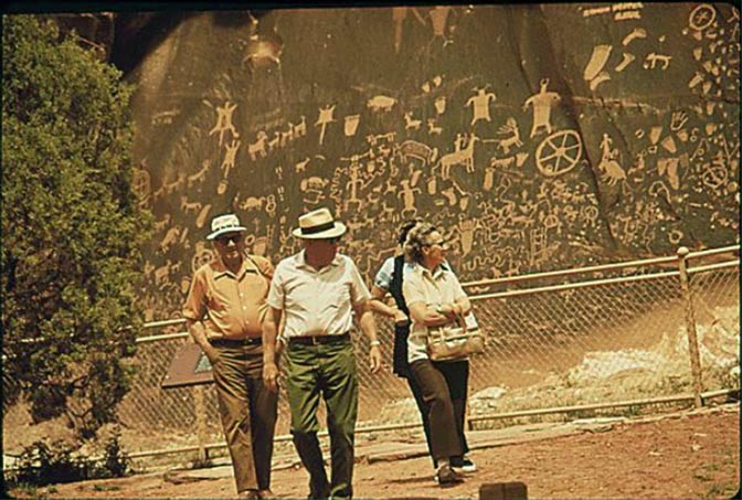
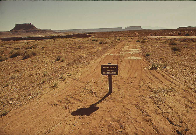
NEWSPAPER ROCK & THE ROAD TO THE NEEDLES
The State Park on the road to the Needles District of Canyonlands NP.
An early NPS attempted to close and “scenically restore” some of the secondary roads in the park. (As a future park ranger, I have to wonder where Brad Boyle was when this photo was taken.)
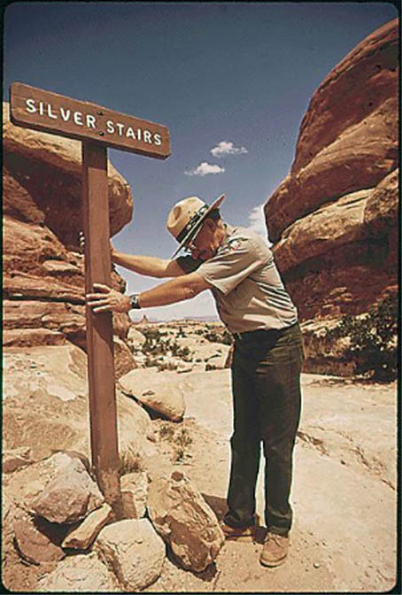
Park Ranger stabilizes a sign in the Needles.
David Hiser’s photos can now be found in the National Archives Catalog.” Hiser moved to Aspen, Colorado when he was 25 years old, and would enjoy a successful career as a photographer, including 66 contributions to National Geographic.
He still lives in Aspen, Colorado.
TO COMMENT ON THIS STORY, PLEASE SCROLL TO THE BOTTOM OF THIS PAGE.
The Zephyr Blue Moon Extra posts weekly, usually on Monday morning. We always post the link on The Zephyr facebook page at about 7:30 AM MST and send out the link to our email list at about 7:45 AM…But occasionally I will put the new Extra on our website the night before. If you want a sneak peak, be sure to check: https://www.canyoncountryzephyr.com/
Actually you can “LIKE”or “FOLLOW” us on Facebook. And I encourage you to “like” & “share” individual posts. Why they can’t justleave the site alone is beyond me, but that’s whatFacebook likes to do. ALSO NOTE: I post old photographs and stories from our 25 year old archives every day. Pictures from Herb Ringer, Edna Fridley, Charles Kreischer.. even a few old photos from my Dad. So if you want to stay caught up on our historic photo collections, be sure to “follow” us on Facebook…Thanks…Jim https://www.facebook.com/FansoftheCanyonCountryZephyr/
http://www.canyoncountryzephyr.com/advertise/indexnewz.htm THESE ARE JUST SOME OF OUR BACKBONE SUPPORTERS. IF YOU’D LIKE TO JOIN THE ZEPHYR BACKBONE & GET ‘TOONED BY STILES, THEN GOD HELP YOU. BUT EVERYONE WHO CONTRIBUTES $100 IS DUE A RENDERING, BUT YOU NEED TO SEND AHEAD & SHOULDERS PHOTO OF YOURSELF AND HOPE FOR THE BEST.
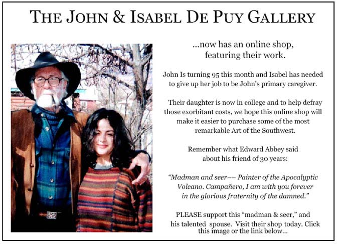
As many of you know, John died on March 15, 2023, 34 years and one day after the passing of his best friend Edward Abbey…Adios Amigo…
More than six years ago, The Zephyr, me & four other individuals were sued for defamation by the former Moab City Manager. Faced with mounting legal bills, my dear friends John and Isabel De Puy donated one of John’s paintings to be auctioned. ALL the proceeds went to our defense. Thanks to them, our bills were almost completely covered. Now I’d like to return the favor. Check out the link below and their online shop… JS https://www.depuygallery.com/shop.html
For hundreds of archived stories & thousands of historic images, visit our Zephyr home page and use the search bar, or just scroll down the homepage: https://www.canyoncountryzephyr.com/
1972… that fall I went on my first backpacking trip (age 16) in a blizzard on the Appalachian Trail. I had no idea southern Utah even existed. It would be another 9 years before I stumbled into Arches National Park.
The “unknown couple”in the picture with the sheriff are Moab natives Dan and Helen Winbourn. Dan was a game warden and Helen’s maiden name was Fish. Dan is my uncle. The Winbourns were quite prominent in Moab for many decades.
I have to confess that the dump fire pics, ugly as a dump fire is, are kind of classic. That said, I’ve never understood the passion for burning garbage and leaves and yard waste.
God, not only was the town prettier back then, but the people were too! I love that early 70s look.
Anyone know the viewpoint from which the pic from far north of town would have been taken?
The Portal Overlook Trail was reworked from the northside Colorado river road in 1978 by the Young Adult Conservation Corps along with the nearby spring. It trends upward on a long scenic bench. Take water as most of the trail has no shade.
Wow, guess as a person gets older they enjoy the old photos more and more. Moab has sure changed over the years especially the last 10 or so years with all the new Motels and amenities, and road expansions.
Had to chuckle of the photos of the Paddle Wheel Boats on the Colorado, now these days it’s loud Jet Boat Tours almost at the Amusement Park level.
On the Deadhorse Point, even back then the Potash Evaporation Ponds ruined such a beautiful view. Sometimes even the roads can keep away taking an awesome photo.
Keep up the great work, always look forward to your next posting.
Beautiful pictures and wonderful commentary! The lady with the Bowmans looks familiar. I will keep scratching my head to see if it comes to me and may ask a few family members. I laughed when I read Betty Jacob’s letter. I think she was also the Secretary at our High School. I will have to look at an old yearbook to see for sure. I left Moab in 1972 when I graduated from GCHS. I was back a few more summers to work at the Travelodge and earn money to pay for college. I sure miss that place. Thanks again for this wonderful trip down memory lane!
Betty Jacobs was a firecracker. I loved her… uh…. Candor. In fact she and Lloyd shared that common trait. I would have bought a ringside seat to watch those two mix it up.
Wow. What a blast to the past! This is a remarkable visual chronicle of the Moab I grew up in. I remember well the carcass dump near the city dump, and this evokes a morbid memory of a group of kids–I won’t name names but I was among them–who would venture up there and use the dead animals for target practice. It was a gruesome place to begin with…but I won’t go on about that. My pappy taught me to shoot his bolt-action .22 rifle at one of the dispersed rifle ranges up on the sand flats. I believe the couple in the photograph of Heck Bowman are Dan and Helen Winburn (not sure if that is the correct spelling), both of whom were friends with my parents. Heck Bowman was a tough lawman, but always fair and compassionate. For the most part in those days, the locals looked out and cared for one another.
I posted earlier but I do not see my post now. My uncle and aunt are Dan and Helen Winbourn. Both were Moab natives. Uncle Dan was a game warden. They are the other couple in the picture with the sheriff.
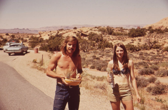
I feel I should recognize all the young people, as we all more or less looked like that. I first started camping in the area in ’68, but didn’t get to move there until 10 years later.


Seems a shame for that dump with fire and smoke to be besmudging that gorgeous landscape!
There’s a backstory to the burning dump. You’d be amazed how long they kept doing that. … into the early 80s for sure.
1972… that fall I went on my first backpacking trip (age 16) in a blizzard on the Appalachian Trail. I had no idea southern Utah even existed. It would be another 9 years before I stumbled into Arches National Park.
I first passed through Moab in January 1973. One of the coldest and snowiest winters that even the oldtimers could recall. And my VW had no heater.
Great photos of the Moab I remember from 1965 and even in the early ’70s.
The “unknown couple”in the picture with the sheriff are Moab natives Dan and Helen Winbourn. Dan was a game warden and Helen’s maiden name was Fish. Dan is my uncle. The Winbourns were quite prominent in Moab for many decades.
I have to confess that the dump fire pics, ugly as a dump fire is, are kind of classic. That said, I’ve never understood the passion for burning garbage and leaves and yard waste.
God, not only was the town prettier back then, but the people were too! I love that early 70s look.
Anyone know the viewpoint from which the pic from far north of town would have been taken?
The Portal Overlook Trail was reworked from the northside Colorado river road in 1978 by the Young Adult Conservation Corps along with the nearby spring. It trends upward on a long scenic bench. Take water as most of the trail has no shade.
Thank you Jim as always great stuff!
Thanks Shannon.
What a treasure trove! Thanks for posting.
Wow, guess as a person gets older they enjoy the old photos more and more. Moab has sure changed over the years especially the last 10 or so years with all the new Motels and amenities, and road expansions.
Had to chuckle of the photos of the Paddle Wheel Boats on the Colorado, now these days it’s loud Jet Boat Tours almost at the Amusement Park level.
On the Deadhorse Point, even back then the Potash Evaporation Ponds ruined such a beautiful view. Sometimes even the roads can keep away taking an awesome photo.
Keep up the great work, always look forward to your next posting.
Beautiful pictures and wonderful commentary! The lady with the Bowmans looks familiar. I will keep scratching my head to see if it comes to me and may ask a few family members. I laughed when I read Betty Jacob’s letter. I think she was also the Secretary at our High School. I will have to look at an old yearbook to see for sure. I left Moab in 1972 when I graduated from GCHS. I was back a few more summers to work at the Travelodge and earn money to pay for college. I sure miss that place. Thanks again for this wonderful trip down memory lane!
Betty Jacobs was a firecracker. I loved her… uh…. Candor. In fact she and Lloyd shared that common trait. I would have bought a ringside seat to watch those two mix it up.
Wow. What a blast to the past! This is a remarkable visual chronicle of the Moab I grew up in. I remember well the carcass dump near the city dump, and this evokes a morbid memory of a group of kids–I won’t name names but I was among them–who would venture up there and use the dead animals for target practice. It was a gruesome place to begin with…but I won’t go on about that. My pappy taught me to shoot his bolt-action .22 rifle at one of the dispersed rifle ranges up on the sand flats. I believe the couple in the photograph of Heck Bowman are Dan and Helen Winburn (not sure if that is the correct spelling), both of whom were friends with my parents. Heck Bowman was a tough lawman, but always fair and compassionate. For the most part in those days, the locals looked out and cared for one another.
I posted earlier but I do not see my post now. My uncle and aunt are Dan and Helen Winbourn. Both were Moab natives. Uncle Dan was a game warden. They are the other couple in the picture with the sheriff.
I feel I should recognize all the young people, as we all more or less looked like that. I first started camping in the area in ’68, but didn’t get to move there until 10 years later.
The couple with the Bowmans: Dan and Helen Winbourne