Tag: bureau of reclamation

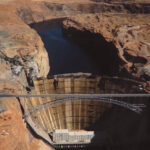
The Irony of Glen Canyon Dam’s Eventual Demise —Jim Stiles (ZX#98)

If you didn’t live through the 1950s, there’s a commonly held but false impression that ‘nothing happened’ during the decade… But the decade of the ‘50s initiated the groundwork, literally, for what was to come. After a decade of the Great Depression and four years of world war. Growth was inevitable, but the explosive growth was stunning…

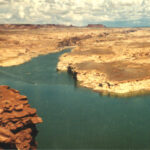
In order for the arid Southwest to grow far beyond anything that could be called “sustainable,” proponents needed two rare commodities for the arid deserts — water and power. Projects like Glen Canyon Dam and the Powell Reservoir were planned and built with that goal in mind.

Damn sustainability…full speed AHEAD.

E.C. LaRue & the Colorado “River of Menace & Destruction” (ZX#33) By Gene Stevenson

“The river of menace and destruction”… In the early 20th century, that’s the way farmers in the Imperial Valley of California viewed the Colorado River after it breached its banks and flooded into the Salton Sink in 1905-07. This wasn’t the first time the mighty river had jumped its banks, but the agriculture industry was determined this HAD to be the last. And it was – maybe. I’m not going to rehash how the Colorado River Compact of 1922 came to be passed by a bunch of politicians who gathered together in some isolated resort lodge near Santa Fe, New Mexico. But one key player is seldom mentioned when the history of the grossly inaccurate Compact is discussed. Or the devastating effect it poses on the future of the Colorado River Basin. His name was Eugene Clyde LaRue.

Even though erroneous assumptions were made and compiled in various tables, E.C. LaRue knew the Colorado River better than almost anyone, and was the most experienced engineer, even if his goals for the river were as wrongheaded as everyone else. He had personally surveyed just about every tributary and segments of main stems of the entire Colorado River Drainage Basin. Why did his compatriots give him a place at the table? Who was this guy anyway?

GLEN CANYON & HITE OVERLOOK—The View for the Past 51 Years w/Jim Stiles (ZX#30)

But in the late 1960s, plans were made to pave the entire Hanksville to Blanding Road. In addition they would have to find an alternative for the ferry. The waters of Lake Powell reached Hite by 1964. The ferry was gone. To replace this simple operation would not be easy. At pool level the lake would be too wide for a single bridge. And so UDOT devised a plan to connect the two sides of the river by constructing three new bridges. It was their only option. Coming from the east, the first formidable barrier was White Canyon. It was a narrow crossing but very, very deep. Once that obstacle was overcome, the new road descended toward the Colorado. At the point where Narrow Canyon meets the Glen, the largest of the three bridges crossed the Colorado River. Finally there was the Dirty Devil River to get over. Thus bridge number three.

When I first discovered the old Utah Hwy 95 in 1971, I was coming from the east and Blanding. The road stayed paved for just a few miles before it turned to dirt. I reached the top of the Comb Ridge Dugway, descended 2000 feet to the wash and then climbed out of the wooded verdant valley and onto Cedar Mesa

It was like another world, I saw no one…. and then everything changed.