
Just as the Boom was Beginning…
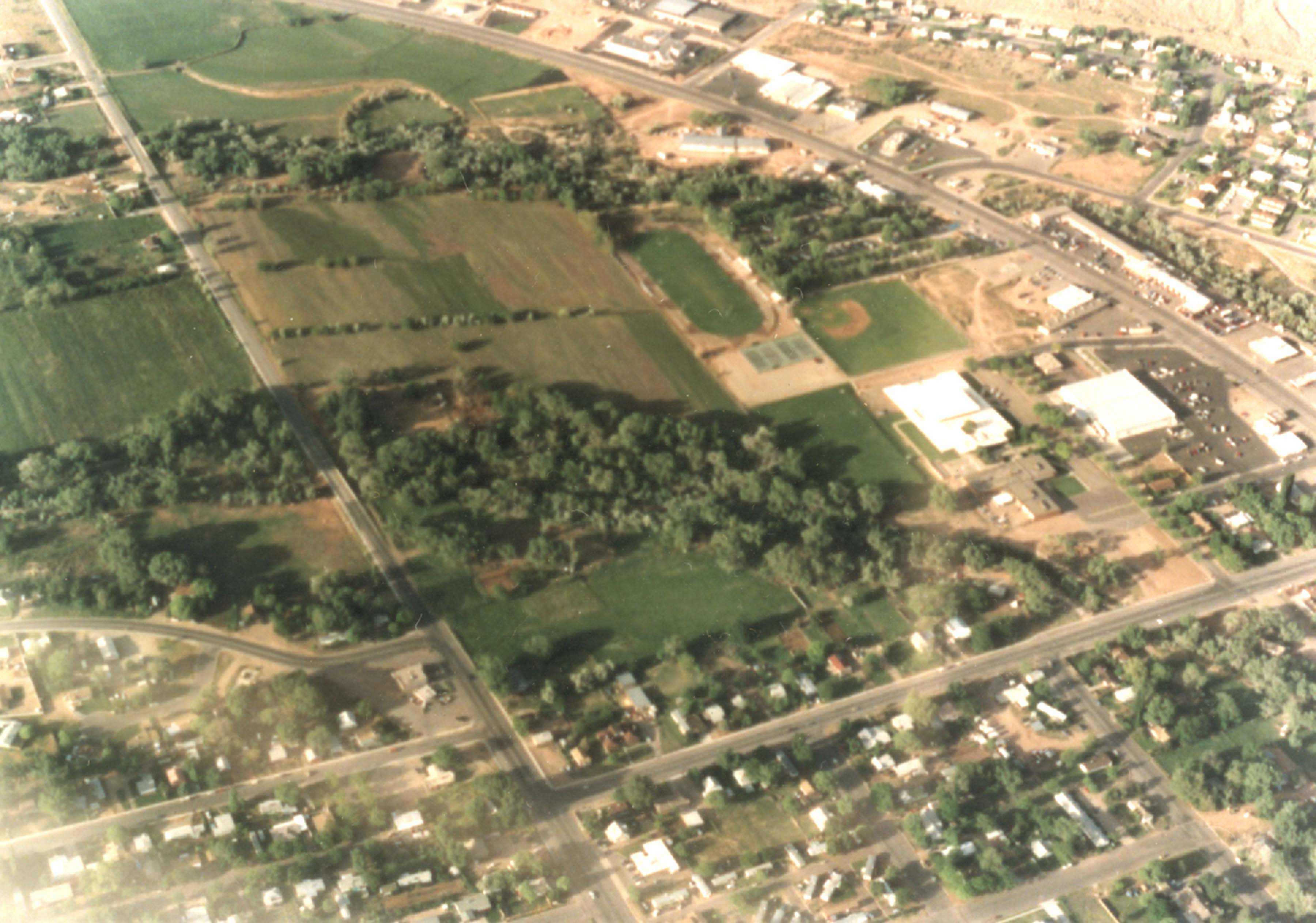
ABOVE: This is an image of the southeastern part of Moab. The curving highway that crosses the top part of the photo is US 191.. Visible is the just built City Market and McDonald’s and across Kane Creek Blvd, the old Main St. Broiler, later torn down and replaced by a Burger King. The road decsending from top left is 400 East. The new high school has not been built and the area now occupied by the football field is still in pasture. Milt’s and Dave’s Corner Market are visible at the junction of 400 East and Mill Creek Drive. Across the street, the future Mill Creek Pueblos are nowhere to be seen.
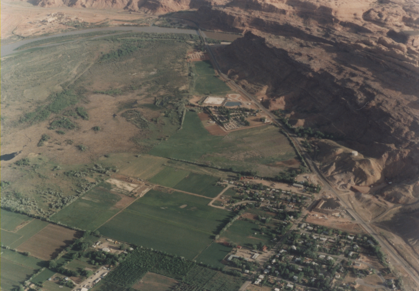
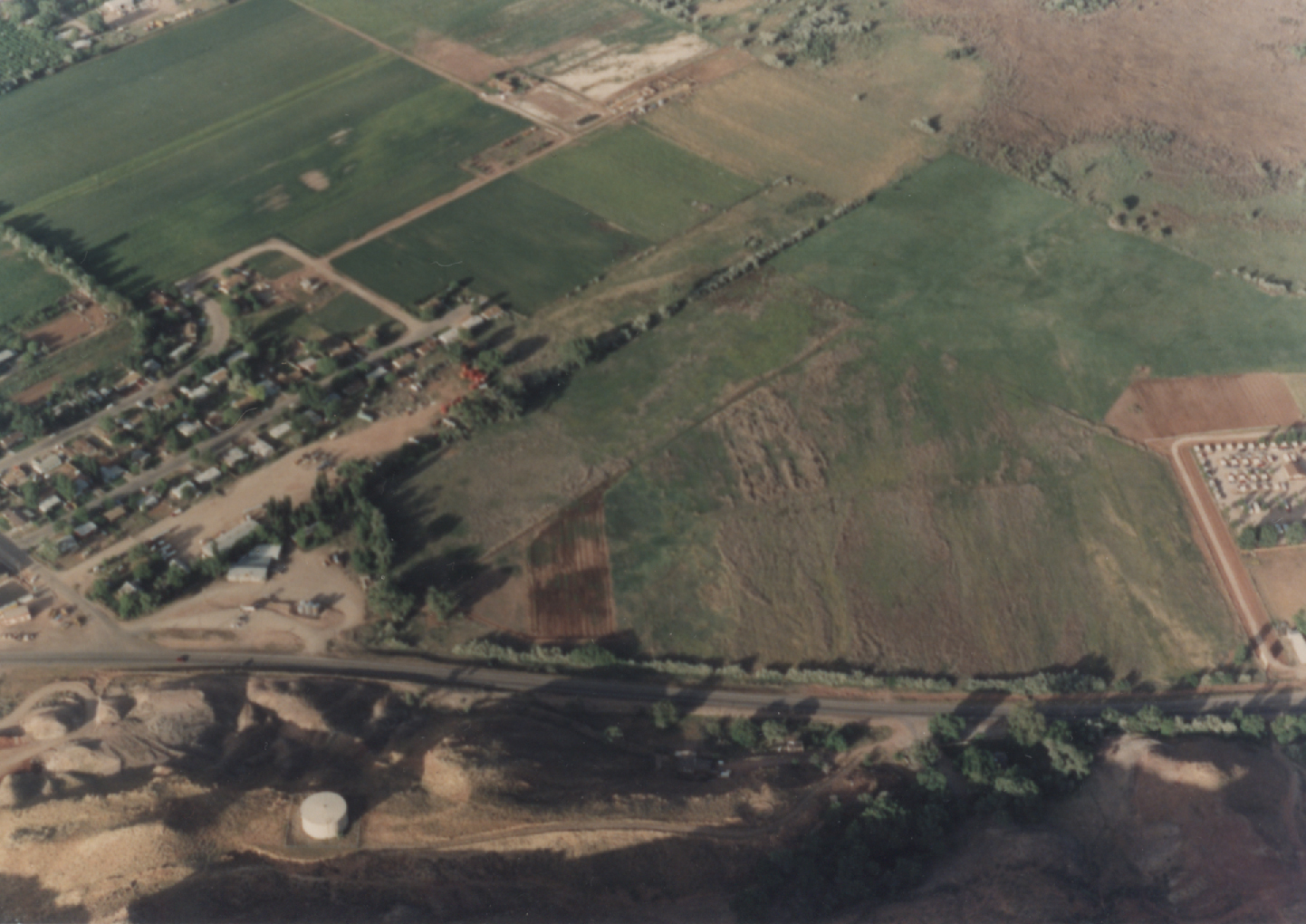
BELOW: Two views of the North Highway (US 191). In the first, the view extends to the river and the old bridge. The area now occupied by three motels is still horse and cattle pasture. The Doxol gas storage facility adjacent to the Slickrock campground has been removed. In the second photo, just to the right of the water tank is the Old Grand Ranch, still there but now ‘supplemented’ by Moab Springs Condos.
To read the PDF version of this article, click here.


[…] http://www.canyoncountryzephyr.com/2013/04/01/the-view-from-above-moab-in-the-early-90s-by-jim-stile… […]