
CHARLES KREISCHER & EDNA FRIDLEY loved the West, and especially the Colorado Plateau. Both explored the canyons of southeast Utah in the days when very few people even knew they existed. At the time, most Americans’ knowledge of the Colorado Plateau came from John Ford movies, and they rarely mentioned film locations in the credits. But Charlie and Edna knew, and they took hundreds of amazing Kodachrome transparencies to remember their experiences.
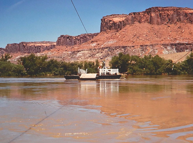
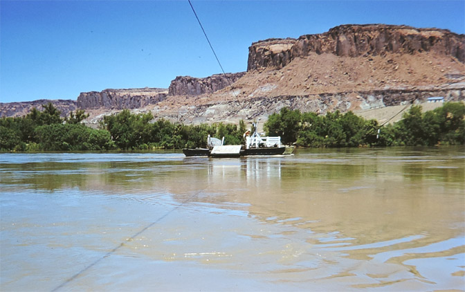
In a previous issue The Zephyr published images by Kreischer and Fridley of the road to Hite Ferry— old Utah Highway 95 — which remained a dirt and gravel road from Blanding to Hanksville, until the rising waters of Lake Powell flooded the ferry. Subsequently, three bridges were built, at a cost of millions of dollars, to connect the east side of the reservoir to the west.
In this issue we focus entirely on the Hite Ferry itself and the surrounding area. And at the end of this post, look for some new information and of new images yet to come…JS
EDNA FRIDLEY
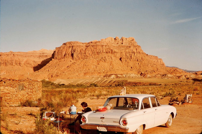
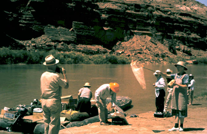
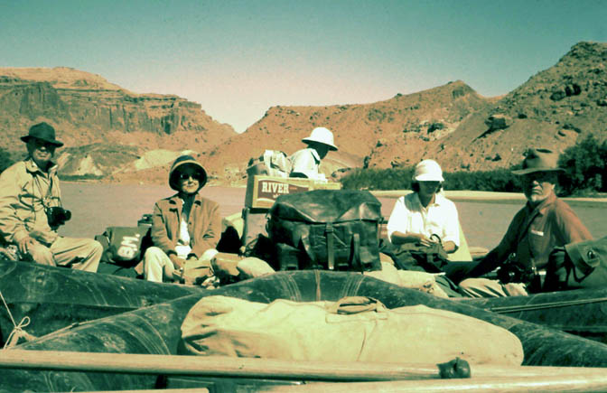
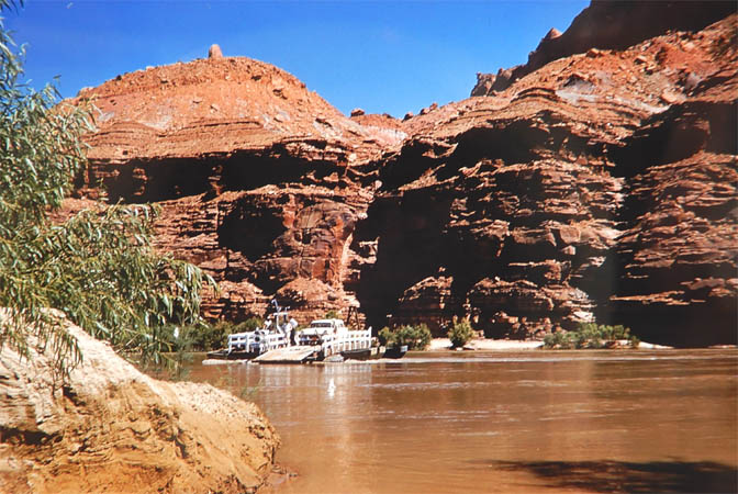
In the fall of 1962, Edna set off on her last trip down Glen Canyon. The dam, 150 miles downstream, was almost complete. Within months the Bureau of reclamation would close its diversion tunnel and stop the free flow of the Colorado River. Edna had been invited to join a party of friends to celebrate Harry Aleson’s wedding, which was to happen during the trip. She flew to Salt Lake City, then rented a car to Page, Arizona via Zion National Park. At Page, after checking in at the Page Boy Motel, she arranged a flight to the dirt airstrip at White Canyon. She took thousands of photographs of her pack and river trips with legendary guides Ken Sleight and Harry Aleson.
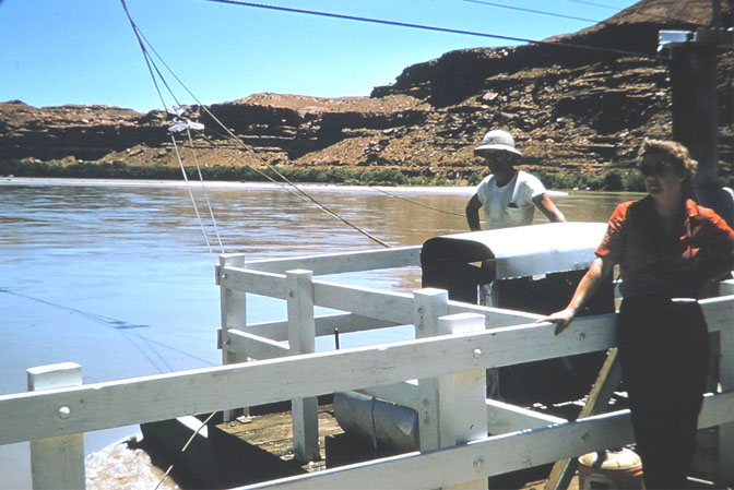
But she also kept journals, often scribbled in small spiral notebooks. Here are excerpts from Edna’s last journey down Glen…and, of course, these amazing, never-before-seen photos. This installment of Fridley photos devotes itself to the Hite Ferry, operated in 1962 by Woody Edgell. (Following Edna’s images and journal entries, comes Charlie Kreischer—all these pics are amazing)…JS
29 Sept 1962
“Have had quite an eventful times since leaving home…Gorgeous day. Long way from Kanab to Page; arrived about 2:30.”

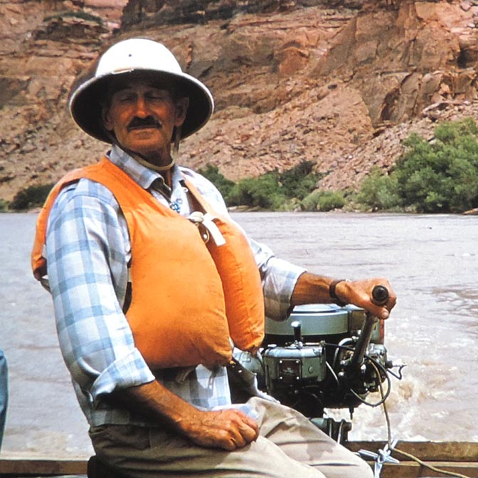
“Went to airport, then to Page Boy. Had shower, rested, went out to the dam, then back to airport. Had to wait 1 1/2 hours for weather which cleared. Also Royce got another run to Navajo Mtn. so he reduced my fare to $25—goody—then took off. What a stupendous thrill! ARR White Canyon about 12:30 or so. Woody (Woody Edgell, the operator of the Hite Ferry in 1962) surprised to see me. Took me back, cooked rabbit—good-—he went to Monticello after introducing me to Fran and Ethel Barrett.“
“Slept out in the front yard! til 4:30 AM when rain started. Rain lasted pretty much til daylite.“

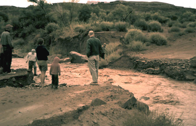
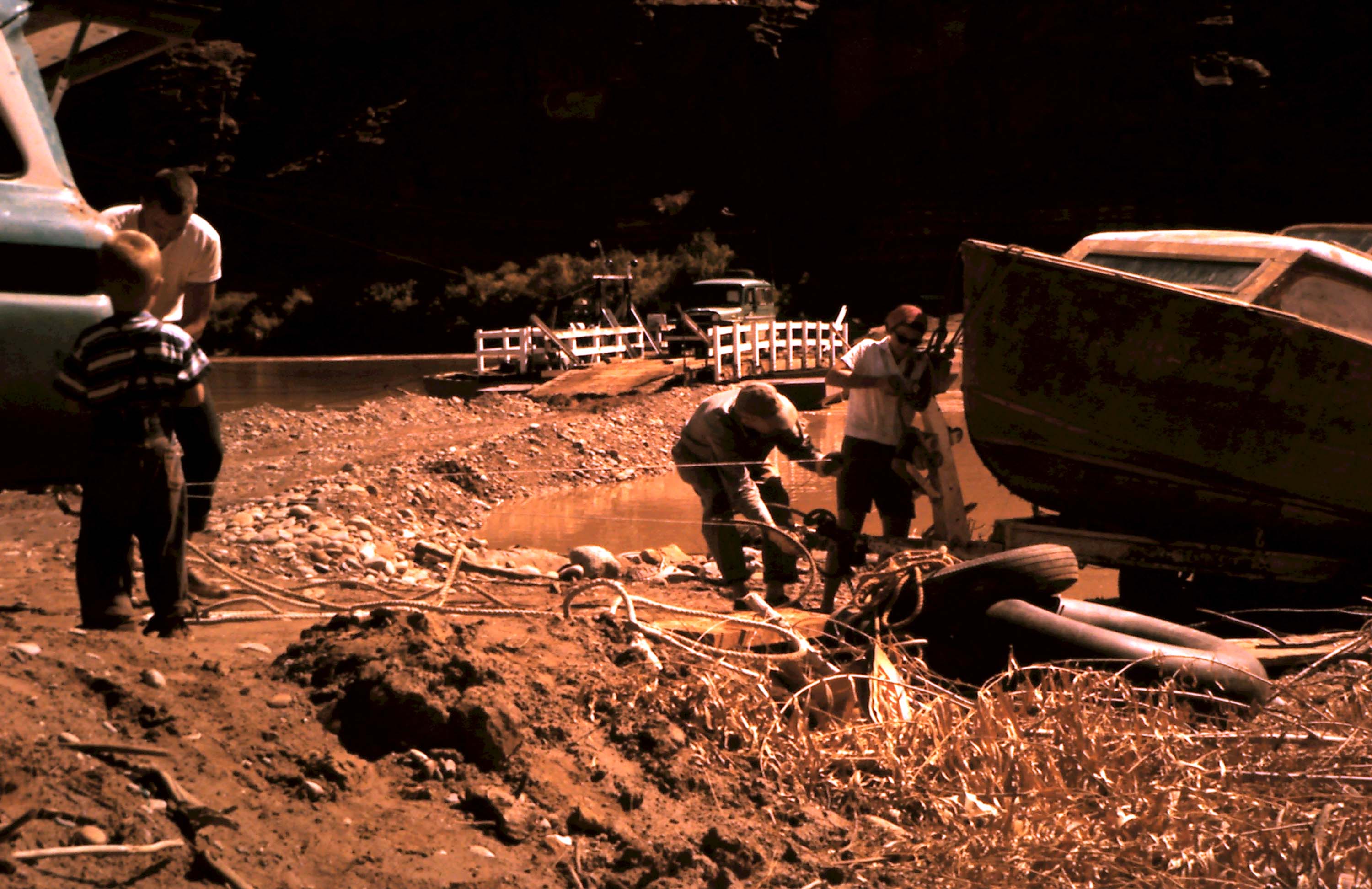
“Was isolated by creek in Farley Canyon—or so I thought. Was taking pictures when station wagon & pickup truck drove to opp. side and some mad woman leaped out and started to wade the creek. After cars drove thru found out it was the Staveleys from Mexican Hat! They had camped the nite on the other side of White Canyon. Then started the adventure that lasted all day…Drove to where road was washed out. Then the fun started, the car got stuck. Some 21/2 hrs later some one-handed guy (hook) got it started.“
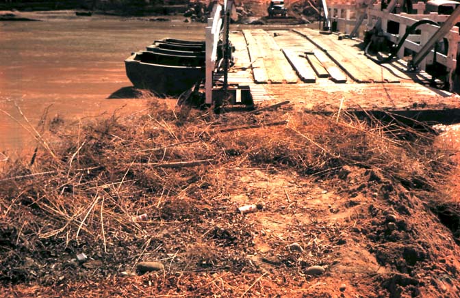
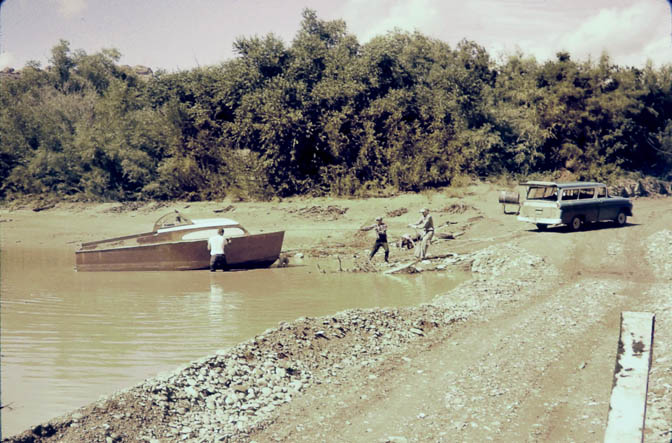
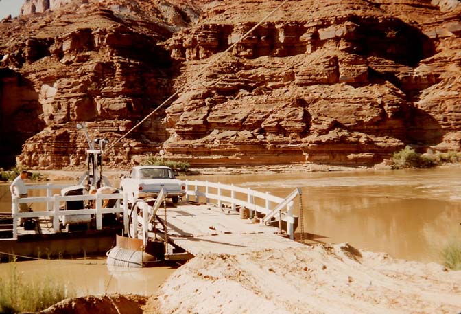
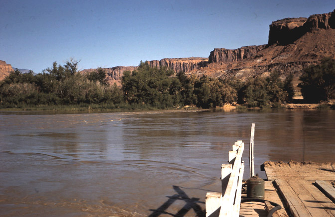
“Went over to Hite side on ferry–seemed simple job to get boat out–but after boat was partially on trailer, it all settled into the mud–egads! Some Time Later after using up the balance of my film-the boat and trailer were out of R and we went back across to the place. Was obvious boat was too long and angle too sharp to go thru behind station wagon.“
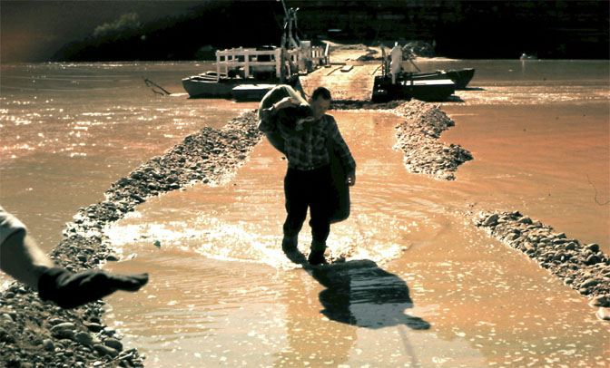
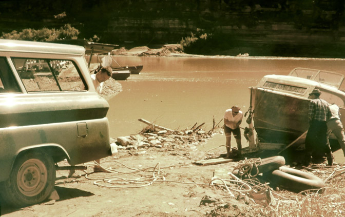
“About this time the mail plane came in. Still very cloudy and on the rainy side. Day’s father was already over so he started for air strip for me to tell pilot-no mail-but after Mr Staveley got stuck – another place here came Frank Barrett-he’d gotten thru, picked up mail and was on his way to strip – egads again. So I took mail and started hoofing-almost reached strip when here came Mr Staveley – anyway, did get the mail to plane, (whee,) went back to the place. Dick (US Geological Survey) had pulled boat over by backing up (I guess.)“
“Anyway, it was all over. Came back to store–whiled away some time til we decided what to have for dinner-hamburger, gravy (mine) on bread and serve rolls, green beans and apple pie–couldn’t talk Joan into goat burgers! After dishes (oh yes-when back from getting boat, discovered no water at Woody’s) all tired and so to bed.”
NEXT DAY…
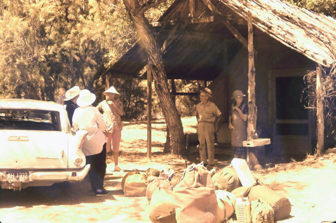
“Slept out—no rain this time. Up at dawn—washed face, brushed teeth, small jaunt, back and made coffee. Grandpa Staveley up. We both had cups and cups of coffee until the rest arose at 8:00. Then had bacon, French toast—which I made. Staveleys lashed down boat while I washed dishes and Joan cleaned Woody’s quarters. MORE COFFEE. Dock Marston flew in–Dick brought him up.”
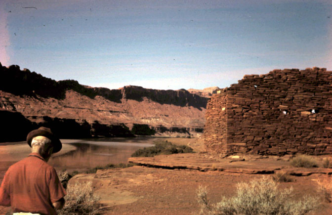
“At noon I decided if I were going to explore would have to get with it. Dock said he’d go with me. Finally took off, walked down to lookout tower, then along cliff edge to other ruins. Spent considerable time looking at names scratched in tower. Jacobs, Elmer Kane—Dock supplying info on each. Both these men with EAST Exp 1891. E. Kane on 2-TALL man 6’4”. BIG man physically too. FUN. When along cliff saw Harry arr. Dock called to him. he answered—we went down the road & met him.”
CHARLES KREISCHER
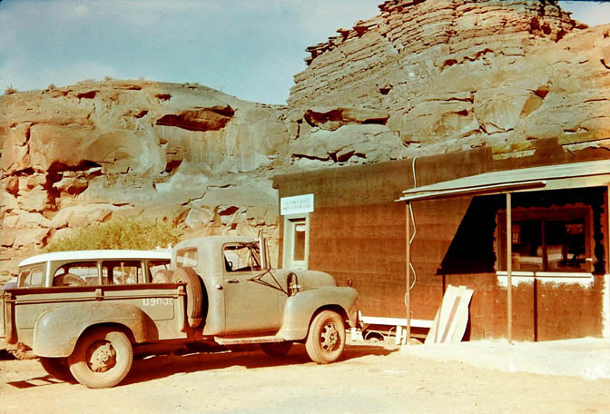
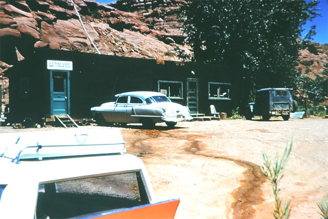
CHARLES KREISCHER and his wife were regular campers at Arches NP when I was a ranger there in the late 70s. The Kreischers had floated Glen Canyon twice, in the late 50s, while the dam was under construction. He was delighted to learn of my interest in Glen Canyon. A few weeks after their visit, a package came in the mail. Charles sent me more than a hundred Kodachrome slides of their journeys. They are some of the best images of the Glen I have ever seen. Included here are his photographs of Hite ferry and the White Canyon store…and the Nielson Farm.
And coming soon…The “Nielson Collection. In July 2021 I received an email from Leslie Nielsen. She had seen some of the images we’ve posted here of the Hite Ferry and surrounding area and wanted to share some additional information. Leslie wrote:
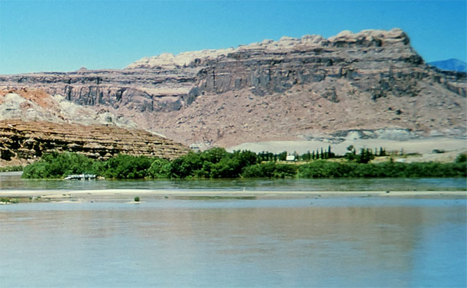
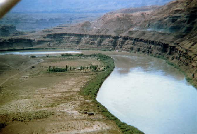
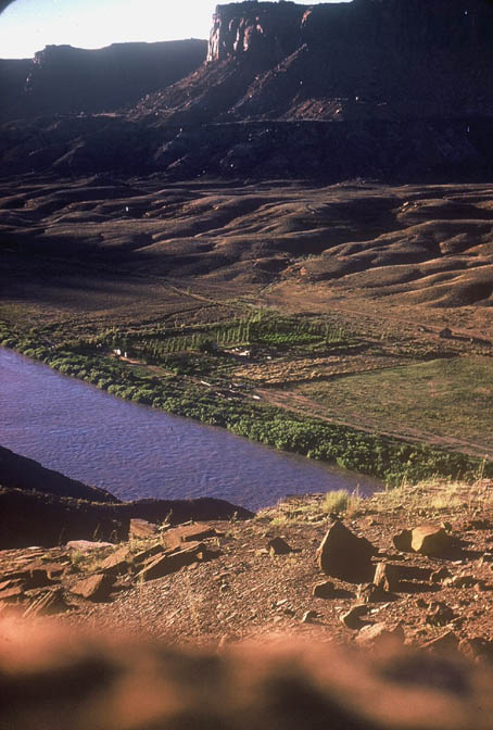
“I am the keeper of my grandparents’ 1,000+ slides taken in and around Hite and southeastern Utah from the 1950’s through the 1960’s. Their names are Beth and Ruben Nielsen, and they lived on the Colorado River at Hite from 1949 through 1963. Ruben helped Chaffin keep the ferry running and also worked at the Happy Jack Mine in Fry Canyon. I was in Hite in 1959 (that’s me on the left holding the grapes), and here is Beth and Ruben’s property in about 1954. The row of poplar trees is visible in many Hite area photos during those years, and they were located on their property.“
Since then, Leslie has sent me this remarkable image, taken from the ledges above the river and more photos of her family and the farm as it existed before the lake. Now, Leslie and I are working to put together a collection of her grandparents’ photographs, to include as its own story in a future Zephyr Extra. Stay tuned…JS
TO COMMENT please scroll to the bottom of this page.


Wonderful that these pictures have survived and become available! Donna
All these images and Edna’s journals are priceless! I’m so glad you are publishing these amazing moments in Glen Canyon/Hite history. I visited Hite several times from 1973-1977 & often wondered what it had been like in the ‘hood old days’, so these images & stories are wonderful.
Thanks for sharing these beautiful pictures. The view of Fort Moki is a reminder of how high the water was to rise – the top of the stones would end up 160 feet below the surface of the reservoir.
It’s fairly depressing to think this little oasis in the Hite/White Canyon area has been replaced by 150 feet of sediment.
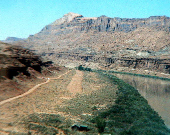
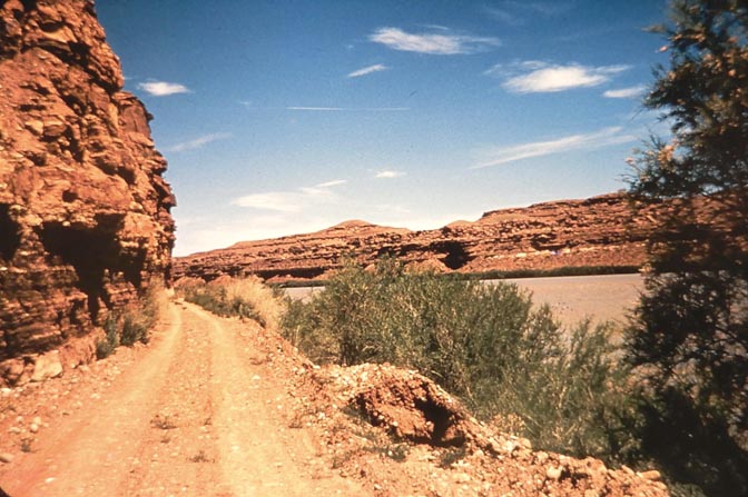
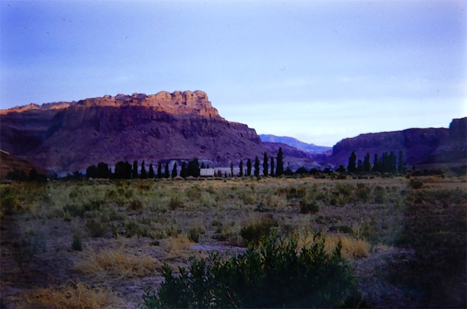
P.S. Picture 2 is flipped horizontally. This was taken in Farley, looking WSW, at the last point the wash crossed 95 before reaching the river. The flow was from left to right. The picture was taken at, or close to, 37.812013,-110429800
Edit: 37.812013,-110.429800
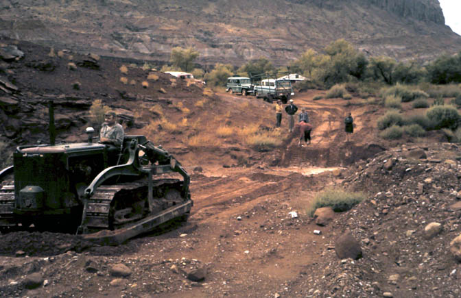
Edit #2: Obviously, the bulldozer photo was taken at the same place as picture 2 in FARLEY CANYON.
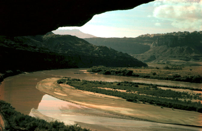
North Wash is over four miles to the north.
The ‘road’ is crossing the wash in Farley for the last time before turning south to cross the bridge over the creek at the mouth of White Canyon and then on past the uranium works to the ferry.
Get your act together, Stiles.
Bob…I could only provide captions based on what little information Edna or Charles wrote on the slides. And since many of the images have been underwater for most of the last 60 years, all I could do was to give it my best guess…(PS..my ‘act’ hasn’t been ‘together’ in ages)
Ha ha, Jim. Fair enough.
Keep posting these invaluable photos and, above all, keep your chin up!
I did eventually get around to reading the whole ‘rehab’ post. What an utterly horrific experience for anyone to go through. I CAN believe this sort of malpractice is going on in the US in 2022 but you were so unlucky to fall into the spider’s web.
I’m so glad you had a good friend locally to help with your extrication from that nightmare.
You have friends everywhere but some of us are thousands of miles away.
Stay strong, Stiles.
Awesome stuff Stiles! Keep ’em coming. As you know, I run a Facebook group on Glen Canyon pre-damn History and love to post these pieces in there.
This is what historical stewardship should look like. The photos are a treasure trove of memory, taking us back to a time that has not fully escaped our understanding. Many would go back to the way things were in those days, if we could. There is no editorializing, no presentism, no judgement of people or events or places, one way or another. This simply tells a story, and I for one am envious of those who were there.
As I prepare to leave shortly from Oregon to return to a 2-month job at my beloved Natural Bridges Nat’l Mon., I marvel at these exquisite photos and journal entries. I was too late in life to enjoy the original Hite, much less Glen Canyon, so enjoy it vicariously with your wonderful shares, Jim. And last summer I followed much of the original road in lower White Canyon and Farley Canyon. I’m looking forward to seeing the re-emerging Glen soon. BTW, a good read is the first chapter “How It Was” of one of Ed Abbey’s less-known books, Slickrock, a Sierra Club coffeetable book. He gives a marvelous description of a 1953 trip through White Canyon and crossing the river at Hite.
Very interesting historical photos. Looking forward to Nielson photos. Thanks for keeping the memories alive.
These photos bring back childhood memories. I was born in 1952 and visited White Canyon a couple of times with my parents before the dam was built. My aunt Christine was married to Woody Edgell for a few years and she ran the post office. She took us to some remote Indian ruins and a place she called the robbers roost in her green government Jeep. She had an old shaggy sheep dog that would go with her wherever she went. I remember eating some wild goat that my aunt had shot from the back door of the post office. This was a special place to visit as a young boy and I remember thinking that I was almost in the old wild west.
Love seeing these old photos. My dad worked on the river while they were building the dam and I’ve got some slides of his that I’ve digitized from that time period – including Hite ferry, store, and homes. I’d love to know where, exactly, on a map some of these places are. My guess is around the bend in the river at White & Farley canyon, but that’s as specific as I can get. Supposedly the old Cass house ruin has emerged from the water, I’d be curious if anything else has survived the inundation.