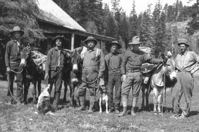
For most of the last 34 years, going all the way back to the very first Zephyr issue in March 1989, I’ve always enjoyed sharing my love of history, and especially the photographic documentation that I’ve been able to post over the past three-plus decades. The collections that I have been entrusted with are some of my most treasured and cherished possessions. Of course I’m referring to the work of my dear friend Herb Ringer, who gave me all his thousands of transparencies, as well as his journals, travel logs, and a collection of other historic “artifacts” that I plan to share with you soon.
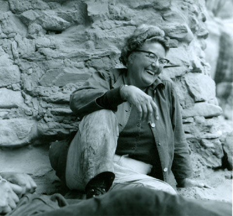
And it’s been 20 years since Marti Fridley called me up and asked if I’d like to have her mother’s photo collection. Edna Fridley spent every free hour of her life wandering the Colorado Plateau, often under the leadership of her favorite guides, Ken Sleight and Harry Aleson. Like Herb’s work, her photos are invaluable. Marti told me to come by her trailer, the RV Court that was just north of Tom Tom’s VW Museum. She carried out box after box and we loaded them all into the backseat of my car. I was overwhelmed.
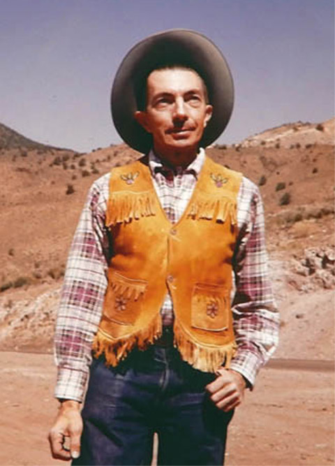
Finally, I have more than one hundred Kodachrome transparencies that Charles Kreischer gave me 50 years ago, of his trips down Glen Canyon and their travels around the Colorado Plateau. They are some of the highest quality images I have ever seen of Glen Canyon.
Edna Fridley
But these are still images. Trying to locate movie film, especially going back to the 1940s and 1950s has been almost impossible. Sometimes the best I could hope for were John Ford Westerns and one of George Stevens’ last films, “THe Greatest Story Ever Told.” All the exterior scenes were shot in Glen Canyon, as the dam was being built.
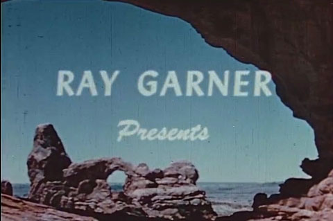
But one exception came to me a few years ago, via a DVD that was mailed to me anonymously.. On it was a very rough copy of a silent 16mm film —a travelog of sorts— shot in 1949 by Ray Garner and his wife Virginia. I grabbed a few screenshots and clips from that DVD and I believe you can even find the clips on The Zephyr facebook page. But again the quality was poor and even distorted—- the image was stretched when it was digitized.
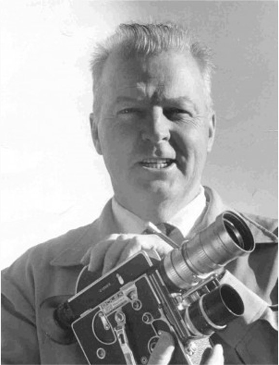
But recently, and sheerly by accident, I found the film in its entirety on the internet. It had been donated to the National Archives and though the film quality still pales by today’s standards, it is the history in these films and images that I love, more than the film quality itself. Ray and Virginia Garner started making films in the late 1930s. Ray’s first known project was a film about ascending the Grand Teton with a group of Boy Scouts in 1936. Sadly the film has been lost. But it was the beginning of an independent filmmaker career and soon, a wonderful collaboration with his new wife Virginia. Though the title of the film I’m offering here gives credit to Ray, Virginia, or “Jinny” as she was known to everyone, was not only his equal in the filming, production and presentation of what were often silent films, she was certainly more photogenic and appears often in them. That’s’ what gives these 16mm movies such a personal feel. As I understand the story, they toured the country with their movies and at various gatherings, they would narrate the film in person as it was being shown.
Ray Garner
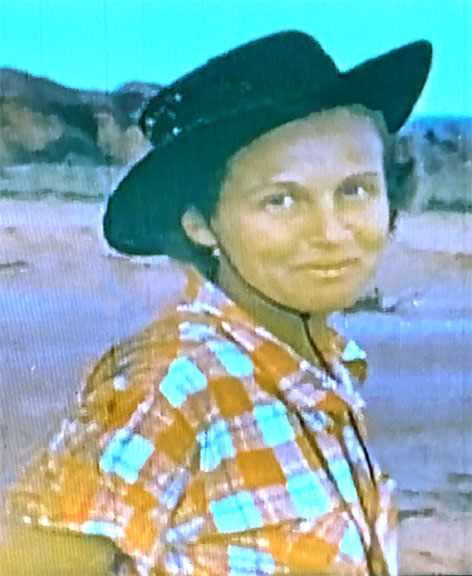
Virginia Garner
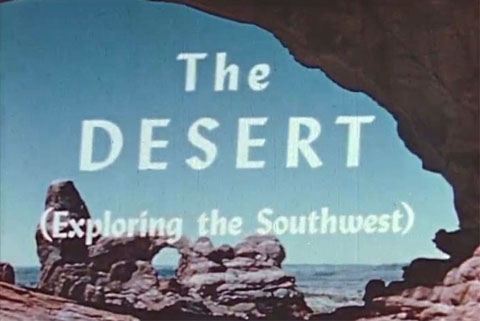
Ray and Virginia came to Southeast Utah in May 1949. They spent the summer wandering the Four Corners, from what was then a very empty Arches National Monument, to the Needles, more than 15 years before it would become a part of the new Canyonlands National Park. They traveled south through Tuba City and scaled Agathla Peak on the Navajo Reservation and even drifted as far south as Sedona.
I have pulled dozens of screenshots from the film and tried to restore them as much as possible. And at the bottom of this page and in further installments, I’ll include the link to the Garners’ one hour motion picture in its entirety.
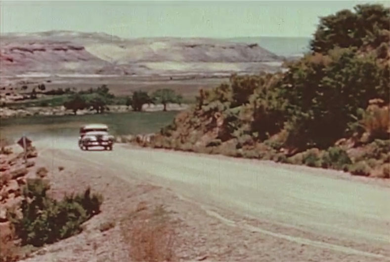
In this post, I concentrate on their visit to Arches National Monument, and their camp at the Devils Garden. If you know Arches at all, you’ll know exactly where they pitched their tent. I also have a couple images of Moab, shot at the corner of Main and Center Streets, as they park their Chrysler Woody (or whatever they called their wood-paneled station wagons back then). Again, you’ll know precisely where the film was shot, and yet you’ll be stunned by the changes.
I’ll include more biographical information about the Garners in future posts, but briefly, Ray was born in 1913 and died in 1989. Virginia came along in 1915. She met and married Ray in 1938; it was the start of a 50 year partnership that took them all over the world, from canyon country to Egypt and to equatorial Africa. They were not wealthy by any means. but they were lucky to have caught the attention of the Harmon Foundation. The non-profit organization created to support the arts and history was the brainstorm of former Alaska Governor William Harmon. The governor was fairly prosperous and the Harmon Foundation was his legacy. He, in fact, died in 1928, before he ever saw the work of the Garners. But his generosity and support of projects like theirs is a tribute to the governor and his vision; the Garners were grateful to him and to the foundation for decades.
According to Virginia Garner’s obituary, she and Ray even “made a film on learning to fly at the U.S. Army air base at Tuskegee, Alabama. Here, they were taught to fly by members of the famed African-American combat unit which came to be known as the Tuskegee Airmen. In a rare tribute, ‘Jinny’ was made an honorary Tuskegee airman.” She died in 2007.
I’ll include more stories about their incredible life together soon, but for now, here is the first installment of images (and a link to the film) “The Desert— Exploring the Southwest”… Jim Stiles
RAY & JINNY GARNER COME TO MOAB, UTAH & ARCHES NATIONAL MONUMENT…CAMPING 1949-style
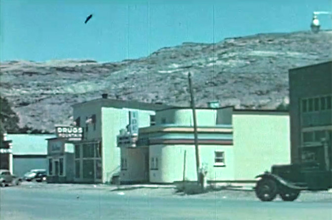
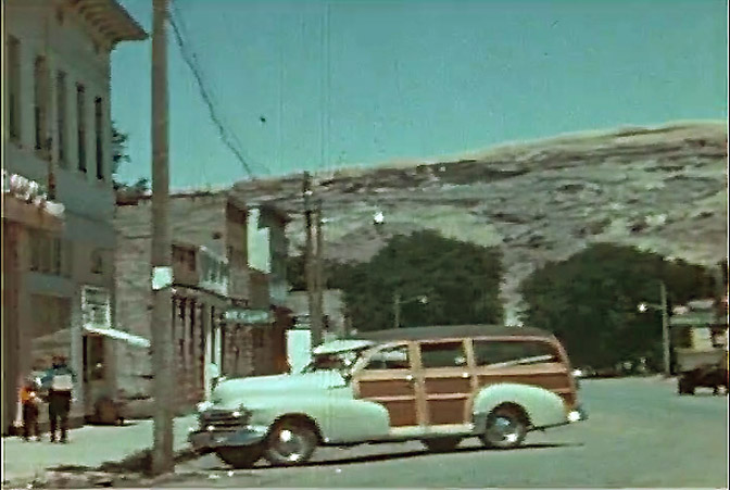
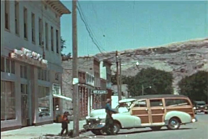
COMING INTO MOAB: Ray Garner is standing in the middle of Main Street, at its intersection with Center Street, looking north. I love the old truck emerging on the far right. He’s passing the old bank building and just ahead, the amazing art deco Ides Theater. Beyond it is the Drug Store that was still at that location until the early 1990s.
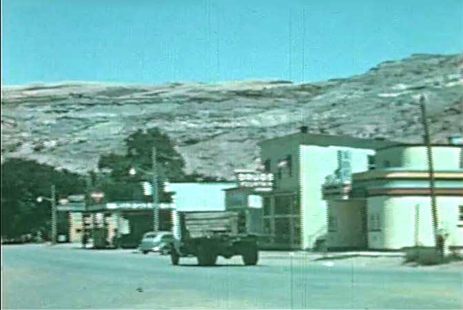
As Garner follows the truck, you can see the Moab Garage at left center of the photo. And then, at the corner of Main & 100 North, the building many of us in the future would call The Poplar Place.
Now Garner’s camera settles on their station wagon and the the building that still stands on the northwest corner of that intersection. You can see Jinny and her daughter Gay, carrying food and supplies from the store.
Another view, showing more of the building that I knew for years as “Budget Family Clothing,” owned I think by the late Ray Tibbetts. Later it became the Grand Emporium, and finally a restaurant under various names and owners.
The Garners made their way to Arches NM and took the old entrance road via Willow Springs. In those days the “road” was often in terrible shape and crossing Upper Courthouse wash could be a real challenge. If water was flowing, they could encounter quicksand; if it was especially dry a vehicle could bury itself in the sand. It was what you call a real adventure.
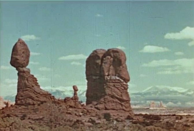
Another image of Balanced Rock and the “Chip off the Old Block.” Ray often kept his movie camera running on the same scene for almost a minute, to capture the lighting changes as the sun passed in and out of the clouds. Just as a side note, the ‘Chip” collapsed in December 1975. I was a wet-behind-the-ears volunteer, but neither the NPS paid staff or me noticed its fall. A tourist stopped by the visitor center and asked me if there was supposed to be another smaller spire next to Balanced Rock. I believe I replied, “Yes…Isn’t it still there?” My boss Jerry Epperson told me to take a the park cruiser and check it out. Sure enough, the “Chip” was no more. I called it in on the two-way radio. Later Park Service technician Maxine Newell wrote a press release that was published in the next issue of the Moab Times-Independent. I reportedly said, “It’s true! The spire has fallen!”
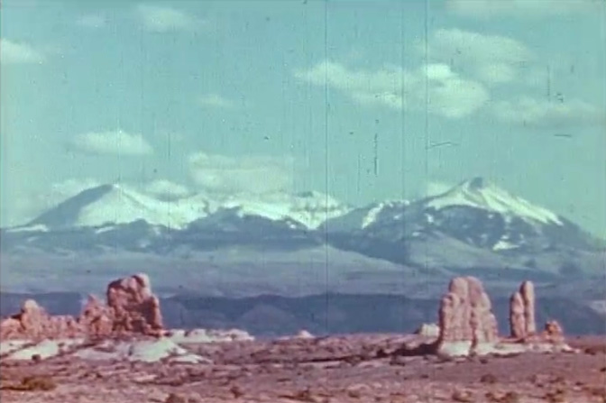
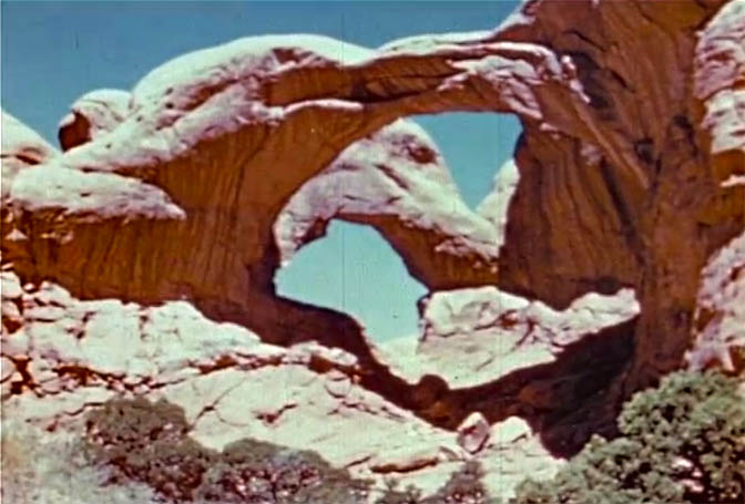
Garner then panned his camera to the right, to other spires in the Windows at Arches and the distant La Sal Mountains.
Jinny and Ray took a side trip to the Windows and captured this image of Double Arch. Then they drove back to Balanced Rock and to the old road that descended the ridge and into Salt Valley. It was a precarious drive with a few tight switchbacks. Years later, one of Charlie Kreischer’s still images showed a sign at one of those tight turns. It just said, “WHOA.” During my tenure at Arches, we always called the new highway that drops into the valley from Panorama Point, “Whoa Hill.” It was only after finding Kreischer’s photo that I discovered its origins.
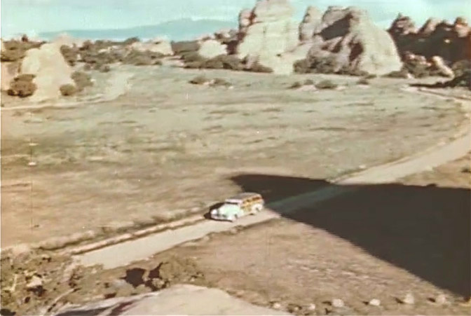
THE DEVILS GARDEN, looking south. There was no ‘loop’ in 1949. In this photo, the current picnic area is tucked between and beneath those spires in the center of the picture. The Devils Garden Campground in its current form didn’t exist in 1949.
Another image as the station wagon gets closer to the Devils Garden trailhead.
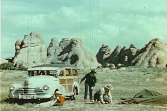
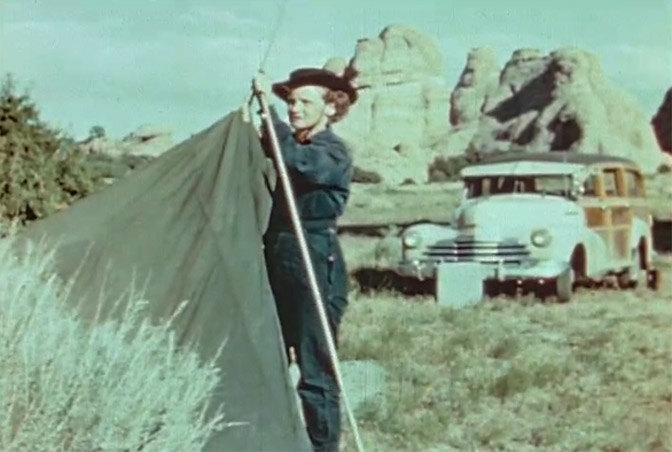
Setting up camp at the Devils Garden Trailhead.
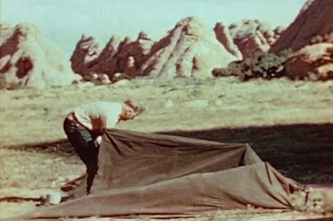
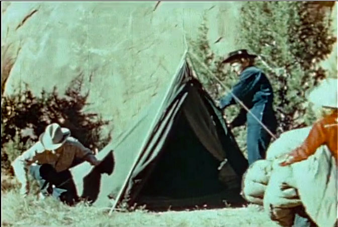
Many of the tents used in the late 1940s were Army surplus heavy canvas tents that had an interesting characteristic. They were waterproof and a rain fly wasn’t necessary, unless you made the mistake of touching the canvas on the inside. Then it was no longer rain proof and the water would pour through the fabric…something I learned from ‘real life’ in the Boy Scouts.
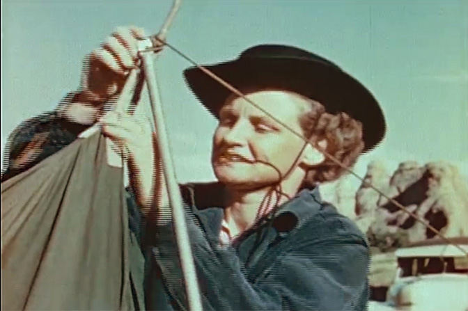
Jinny attaches the poles to their tent with that magnificent station wagon behind her.
Jinny Garner
A rare photo that includes Ray; he must have used a tripod and timer. Even daughter Gay is in the photo at far right.
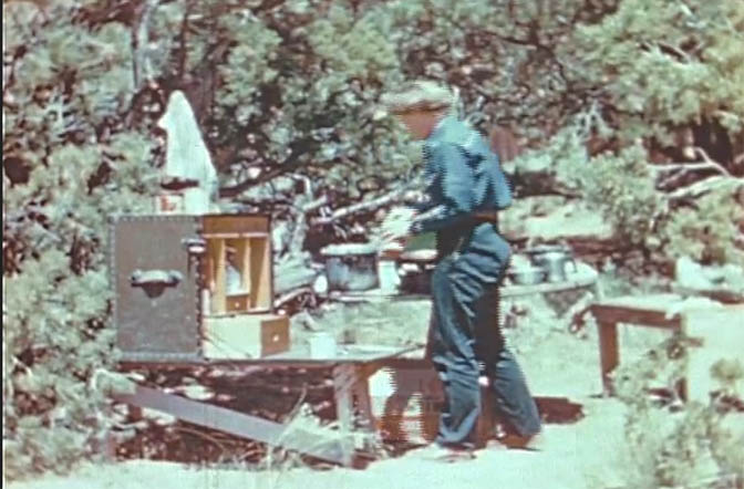
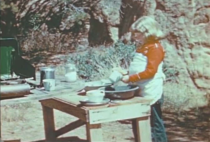
With the tent up, Jinny prepares dinner. Note the magnificent cook box, apparently made from an old steamer trunk. They managed to pack a lot of gear into their Woody.
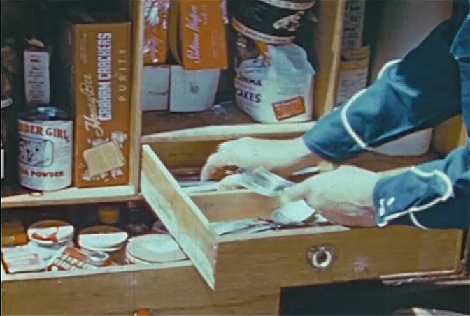
CLOSE UP OF THE COOK BOX: Note the “Clabber Girl Baking Powder,” the “Aunt Jemima Pancake mix,” and the “Honey Bee Graham Crackers.” But can anyone make out what Jinny is taking out of the drawer? To me it looks like paper money.
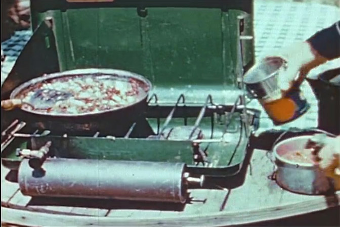
THE UBIQUITOUS COLEMAN STOVE: These cook stoves, fueled by “white gasoline” were an absolute must for campers well into the 80s and even the 90s. Note the plunger at the far right end of the fuel tank. To use the stove, the would-be cook had to pump it furiously, maybe 25 or 30 times, to build up enough pressure to light it. Then you turned on the gas valve at left, lit a match and held it to the burner. You then hoped that it would light and also that it would not explode. If when filling the tank, the operator was sloppy with the procedure, excess gas would ignite the surface outside the tank. The subsequent flames often terrified rookie users into abandoning their stove altogether. When I was at Arches, I recovered several Coleman stoves in perfect working order. I still have a few of them.
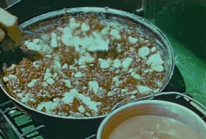
DINNER IS SERVED: Whatever it is…Mulligan Stew? Wolf Brand Chili and potatoes?
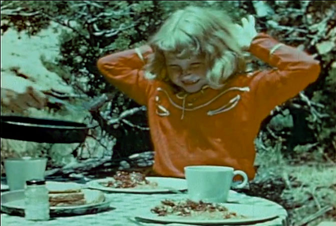
TIME TO EAT: I especially love the clothing style of both Jinny and Gay. Real Westerners…Roy Rogers and Gene Autrey would be envious…so am I.
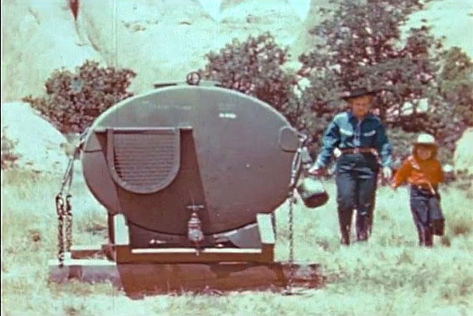
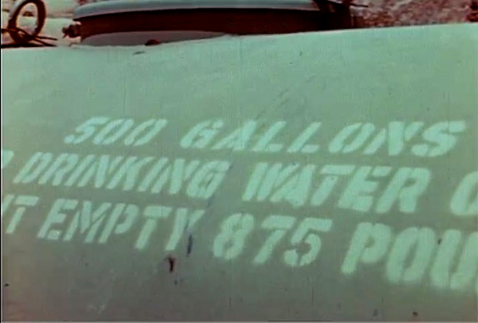
The park kept a 500 gallon tank near the campsites. In those days, that amount of water would go a long ways. But by 1963 when the road was paved and new Devils Garden campground was completed, visitation to the Monument had jumped to more than 100,000. A very deep well was drilled in the middle of what is now the Devils Garden Loop road. The well pump was powered by a Diesel generator that was built behind another sandstone fin at the far western edge of the Devils Garden. Then the water was pumped into a tank and gravity fed back to the campground’s three new “comfort stations.” But in 1949, this was as good as it got. And it was.
The 500 gallon tank
An actual photograph of a child pitching in and doing what were then called “chores.” In this case, Gay is doing her best to clean up the dirty dishes in a small wash pan.
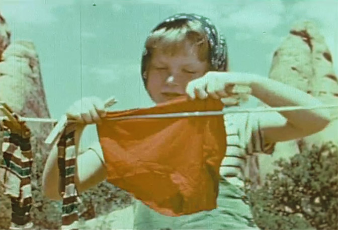
HANGING THE LAUNDRY: While this was legal in 1949, one has to wonder if in the future, NPS “covenants” will ban such practices (like they do now in gated communities), because of its unsightly appearance! I can almost hear the complaints— “That red underwear is ruining my aesthetic experience!!!”
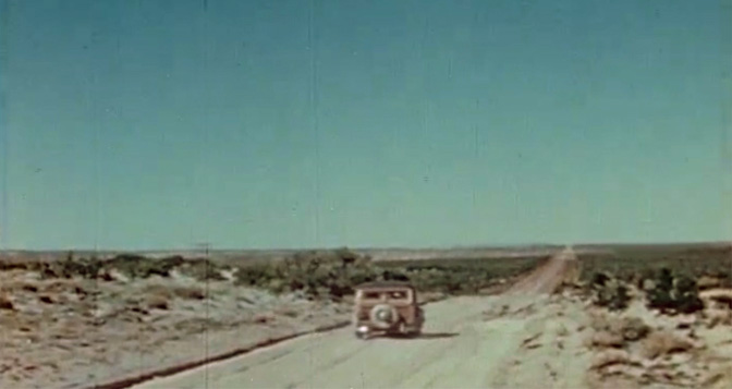
WHERE NEXT? DUE TO A ‘RAIN DELAY,” THE GARNERS HEAD SOUTH
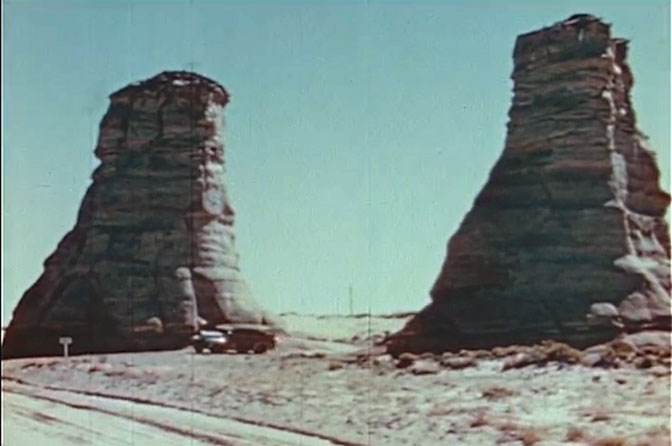
According to the May 1949 monthly report by Arches Custodian Russ Mahan, the Garners were mentioned as “noteworthy visitors.” But he added that inclement weather was playing havoc with their film schedule. So rather than sit there in the canvas tent, the Garners drove south, into Arizona. Their goal was Agathla Peak on the Navajo Nation, north of Kayenta. In the next installment, I’ll include screenshots from their ascent. The next two images include images from their return north after the climb. The first is a familiar sight to most of us who know the area—The Elephant Feet.
This is just after the turn north, as the Garners head back to Moab and Arches.
TUBA CITY: This picture stumped me, but friend Doug Meyer figured it out. This is the old road out of Tuba City, Arizona, looking south.
I NEED YOUR HELP! It’s been fun really, trying to identify some of the various filming locations, and with the help of more knowledgeable friends, I’ve been able to pinpoint most of them (like the image above). But the photo below has us stumped…my best guess is Indian Creek on the Needles Road, near Newspaper Rock. But there also clues that it might be near Sedona. I’d appreciate your input and suggestions…JS
WHERE IS THIS?
THE LINK TO THE MOVIE IN ITS ENTIRETY… THE FILM IS 57 MINUTES LONG AND THERE’S NO SOUND…
TO COMMENT ON THIS POST, PLEASE SCROLL TO THE BOTTOM OF THIS PAGE…THANKS…Jim
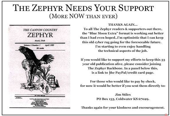
THE ZEPHYR BLUE MOON EXTRA posts weekly, usually on Monday morning. That’s when we post the new story on Facebook and send the link to our readers who signed up for our email list. But I do sometimes post the Extras early–like the previous evening. So if you’re anxious to see The Zephyr’s next post, you might take a look.
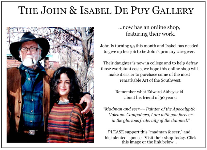
Six years ago, The Zephyr, me & four other individuals were sued for defamation by the former Moab City Manager. Faced with mounting legal bills, my dear friends John and Isabel De Puy donated one of John’s paintings to be auctioned. ALL the proceeds went to our defense. Thanks to them, our bills were almost completely covered. Now I’d like to return the favor. Check out the link below and their online shop… JS https://www.depuygallery.com/shop.html
Billionaire Wilderness takes you inside the exclusive world of the ultra-wealthy, showing how today’s richest people are using the natural environment to solve the existential dilemmas they face. Justin Farrell spent five years in Teton County, Wyoming, the richest county in the United States, and a community where income inequality is the worst in the nation. He conducted hundreds of in-depth interviews, gaining unprecedented access to tech CEOs, Wall Street financiers, and other prominent figures in business and politics. He also talked with the rural poor who live among the ultra-wealthy and often work for them. The result is a penetrating account of the far-reaching consequences of the massive accrual of wealth and a troubling portrait of a changing American West where romanticizing rural poverty and conserving nature can be lucrative, socially as well as financially. To find Justin Farrell’s brilliant book, click the photo to access it on Amazon.
Actually, Facebook is getting rid of “likes” for pages like The Zephyr… Instead you get to “FOLLOW” us. You can still “like” individual posts. Why they can’t just leave the site alone is beyond me, but that’s whatFacebook likes to do. ALSO NOTE: I post old photographs and stories from our 25 year old archives every day. Pictures from Herb Ringer, Edna Fridley, Charles Kreischer.. even a few old photos from my Dad. So if you want to stay caught up on our amazing historic photo collections, be sure to “follow” us on Facebook…Thanks…Jim https://www.facebook.com/FansoftheCanyonCountryZephyr/
Thanks for your note. I mention several times in the text that it was shot on 16 mm film and I’m fairly aware that video cameras didn’t exist in 1949. Facebook limits the number of characters that one can see on a small device so I was looking for a word that would immediately tell the viewer that these were based on a movie. It occurs to me that “filmmaker” might have been a good option but in today’s world I’m not even sure that would have been clear enough. But
Like I said I did reference 16 mm film in the text, so hopefully everyone will know that it wasn’t shot on a smartphone.
Nope…It’s a late 1940s Chrysler Town and Country Station Wagon. Read the comments by Donna Andress below. In fact, I’m looking at and have saved a photo of the car that I found on Google. Even the same color with the windshield shade. Just Google it or try this Pinterest link.
Jim, google “1947 Chevrolet woody wagon”, compare the pictures to the car in this article, paying close attention to the grille and fenders, and let me know what you think.
PS: Really glad you are keeping the Zephyr alive, especially with all the emotional trauma you have had to cope with the last year. I think it’s better than ever, and I have been a reader since the first issue. Great articles without the fluff. Keep it going bro, from a former fellow Moabite before gentrification.
Hey Marc, if you look at the film to find this image (right after images of the Sedona area early in the film, but that doesn’t say much about where this image was taken) you’ll see that the vehicle actually drives through the water and it’s a pretty healthy depth. My recollection of Shonto is that that the creek there is like others in the region south of Navajo Mountain, ie, a very small amount of water in a small sandy wash cut into the Navajo Sandstone. It seems to me there would have to have been some kind of small dam in Shonto in 1949 to create that much water to drive through. Do you know where we can find old photos of Shonto that might shed light on this image?
Another great piece of history! I loved the old pump up Coleman stove and in 1969 during a month long trip to the canyon country it served me well.
In the photo captioned, “old road out of Tuba city looking south”, that road is still there only now it’s paved and is US 160 coming up from the very green Moencopi wash, the junction with US 89, Cameron, and Flagstaff. The Hopi village of Munqapi is located in that valley.
Tuba City was named after Tuuvi, a prominent Hopi, by the Mormon settlers in that area who had a tin ear when it came to listening to the Hopi language.
After taking over all the best pasture land and springs in the area from the resident Hopis, the Mormons were forced to leave the area by the United States Government. This may have been the only time in American history that land which belonged to the original inhabitants was returned to them after being taken over by non-natives.
Now I’m gonna go watch that film with no sound and weep at what we’ve lost to the hordes who visit them now.
Thanks for the info on the Mormons in the area, I always wondered why the wash close to Hwy 89 is called “Jacob Hamblin Wash”, now I know why.
Years ago I reconstructed that photo of the south entrance to Tuba City and discovered that the old road is what is now known on google maps as Kerley Rd, and that road is nicely graded but still not paved I believe. Kerley Road goes straight into the “Navajo side” of Tuba City, and when they re-aligned the modern day US 160 entrance to Tuba City, I’m thinking it was a deliberate attempt to “split the difference” between the Navajo and Hopi “sides” of Tuba City. When I first came to the area in the 1990’s, the Hopi side of the new highway in Tuba was almost completely undeveloped and the Navajo side only had some gas stations and maybe the grocery store. I’m sure there’s a lot more back story to that, since the new alignment basically took all the traffic away from the old Navajo “downtown” Tuba City.
You could be right. I’ll check it out on my next trip to Tuba City. There’s a lot of recent development on both sides of the the junction where AZ State Route 264 ends at US 160 and there’s now a traffic light there. On the Hopi side there’s the Moenkopi Legacy Inn and a Denny’s restaurant and Upper Munqapi (the correct Hopi Spelling of Moencopi/Moenkopi) is right up to the Legacy Inn on one side of 264 and up to the big Hopi Travel Plaza on the other side. The older and original Lower Munqapi is still down in the valley. On the Navajo side of US 160 there is lots of development as well including a huge Supermarket. Interesting factoid: the gas station on the Navajo side back in the “60s, “70s and “80s pumped more gas than any other station in Arizona due to the fact that to the many tourists coming from or going to Monument Valley and four corners in the north and coming from or going to Flagstaff or the Grand Canyon east entrance always stopped there to gas up.
“Downtown Tuba City”, has not died as it has a major I.H.S. Hospital, Mcdonalds,Taco Bell, a Codetalkers Museum, and the old Tuba City Trading post is now a museum and gift shop. Not to mention three high schools, and it’s a regional administrative center for both the Navajo tribal government and B.I.A.
Some of the old multi-storied orange sandstone buildings built by the Mormons are still there as well.
and of course during the mid 20th century it was very common for towns all over the USA to re-route their main highway away from the original commercial center…it had to be done, there just wasn’t enough room for a major highway in the middle of town…
Great history on early Tuba City. But note the recent land grab reversal of Bruce’s Beach in Los Angeles County of Manhattan Beach historical property. Sometimes…justice prevails…but not often.
Chrysler Corporation called their “woodies”Chrysler Town and Countries. Gail’s Grandfather, C. C. McDaniel, had the first Chrysler-Plymouth agency in Las Vegas, NV. He opened it in 1932 at First and Ogden Streets. Cars not being produced during World War Two, he took the real estate exam! But then the war was over, he got 4 Town and Countries in. They sold immediately and if I remember correctly they were about $3500 per car. They were such beautiful cars, and I think the first of that type, that Granddad and his salesmen drove them out to Hoover Dam for photographs. Even one of the new owners, Tom Campbell, drove his out there. He’d already taken delivery.
What a tremendous story. “Town and Country Chrysler.” Very classy. I’d think $3500 was pretty pricey in those days. Do you have any photos of them? Anyway Donna, your comments have become a vital part of every Zephyr post. You’re our bonus Zephyr contributor.
Just watched the entire film. Lots of interesting images of exploration that could only be done when you’re essentially the only one doing it all year. O the joys of tramping in unknown places in the early 20th century.
Jinny is indeed getting silverware from the cook box; it showed clear in the moving picture.
Jim, the Woody is definitely not a Chrysler or Chrysler product. Determining by the grille, the fender side torpedo bulges, and general lack of gaudy chrome ornamentation, I’d bet that car to be a Chevrolet, prolly about a ’47. Very cool car though.


Thanks for making us aware of this footage.
I think Jinny is taking forks out of the drawer–the motion blur simply distorts them.
This must have been shot on 16mm film, no? Curious as to why you refer to them as “videographers”, (asks the filmmaker who uses a video camera).
Thanks for your note. I mention several times in the text that it was shot on 16 mm film and I’m fairly aware that video cameras didn’t exist in 1949. Facebook limits the number of characters that one can see on a small device so I was looking for a word that would immediately tell the viewer that these were based on a movie. It occurs to me that “filmmaker” might have been a good option but in today’s world I’m not even sure that would have been clear enough. But
Like I said I did reference 16 mm film in the text, so hopefully everyone will know that it wasn’t shot on a smartphone.
Nope…It’s a late 1940s Chrysler Town and Country Station Wagon. Read the comments by Donna Andress below. In fact, I’m looking at and have saved a photo of the car that I found on Google. Even the same color with the windshield shade. Just Google it or try this Pinterest link.
https://www.pinterest.com/pin/534239574520979320/
Jim, google “1947 Chevrolet woody wagon”, compare the pictures to the car in this article, paying close attention to the grille and fenders, and let me know what you think.
PS: Really glad you are keeping the Zephyr alive, especially with all the emotional trauma you have had to cope with the last year. I think it’s better than ever, and I have been a reader since the first issue. Great articles without the fluff. Keep it going bro, from a former fellow Moabite before gentrification.
WHERE IS THIS?
Appears to be Shonto Trading Post, Navajo Reservation.
Hey Marc, if you look at the film to find this image (right after images of the Sedona area early in the film, but that doesn’t say much about where this image was taken) you’ll see that the vehicle actually drives through the water and it’s a pretty healthy depth. My recollection of Shonto is that that the creek there is like others in the region south of Navajo Mountain, ie, a very small amount of water in a small sandy wash cut into the Navajo Sandstone. It seems to me there would have to have been some kind of small dam in Shonto in 1949 to create that much water to drive through. Do you know where we can find old photos of Shonto that might shed light on this image?
Another great piece of history! I loved the old pump up Coleman stove and in 1969 during a month long trip to the canyon country it served me well.
In the photo captioned, “old road out of Tuba city looking south”, that road is still there only now it’s paved and is US 160 coming up from the very green Moencopi wash, the junction with US 89, Cameron, and Flagstaff. The Hopi village of Munqapi is located in that valley.
Tuba City was named after Tuuvi, a prominent Hopi, by the Mormon settlers in that area who had a tin ear when it came to listening to the Hopi language.
After taking over all the best pasture land and springs in the area from the resident Hopis, the Mormons were forced to leave the area by the United States Government. This may have been the only time in American history that land which belonged to the original inhabitants was returned to them after being taken over by non-natives.
Now I’m gonna go watch that film with no sound and weep at what we’ve lost to the hordes who visit them now.
Thanks for the info on the Mormons in the area, I always wondered why the wash close to Hwy 89 is called “Jacob Hamblin Wash”, now I know why.
Years ago I reconstructed that photo of the south entrance to Tuba City and discovered that the old road is what is now known on google maps as Kerley Rd, and that road is nicely graded but still not paved I believe. Kerley Road goes straight into the “Navajo side” of Tuba City, and when they re-aligned the modern day US 160 entrance to Tuba City, I’m thinking it was a deliberate attempt to “split the difference” between the Navajo and Hopi “sides” of Tuba City. When I first came to the area in the 1990’s, the Hopi side of the new highway in Tuba was almost completely undeveloped and the Navajo side only had some gas stations and maybe the grocery store. I’m sure there’s a lot more back story to that, since the new alignment basically took all the traffic away from the old Navajo “downtown” Tuba City.
You could be right. I’ll check it out on my next trip to Tuba City. There’s a lot of recent development on both sides of the the junction where AZ State Route 264 ends at US 160 and there’s now a traffic light there. On the Hopi side there’s the Moenkopi Legacy Inn and a Denny’s restaurant and Upper Munqapi (the correct Hopi Spelling of Moencopi/Moenkopi) is right up to the Legacy Inn on one side of 264 and up to the big Hopi Travel Plaza on the other side. The older and original Lower Munqapi is still down in the valley. On the Navajo side of US 160 there is lots of development as well including a huge Supermarket. Interesting factoid: the gas station on the Navajo side back in the “60s, “70s and “80s pumped more gas than any other station in Arizona due to the fact that to the many tourists coming from or going to Monument Valley and four corners in the north and coming from or going to Flagstaff or the Grand Canyon east entrance always stopped there to gas up.
“Downtown Tuba City”, has not died as it has a major I.H.S. Hospital, Mcdonalds,Taco Bell, a Codetalkers Museum, and the old Tuba City Trading post is now a museum and gift shop. Not to mention three high schools, and it’s a regional administrative center for both the Navajo tribal government and B.I.A.
Some of the old multi-storied orange sandstone buildings built by the Mormons are still there as well.
and of course during the mid 20th century it was very common for towns all over the USA to re-route their main highway away from the original commercial center…it had to be done, there just wasn’t enough room for a major highway in the middle of town…
Great information and another excellent contribution to history. Thanks.
Great history on early Tuba City. But note the recent land grab reversal of Bruce’s Beach in Los Angeles County of Manhattan Beach historical property. Sometimes…justice prevails…but not often.
Chrysler Corporation called their “woodies”Chrysler Town and Countries. Gail’s Grandfather, C. C. McDaniel, had the first Chrysler-Plymouth agency in Las Vegas, NV. He opened it in 1932 at First and Ogden Streets. Cars not being produced during World War Two, he took the real estate exam! But then the war was over, he got 4 Town and Countries in. They sold immediately and if I remember correctly they were about $3500 per car. They were such beautiful cars, and I think the first of that type, that Granddad and his salesmen drove them out to Hoover Dam for photographs. Even one of the new owners, Tom Campbell, drove his out there. He’d already taken delivery.
What a tremendous story. “Town and Country Chrysler.” Very classy. I’d think $3500 was pretty pricey in those days. Do you have any photos of them? Anyway Donna, your comments have become a vital part of every Zephyr post. You’re our bonus Zephyr contributor.
Just watched the entire film. Lots of interesting images of exploration that could only be done when you’re essentially the only one doing it all year. O the joys of tramping in unknown places in the early 20th century.
Jinny is indeed getting silverware from the cook box; it showed clear in the moving picture.
Jim, the Woody is definitely not a Chrysler or Chrysler product. Determining by the grille, the fender side torpedo bulges, and general lack of gaudy chrome ornamentation, I’d bet that car to be a Chevrolet, prolly about a ’47. Very cool car though.
I think Bill Pytleski is right. See:
https://www.barrett-jackson.com/Events/Event/Details/1948-CHEVROLET-FLEETMASTER-WOODIE-WAGON-182093
Well
Maybe so.