
With additional images of Glen Canyon Dam, under construction, from 1956 to 1963, by Edna Fridley & Charlie Kreischer & additional text by Jim Stiles
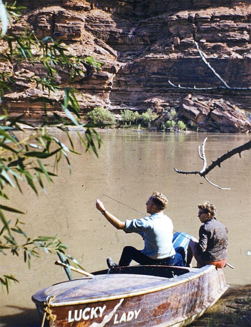
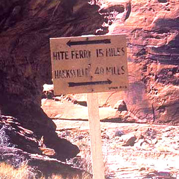
In the summer of 1963, life at Hite Ferry, White Canyon, and at the Nielsen farm, almost felt as it always had. Still quiet and remote. Woody Edgell, now hired by the State of Utah, was running tourists and workers alike across the Colorado River on the ferry first built by Arth Chaffin in 1946.
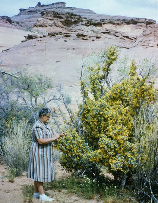
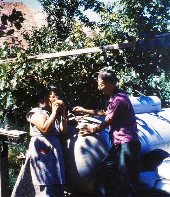
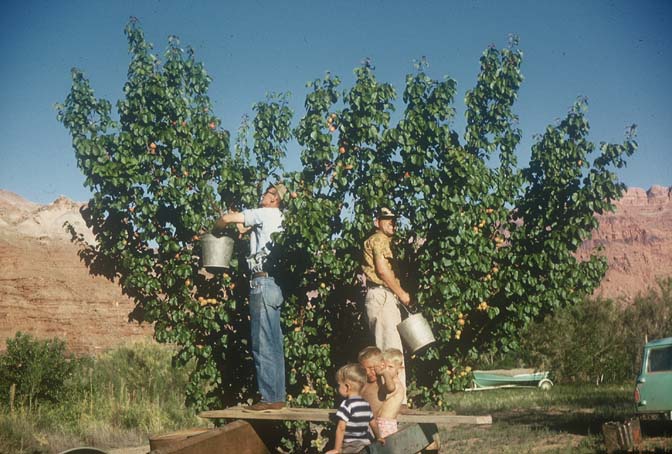
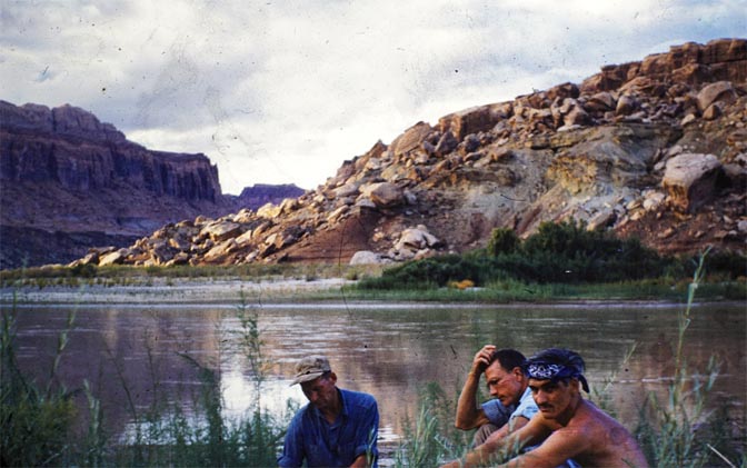
Beth Nielsen was tending to the garden, the orchard and vineyard that they had started so many years before. They were still looking forward to another bumper harvest of almost every fruit and vegetable one can imagine—the Nielsens cared for their little six acre farm with tender, loving care. What they didn’t eat themselves, they gave away to passing motorists and tourists headed downstream with river guides like Harry Aleson, Georgie White, and Ken Sleight. Ruben was also working in White Canyon, at the Happy Jack mine now, about twenty miles east of the ferry. One might think Life could go on like this forever.
But this idyllic life was about to end…
Change was coming downriver, and had been, since 1956.
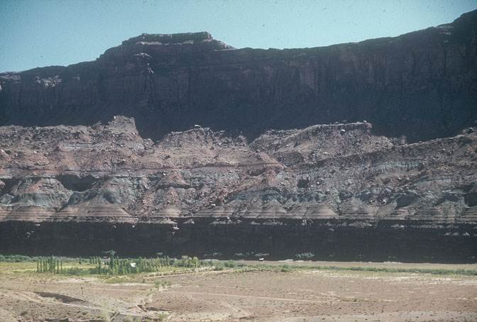
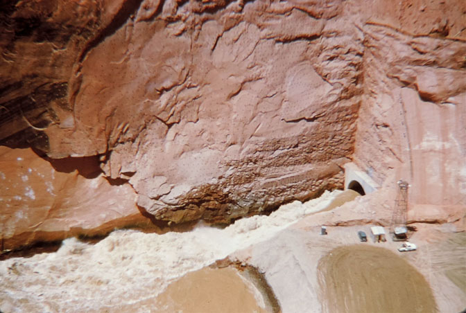
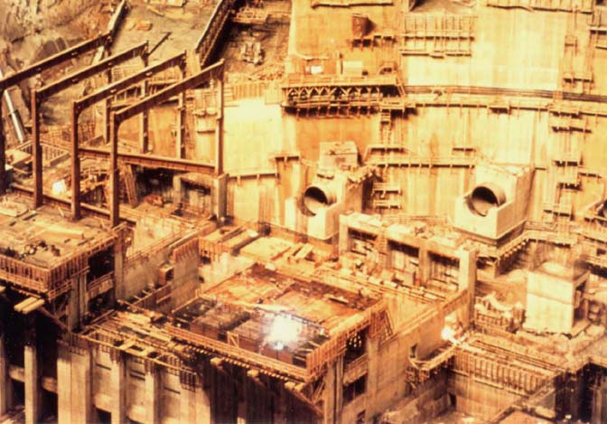
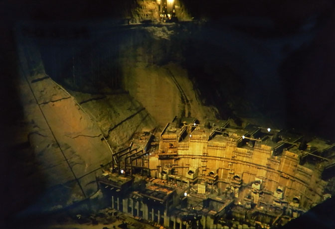
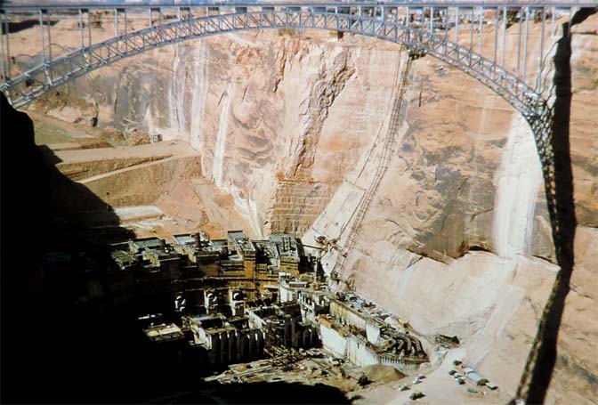
ALMOST TWO HUNDRED MILES DOWNSTREAM GLEN CANYON DAM TAKES SHAPE
Photographs of the dam by Charlie Kreischer & Edna Fridley
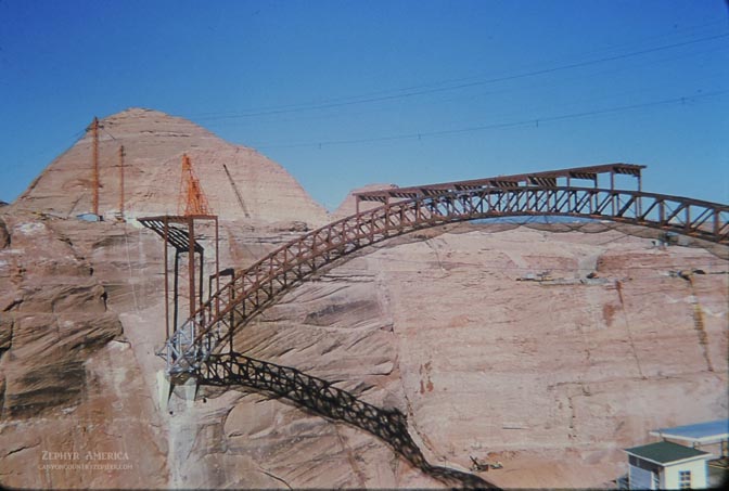
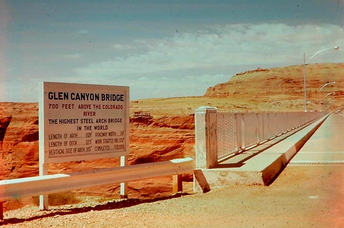
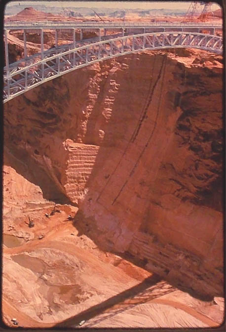
Photo by Charlie Kreischer
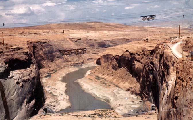
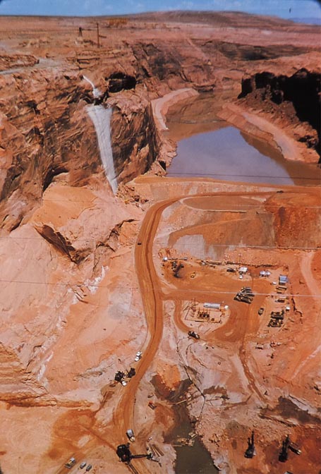
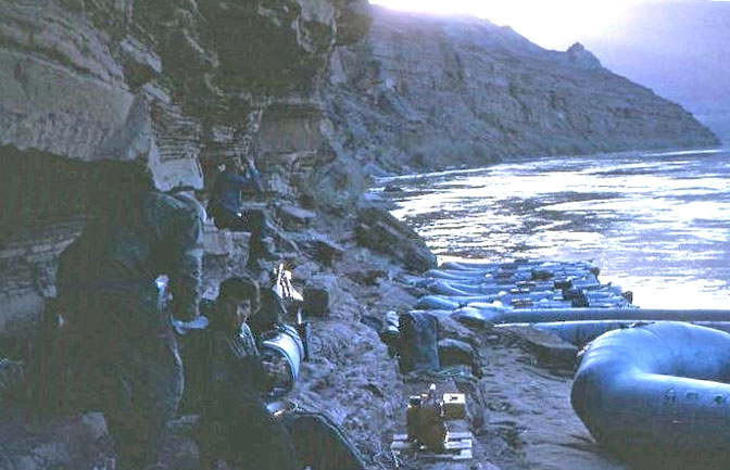
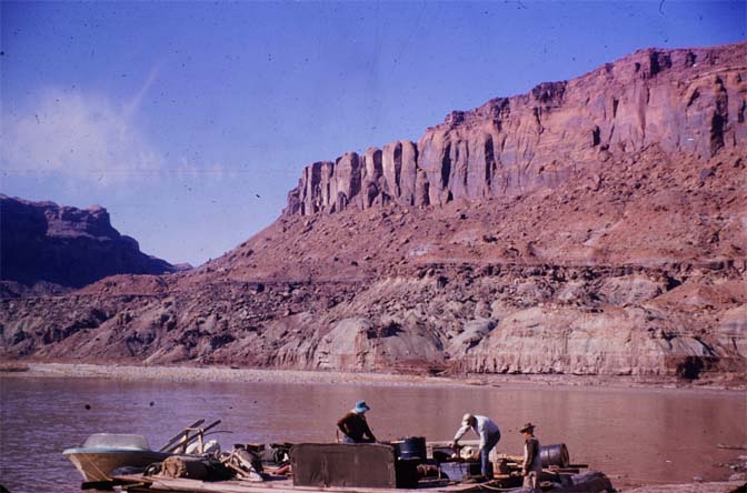
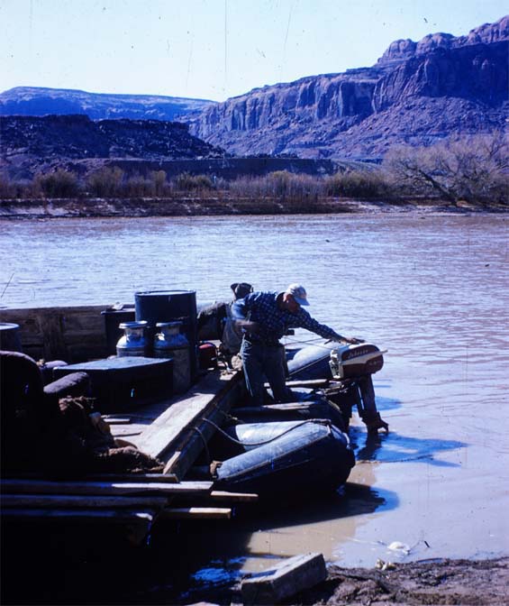
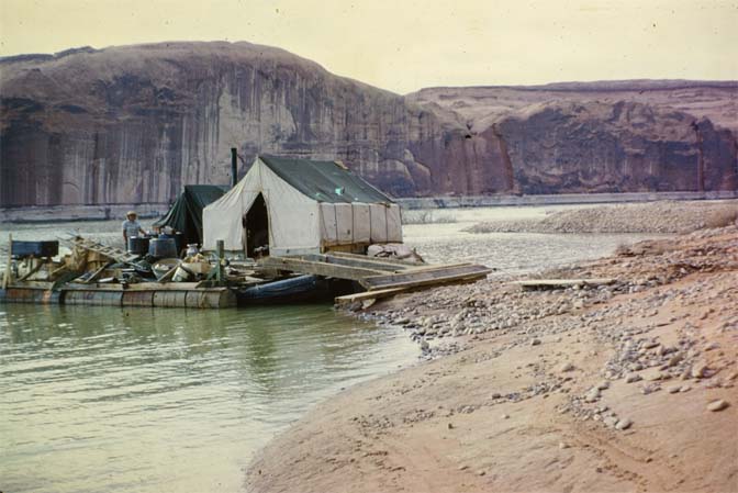
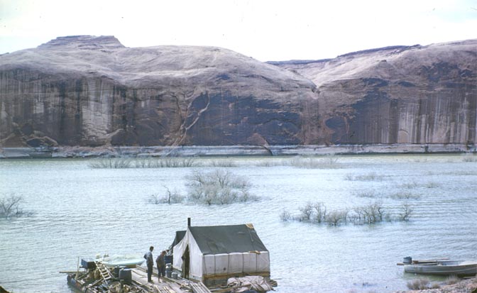
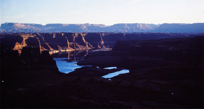
RUBEN & ARTH’S SALVAGE PROJECT AS THE POWELL RESERVOIR BEGINS TO FILL THE CANYON
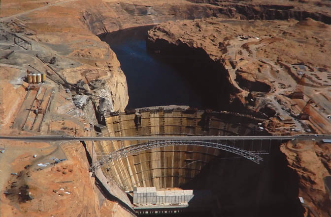
The diversion gates at Glen Canyon Dam closed in January 1963. Much work was still to be done to make the power plant operational, but it was ready to catch the runoff from that winter’s snowpack. As you can see from the last photo in this section, the aerial by Edna Fridley, the reservoir was quickly taking shape.
I recall a story from Ken Sleight. He had put a small boat into the river, above the rising lake waters, to hike up to Rainbow Bridge. He assumed he was far ahead of the encroaching reservoir. Ken hiked up to Rainbow and spent a couple days camping under the massive bridge. At the time, there were concerns that when the lake reached maximum pool level, the standing water would be 34 feet beneath the bridge. Some hydro-engineers feared the water would undermine the integrity of the rock formations upon which the bridge stood, and cause its ultimate collapse. And for sure, from 1980 to the late 1980s, the reservoir was at or even above pool level. Since then the lake has continued to shrink, though Nature has a way of playing with everyone’s hopes and dreams.
In 2005, Lake Powell dropped more than 150 feet, exposing Cathedral in the Desert for the first time since 1963. Many who opposed the dam thought they were seeing the beginning of the end. And in the long run, it probably was. But just a year later, the Colorado and Green River watersheds had record snowpacks. The lake level went up and down and finally, in 2017 the reservoir at Hite had even covered most of the silt plain near the confluence of the Dirty Devil and Colorado Rivers. Then we watched it fall dramatically yet again. But this year, after the winter’s heavy snowfalls, we can expect yet another rise. Fifty or sixty feet, at least.
*****
To get back to 1963 and my Ken Sleight story, when he returned to the river just a few days later, the water had risen by several feet. He had tied the bow to the base of a tree, Now the rope and the base of the tree were under water and his little raft was practically standing vertical atop the rising waters. It happened that fast.
But it was almost 200 miles to Hite and the reservoir failed to reach the ferry at the end of 1963. Still, there was no doubt in anyone’s mind that by the summer of 1964, Hite Ferry, the Nielsen Farm and the little town of White Canyon on the other side of the river would be drowned.
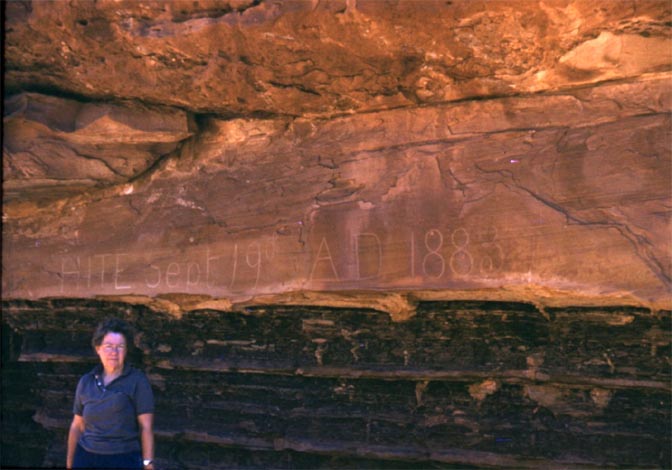
Archaeologists were well aware of the ancient treasures about to be destroyed. C. Gregory Crampton was one of them, and from 1957 to 1963, he and a team of archaeologists and volunteers sought to save as much of the archaeological artifacts as possible. Crampton supervised “an archaeological field program of historical salvage for the National Park Service.” It was a noble effort and smaller antiquities could be rescued, but the structures themselves, the rock art, the petroglyphs and pictographs, as well as historical inscriptions by later explorers were buried within a year.
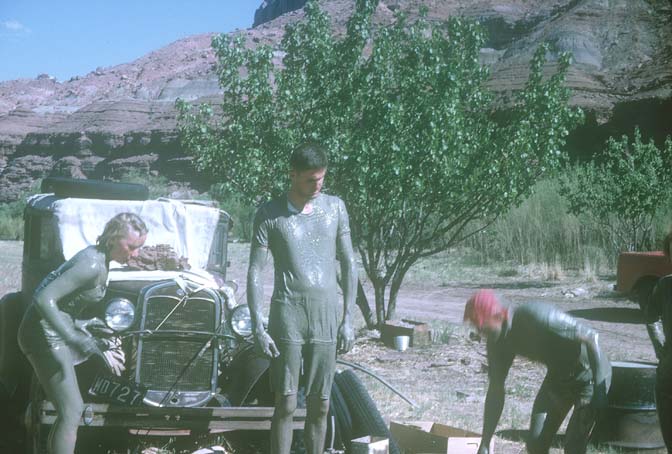
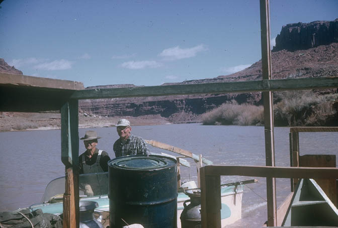
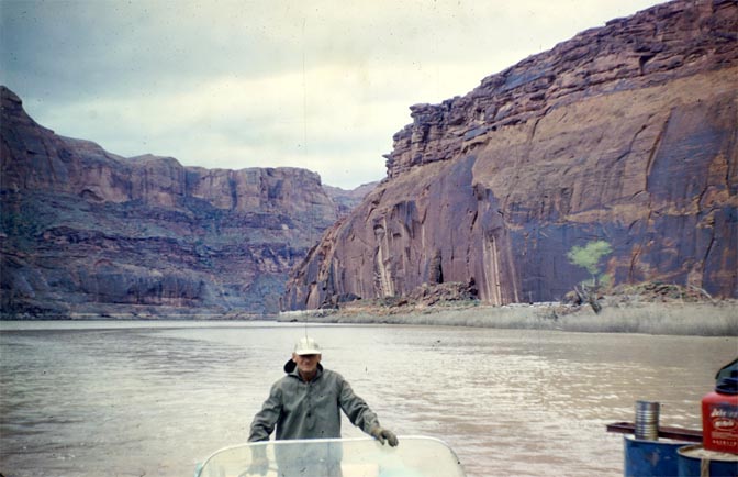
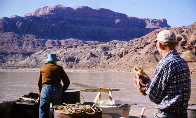
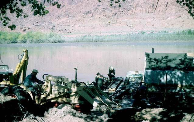
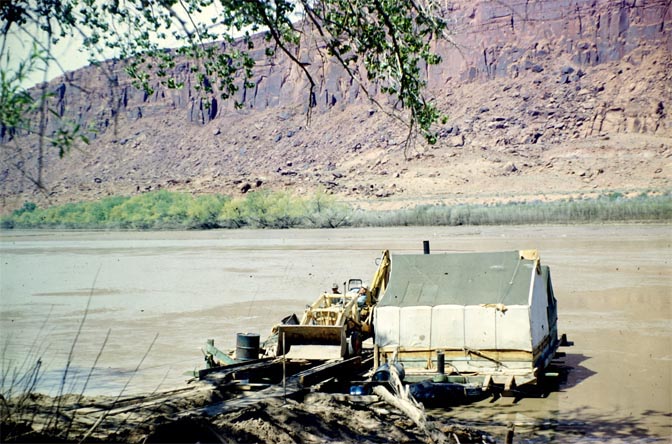
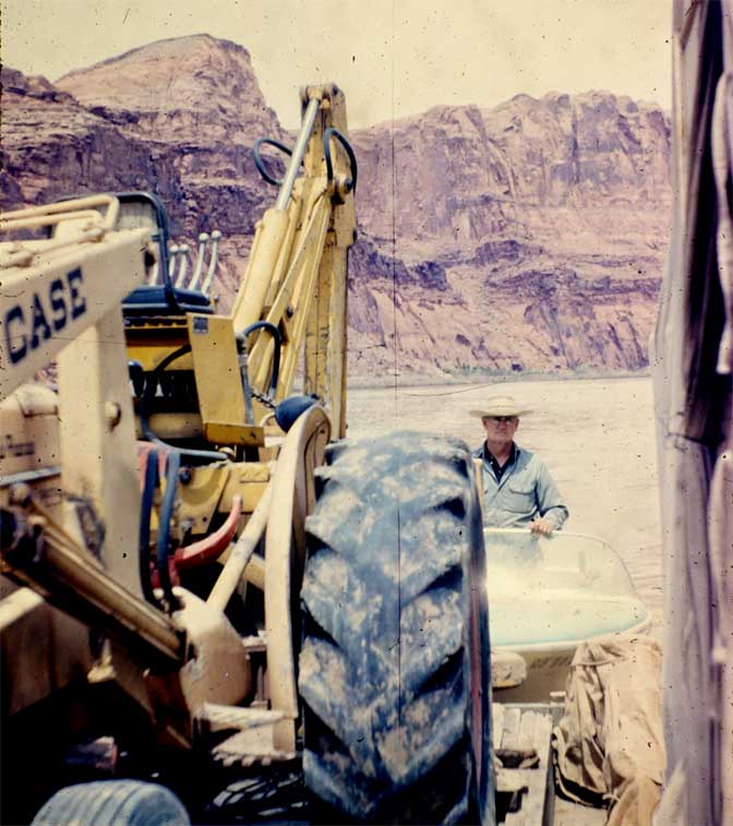
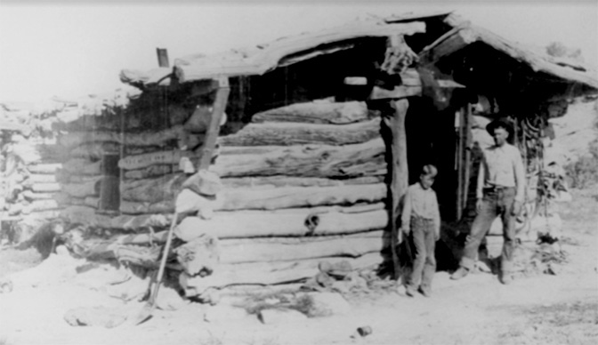
Arth Chaffin and Ruben Nielsen thought there might be non-archaeological treasures to be salvaged as well. The river had seen its share of mining operations over the last century, and even old cabins and sheds still stood. Most of them, like Bert Loper’s old cabin, were drowned by the rising waters. But there was other possible salvageable booty, and I’m just speculating here, but they were likely looking for more practical treasures, like compressors, small Diesel or gas engines, scrap iron, copper wiring, discarded tools, old drill steel, tools, ladders…the kind of material that mechanics and people tied to the mining industry might find of value.
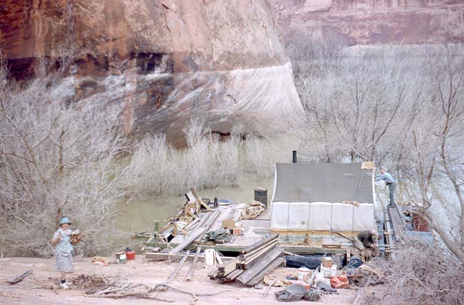
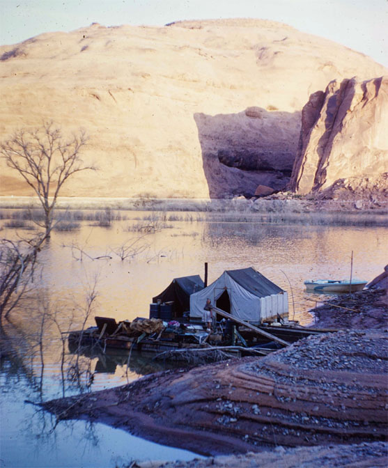
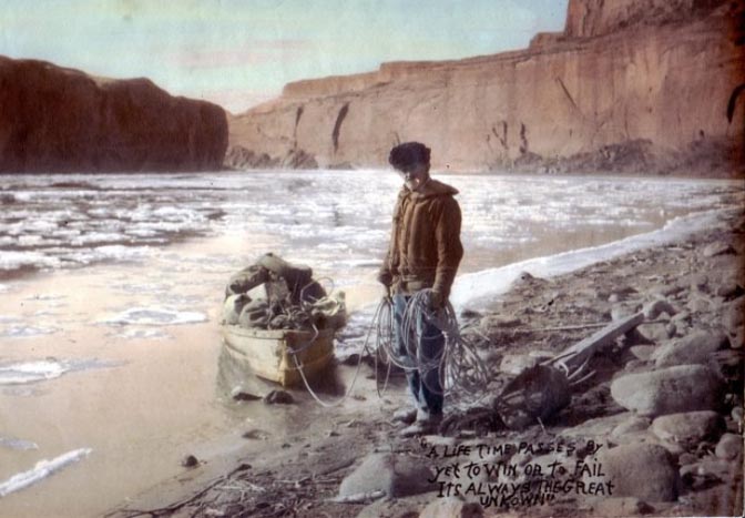
And so Arth and Ruben built a “barge.” It was constructed from empty sealed 55 gallon drums–about fifty of them— which they lashed together and over which, they constructed a crude wooden deck of sorts. On the deck, they pitched two canvas tents for their personal use.
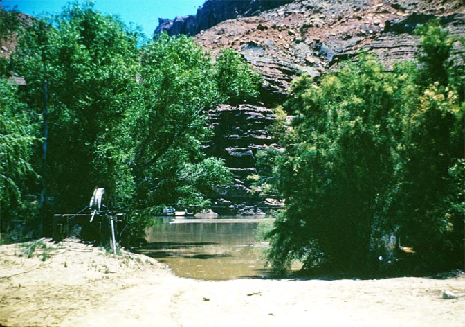
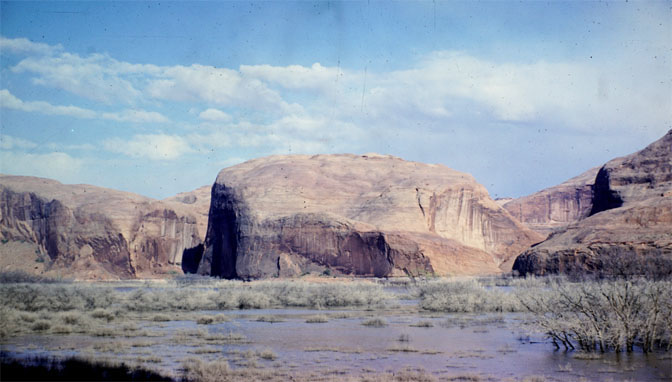
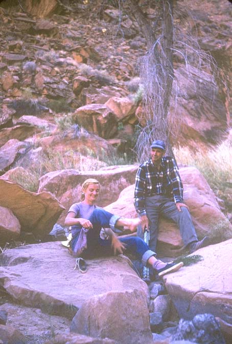
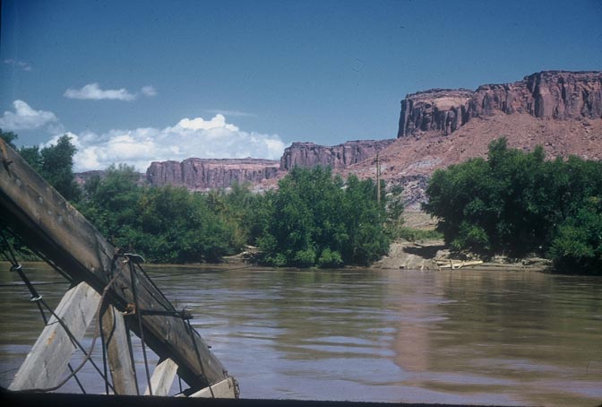
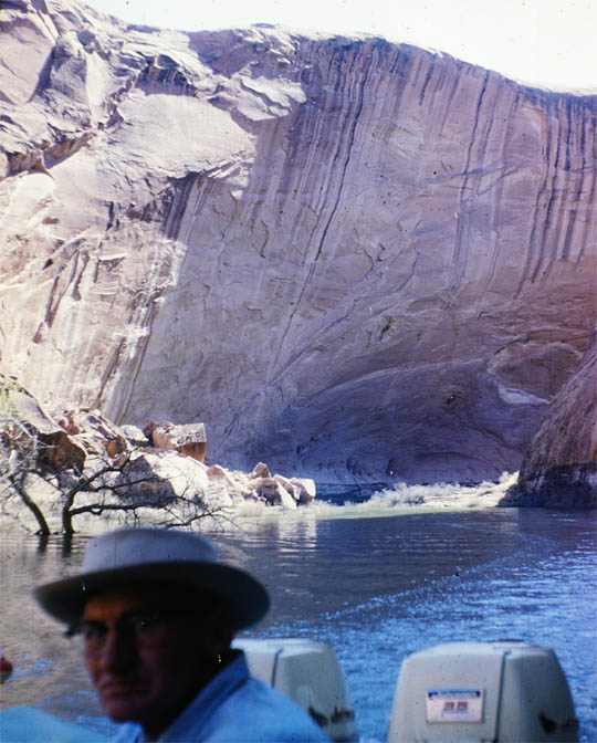
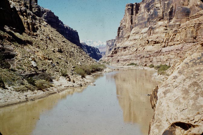
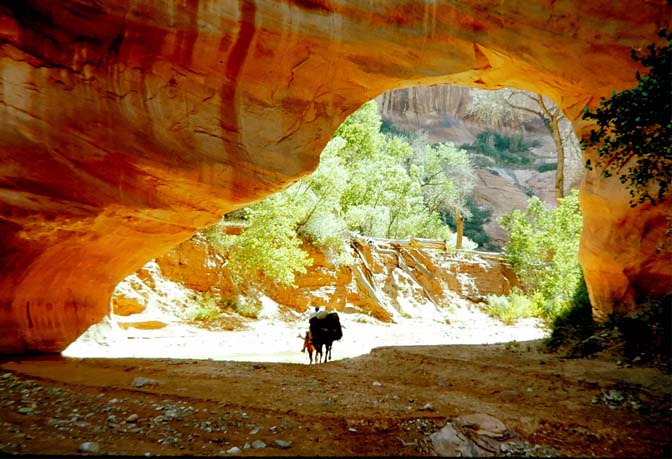
Near Forgotten Canyon. May 1964
AFTERMATH
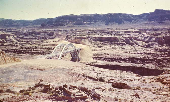
The Utah Highway Department had its work cut out for them. The ferry had been the only way to cross the Colorado River for almost twenty years. Now the plan was to bridge the river. But it wasn’t that simple. Because the reservoir would ultimately be more than a quarter mile wide at the Dirty Devil confluence, and because the topography was so rugged, UDOT was required to build three bridges at a cost of millions of dollars, to accomplish the same feat as Chaffin’s homemade ferry.
The Highway Department, coming from the east, would first have to build a bridge over White Canyon, then veer away from the old road that descended via White and Farley Canyons to the ferry, and build several miles of new road. The bridge over the Colorado River would be the biggest of the three projects, and would cross the river several miles upriver from the ferry. Finally, the highway required yet another bridge to cross the Dirty Devil River. The road would eventually climb out of the canyon and go west, up North Wash and finally, to open ground for the last 35 miles to Hanksville.
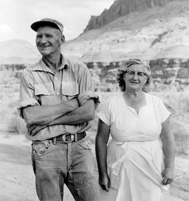
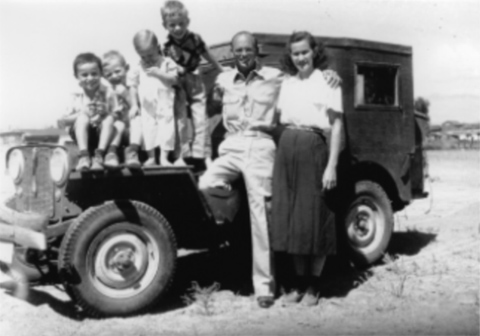
Ruben and Beth had known for almost a decade that the day would come when all their hard work would be gone. That this “little piece of Heaven” would be buried for decades and even centuries under millions of acre feet of water and hundreds of feet of silt. As we are now seeing, its not just the water, it’s the silt that falls out of solution in the Colorado River, once it hit the stagnant waters of the reservoir. Even last summer, as the lake fell to historic lows, it still doesn’t look like the Glen Canyon that the lucky few knew and remembered. Fort Moki sat on a shelf above the Hite Ferry. When the reservoir receded in 2005, the remains of the old stone fort were still there. But last summer, no one could find a trace of it. According to author Tom McCourt, the author of “White Canyon,” the silt from the river and a recent flash flood from White Canyon itself has buried the old structure. It’s gone forever.
The Nielsens’ granddaughter, Leslie Nielsen (who provided all these photos and stories, remembers that they “were resigned to the loss, and my dad says they were sad, but (they) never voiced any objections.” It was probably the last decade, where most Americans trusted their government to “do the right thing.” Imagine how quickly that prevailing attitude dissipated in the years to come.
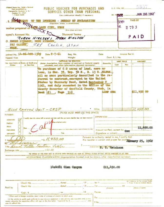
When the Bureau of Reclamation sent a letter to the Nielsens, acknowledging their acceptance of the deal BuRec had offered them, Beth added a handwritten note at the bottom of the letter, with the notation, “Thanks a million.” That was an expression Leslie heard her grandmother use many times.
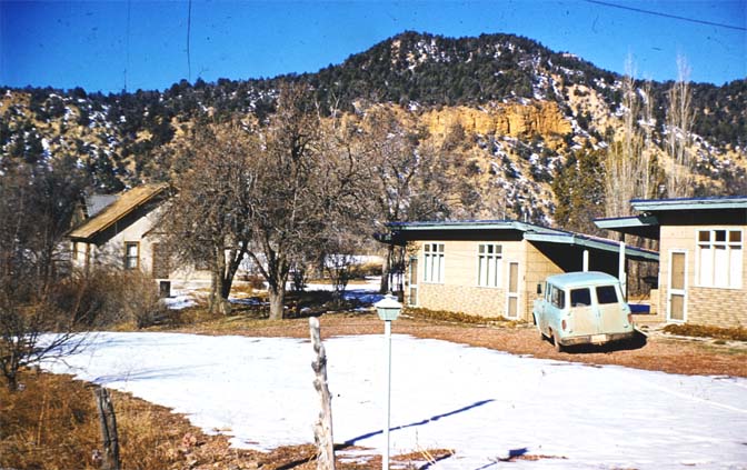
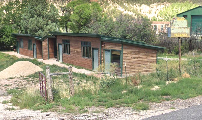
With the $11,450 for their six acres and improvements, the Nielsens bought a home and the four-unit Glendale Motel. In fact, it is still standing on the west side of Highway 89 just south of the Smith Hotel, though a recent Google photo indicates their motel has been empty for many years.
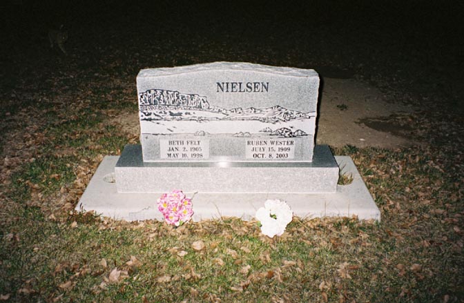
Ruben also worked as a mechanic and handyman at the Thunderbird Motel in Mount Carmel Junction through at least 1974. They lived in Glendale until 1997, when they moved to Hurricane to live closer to their two daughters. According to Leslie, her aunts Wanda Choate and Donna Joyce Mangum arranged for the artwork on the tombstone, after Ruben’s passing in 2003. They knew that Ruben and Beth “had loved Hite and Glen Canyon so passionately.”
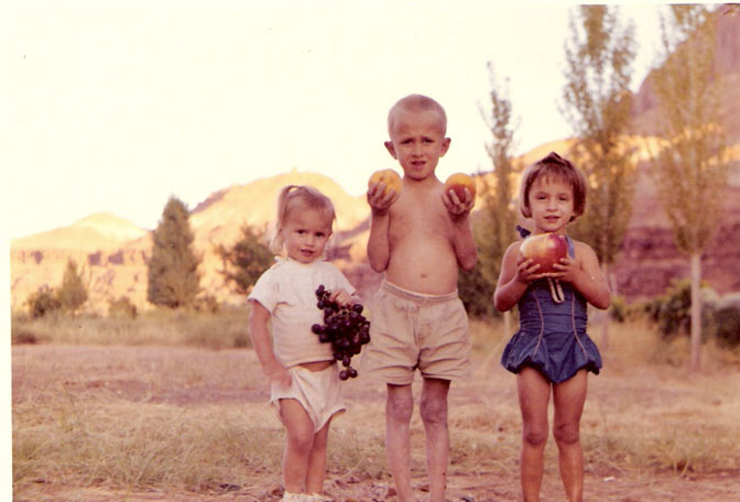
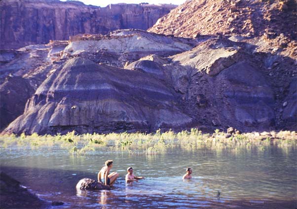
“We swam in the reservoir and river, played in the mud, played in rusted-out jalopies, looked for rocks and arrowheads, fished, explored, hiked, picnicked including along the Dirty Devil in the caves.”
Leslie Nielsen
THE FUTURE…WHAT’S NEXT?
Last autumn, the reservoir level at Lake Powell dropped to its lowest point since the lake began to fill in 1963. Suddenly many of the side canyons that had been submerged for decades came to life again. And of course, in the information age we find ourselves in, word spread far and wide that because of this prolonged drought and climate change, untold beauties were being reborn before our very eyes. National magazines, the New York Times, European travel magazines and, of course, on every social media platform one can imagine, the word was out —GLEN CANYON IS BACK.
Not so fast. Since I’ve lived through this kind of unbridled false hope before, I kept my exuberance in check. The watersheds of both the Colorado and Green Rivers saw their heaviest snowpacks in decades and while the dry ground under it absorbed a lot, the lion’s share of the runoff made it to the rivers and ultimately downstream to Powell and Hoover Dams. Before the melt, Lake Powell’s low water mark was 3519 feet (that’s the elevation above sea level, NOT the depth of the lake! I’ve seen national journalists miss that simple fact).
By July 8, 2023. the reservoir rose to 3585 feet, an increase of almost 66 feet. Now the water level is receding; how low it goes this winter will depend on water demands downstream and whatever administrative decisions the Bureau of Reclamation thinks it needs to make, in order to keep Glen Canyon Dam operational as a power generating source. And of course, next winter’s snow pack.
If the Rocky Mountains are hit with a couple more wet winters, we may see Lake Powell make a comeback similar to what it did in 2017. But again, looks are deceiving. As I’ve noted before, not only is the flow of Colorado River slowly declining, the silt that the river carries with it, settles in the calm waters of a reservoir. The water levels are going down, and the “ground” is coming UP.
***
One thing is certain, despite the drought and the water shortages, the development of the arid Southwest United States will continue unabated. Land will become too valuable to “waste” on crops. But someday…maybe not soon…maybe even if it takes a hundred years. Or even more. But some day there will be a Day of Reckoning for the errors we humans have made and continue to make.
As for Glen Canyon Dam, there have supposedly been discussions, even within the federal government, trying to resolve the crisis and long term threats that this mammoth concrete and steel obstruction will create. Once the reservoir level drops below dead pool, there’s no way to move the water downstream.
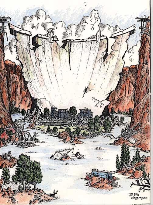
But if the technicians and engineers can’t find a solution, if we humans can’t even find a way to prolong our existence, Nature will surely step in, sooner or later. Someday in the not too distant future as measured in geologic time, the water will eat away at the softer Navajo sandstone and finally, that moment will come when the river breaches the dam, flows freely yet again, and makes it way to the Gulf of California. Some future civilization, or perhaps an alien race passing by, will see the huge concrete plug sitting alone and useless in the middle of a flowing river.
And they’ll wonder whatever could have happened here? No one could have given a better or more heartfelt reply than Beth and Ruben Nielsen.
—Jim Stiles
19963
“No, it wasn’t always this nice.
Most always, yeah, but for a little while the water didn’t flow.”
He shook his antlers and went back to browsing.
From “On the Loose.” By Terry & Renny Russell
To read the first three parts of this series about Beth and Ruben Nielsen and their time at Hite, click here, here, and here.
Jim Stiles is the publisher and editor of The Zephyr. Still ‘hopelessly clinging to the past since 1989.” Though he spent 40 years living in the canyon country of southeast Utah, Stiles now resides on the Great Plains, in a tiny farm and ranch community, Coldwater, Kansas, where there are no tourists.
He can be reached via facebook or by email: cczephyr@gmail.com
I WOULD GREATLY APPRECIATE IT IF YOU TOOK THE TIME, EVEN A MINUTE OR SO, TO COMMENT ON OUR ZEPHYR STORIES…JUST SCROLL ALL THE WAY DOWN TO THE BOTTOM OF THIS PAGE AND LET US KNOW WHAT YOU THINK…THANKS…JIM STILES


And I encourage you to “like” & “share” individual posts.
Why they can’t just leave the site alone is beyond me,
but that’s what Facebook likes to do.
ALSO NOTE: I post old photographs and stories from our 25 year old archives every day. Pictures from Herb Ringer, Edna Fridley, Charles Kreischer.. even a few old photos from my Dad. So if you want to stay caught up on our historic photo collections,
be sure to “follow” us on Facebook…Thanks…Jim
https://www.facebook.com/FansoftheCanyonCountryZephyr/

Signed copies…

https://www.facebook.com/profile.php?id=100086441524150

NOTE: The summer issue of RANGE includes a tribute to lifelong Moabite Karl Tangren.


And check out this post about Mazza & our friend Ali Sabbah,
and the greatest of culinary honors:
https://www.saltlakemagazine.com/mazza-salt-lake-city/

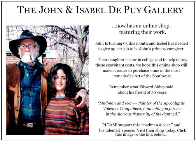
More than six years ago, The Zephyr, me & four other individuals were sued for defamation by the former Moab City Manager. Faced with mounting legal bills, my dear friends John and Isabel De Puy donated one of John’s paintings to be auctioned.
ALL the proceeds went to our defense.
Thanks to them, our bills were almost completely covered.
Now I’d like to return the favor. Check out the link below and their online shop… JS
https://www.depuygallery.com/shop.html

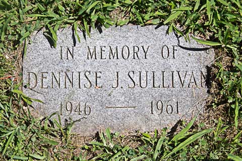
https://www.canyoncountryzephyr.com/2022/05/15/60-years-later-still-searching-for-dennise-sullivan-by-jim-stiles-zx8/
https://www.canyoncountryzephyr.com/2023/07/02/should-arches-wolfe-ranch-be-re-renamed-turnbow-cabin-jim-stiles-zx69/

And once more, now that you’ve read the latest Zephyr Extra and waded through the ads, please take a minute to comment. Thanks for your support…. Jim Stiles
“As the World Turns”, a soap opera title which pretty much depicts what is occurring along the mighty Colorado River. An old Indian gentleman in the Searchlight area once, shaking his head, opined that every 10 years or so “rains, snow comes or not”. Not very scientific maybe but perhaps as knowledgeable as Gore and some others. This historical account of the Dam building stirs various types of emotions. Keep this information coming, Jim. We all need to know the roots of what’s happening!
Thanks Donna. I always appreciate your comments as well as your own amazing knowledge of the West’s history.
A bittersweet tale of happy memories for sure. I “enjoyed” the photographic historical progression, especially the first bridge with no pavement yet leading up to it. How it was… and can never be like again, even in the millennia to come. Thanks for the great stories of Bloab’s old days.
I definitely do a better job looking back than I do thinking of the future.
It is both a curse and a blessing that the American West is arid.
A dearth of water resources makes life hard for those who depend on the land and weather to grown crops and animals and families.
A dearth of water resources also limits how much populations can grow and remain sustainable, at least in theory.
Urban areas with exploding populations such as the Phoenix metro area and Las Vegas are sucking water resources away from millions upon millions of acres of agricultural lands in Utah, Nevada and Arizona.
I’m dogged by the contradictions, and fearful of what is happening in these arid and tenuous regions.
We too easily let go of that which is certain and good–but which takes hard work to maintain–for the promises of what is more leisurely, modern and “progressive.”
Your stories are gems. Beautiful, inspiring, educational, agonizing, heart wrenching. You are a rare beauty. Even in Kansas. Keep that Zephyr rolling.
I appreciate these stories for a number of reasons. They help me understand our collective past and let me escape our present world for a little while. A part of me always hungers for the knowledge of history and you bring it on an understandable level. The pictures help make the story real. Thanks!
On the one hand we have Burec’s desperate ideas for keeping power generation at Glen Canyon Dam in operation.
On the other hand there’s the “Arizona Weather Force” (search facebook) forecaster who last year correctly went against the standard NOAA La Niña -> dry winter forecast and correctly predicted the “atmospheric river”. They also predicted that we’re entering a new 30-year period of wet winters in the Rocky Mountains. They don’t publish the science behind their analysis. Seems to me that GCD’s only hope (for the near future) depends on this group being right.
Great post – thank you for your ongoing histories of this region!
Long live Glen Canyon! Thank you for your writing; it provides the historical backdrop for an area I have been visiting for years.
I got ‘lost’ in this story. For a half hour or so I lost all track of ‘today!’ Thank you, Jim.
I love the history in these pages.
Well done, Jim! Thanks a million for telling their story.
Love the fact that you continue to write so much interesting history of the area. My Uncle Guy and Aunt Nina Robison operated the Hite Ferry for a brief time period. I need to do some research as to when they operated it. Keep on writing Jim!
Thanks, Rob.
I love your photos!
Thanks Jim, I’m happy that the Nielsens weren’t bitter about loosing their place although it was sad they kept moving forward. As always thank you for taking the time to share these amazing pictures and stories of another time when people were just happier with simple things in life.
Thank you once again for sharing this poignant story of birth, life, and death (metaphorically about Glen Canyon, of course). I was hoping you’d mention, in your brief history of the lake’s ups and downs, the super wet year of 1983 when the concrete plugs in the diversion tunnels (the tunnels had been converted to use as spillways by plugging them about halfway up and boring new channels above the old and jutting these new channels above full pool (3,700 feet)) were tested to their limits when so much water came down into the lake that it ran through the spillways for days and days. The engineers at the dam were afraid that the water rushing down the new tunnels would back-swirl against the concrete plugs when the water hit the original tunnels and erode the plugs so much that they would give way and drain the whole lake. They had to resort to putting plywood sheets above the intakes to slow down the water flow (effectively letting more water than full pool stay impounded), until finally all the rain and storms in the Rocky Mountains abated.
Hi Frederick..the 1983 floods is a topic I’ve covered several times before, but I appreciate the reminder.
This story was so interesting. I’ve always heard about Glen Canyon and the dam even though I’ve lived my whole life here in the East. The strong feelings about the lost canyons and the dam itself are fascinating. It’s a Western kind of thinking I guess. One of our major rivers in Alabama, the Coosa, is 280 miles long and is dammed 6 times. And nobody ever talks about it except if there’s some sort of emergency pollution threat on one of the lakes. A beautiful river being compromised like that isn’t ever discussed. Anyway, thanks for the good writing again. I enjoyed it and it kept me from doing my job for a bit, which is always a good thing.
I agree so much with your conclusion about the irrational exuberance surrounding the return of Glen Canyon. I spend a few days in Spring wandering the area of North Wash, White Canyon and Farley Canyon as well as Dark Canyon from above. The idea that a few waves means the canyon is returning is truly naive and wishful thinking. The hundred or more feet of silt at Dark means the old rapid is buried for a generation or so.
I loved seeing the old photographs in this article. Thank you for digging.
OMG Thank you for writing such a wonderful story. No matter one’s political/environmental philosophy this is a touching story of a unique group of people who scratched out a living in a harsh but wonderful place.
Thanks for this insightful piece of history. I remember crossing the Navajo Bridge many times in the early 50s. Since then my absolute favorite part of the country is bounded by Paria, Mexican Hat, Hanksville, and Escalante. Every historical nugget about the river is important to me, so I hope a small donation helps.
An absolutely stellar piece of work, research and writing Jim !! Your work is very much appreciated! Don
Hi, I use to live down by Hite from 1963 to 1965. Years ago I did some research and tried to find some “history” of Hite.I also have my own history of the little town. I would love to talk to someone with knowledge and pictures of Hite, and North Wash area from 1963 to 1965.
Jim – Thanks for publishing these historical photos of Glen Canyon before the dam and telling the stories of people who used to live there.