
Before I ever set foot on an airplane, I loved the view from above. Early on, my only options were tree climbing, and steep hills. Even in Kentucky, there were decent climbs that made me feel like I was almost flying. But not quite. The experience of flight is still like nothing else I can imagine and I’ve never been able to spend as much time in the air as I’d like. Commercial flights for me have been limited to a a few every year, and for the last three or four years, I’ve been ground bound. I’ve missed those views.
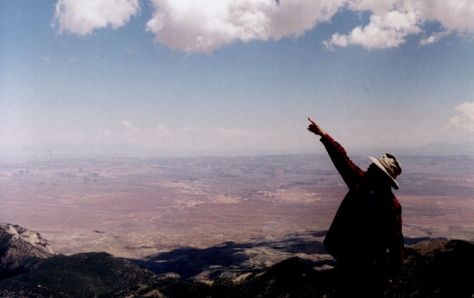
But like so much else, I have my memories and I have my pictures. I’ve been documenting my travels, both on the ground and above it, for a long time. And I have some incredible aerial images, from Edna Fridley and Charles Kreischer, that date back decades and are mostly dedicated to Southeast Utah. For the purposes of this post, I’ll mostly stick to my own photos of the Moab and Arches area. I only have these pictures thanks to the National Park Service in the late 1970s and early 1980s, and to pilot Paul Swanstrom of Mountain Flying Service.
When I was a ranger, we occasionally got in the air, either by fixed wing or helicopter, due to the never ending stream of lost hikers we dealt with over the years. Most of the searches I was involved in utilized helicopters and involved some pretty hairy, low level flights. One of my best friends, Jim Conklin, had been in a chopper crash of a Hillers helicopter during a routine flight at Grand Gulch with the BLM. He and his crewmates survived the crash, but it made all of us a bit wary, especially of the Hillers. We always felt safer in the Bell helicopters. (For more on Conklin’s crash, click here).
But we also managed to arrange a few fixed wing flights for “boundary patrols.” Later, after Reagan became president, his administrations arranged funding to the parks to look for “illegal drugs,” i.e. marijuana patches. The chances of finding pot patches at Arches were slim, but most of us loved to fly anyway, just for the views. We were never ones to turn down funding from President Reagan, to look for Reefer! Even better, I have something akin to an iron stomach and many of my fellow rangers turned green before they were barely airborne. So I often got double duty.
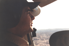
When my NPS career ended in the late 1980s, I wondered if I’d ever see the canyon country from above again. But The Zephyr provided me the access I needed. Ace pilot Paul Swanstrom flew out of Moab in the 1990s and early 2000s. I approached Paul about some Zephyr ads and we worked out a trade. He’d run eighth-page ads in every issue, in exchange for a few hours of airtime every year. We had some great flights, all over the canyon country and a couple times, all the way to Page and Glen Canyon Dam. It never occurred to me that images of the lake with a lot of water in it would ever qualify as “historic,” but if trends continue, they may be. But I’ll save them for another post.
This issue features Moab and Arches and a ways upstream and down the Colorado River. Almost all of them are from the early 1990s thanks to Paul, but a few of the Arches images date back to the late 1970s and early 1980s via those Arches pot patrols.
These photographs are especially notable, because they show just how much the town and the river have changed over the last few decades. So strap yourself in and take a flight…Swanstrom is a damn good pilot…
MOAB & VICINITY
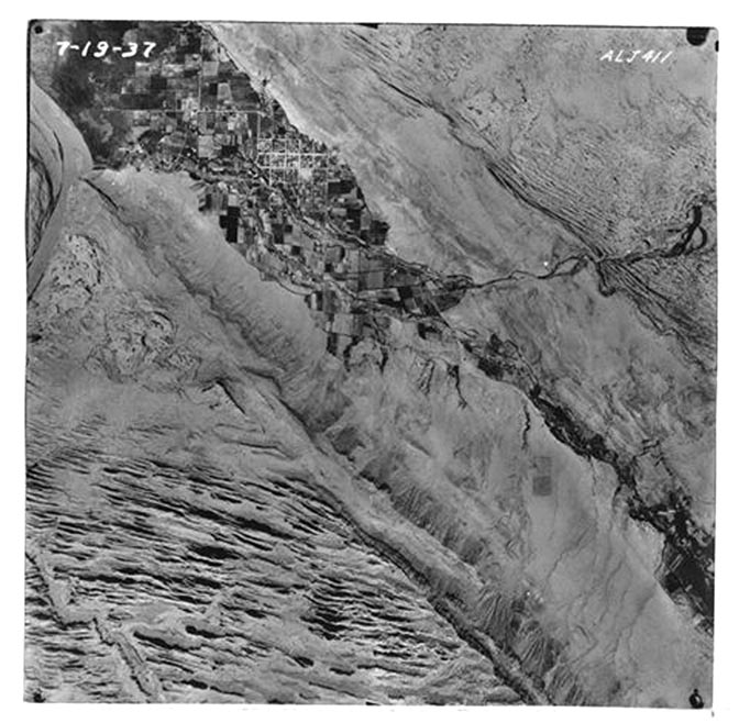
An Aerial View of Moab from 1937
One of the early flights. Looking north from near the Portal. Fifth West is the most prominent street running near vertically and right of center.
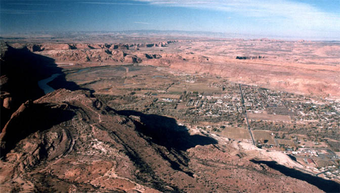
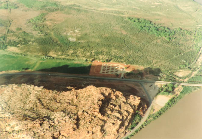
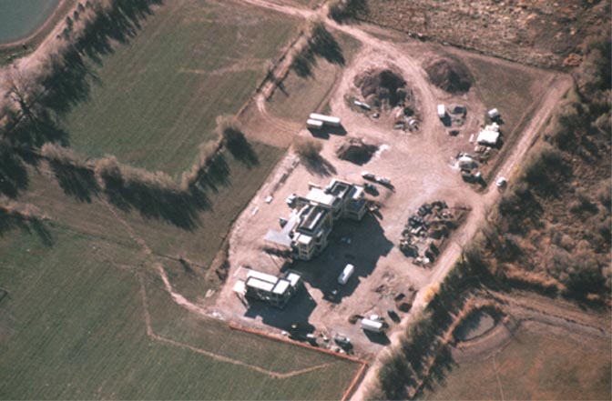
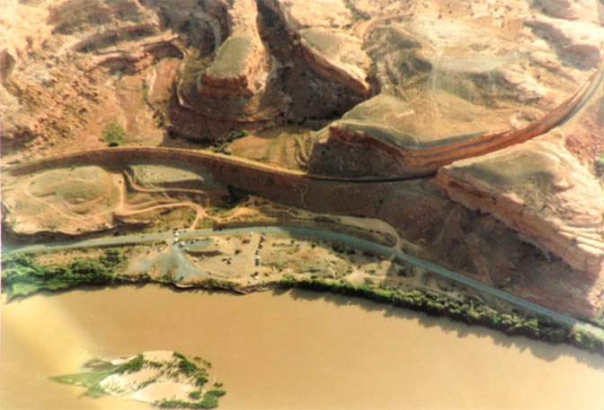
An excellent view of US 191 from the Colorado River bridge, running south to town. The north end was just beginning to be developed. You can clearly see the Doxol plant (now gone) and just adjacent to it, the Slickrock Campground. But there was one new addition— just south of the bridge was the new campground, across from the junction with Highway 128 (The River Road). In the far upper left corner is the Atlas Mill. By now the mill had shut down, but the removal of the plant infrastructure and the tailings pond was still years away.
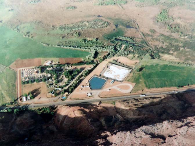
The junction of US 191 and Utah 128 was much as it had been for years, with the exception of the new campground. The Lions Park, adjacent to the river, was still a quiet place for overflow campers, as was most of the river corridor. But by the early 90s, that was changing rapidly. For decades, overflow campers could find a spot amidst the dense stands of tamarisk that grew along the river. You’ll see more of those images below.
For decades the Doxol plant was an underground storage facility for liquid propane. It was stored in vast undergound caverns created by salt domes which, in fact, helped create much of he nearby scenery. On July 31, 1981a violent explosion at the plant killed four campers at the adjacent campground. There was a genuine fear that the tanks could explode and had it not been for the actions of Doug Farnsworth, who suffered severe burns shutting off the valves, the disaster could have been much worse. For a complete account of the incident, read Bill Davis’s Zephyr story here.
In the late 1990s, Moab began to draw the attention of the wealthy. The first of the “Mega-Billionaires” to discover Moab was venture capitalist David Bonderman. While the leveraged buyout king was invested in everything from hamburgers to oil and gas developments and palm oil to budget airlines, he and other wealthy elite became sponsors and benefactors to almost every environmental organization one can imagine. From small grassroots groups to national organizations, Bonderman et all had their fingers in “defending” the wildlands in Southeast Utah. Bonderman’s 10,000+ square foot home took over a decade to build.
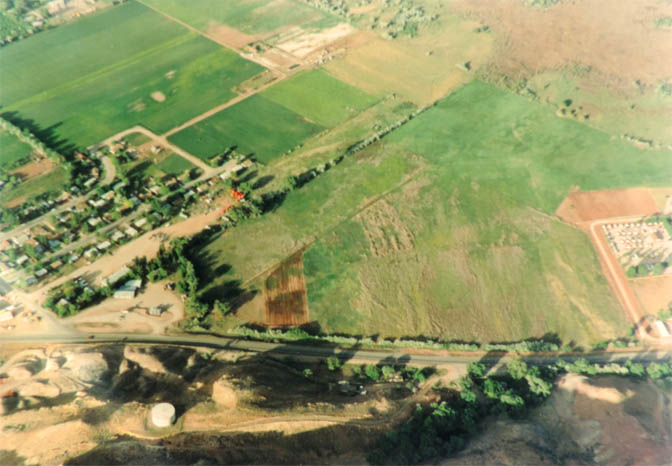
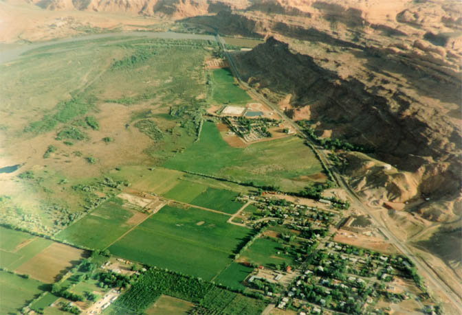
This view, just north of town looks across the highway from what is now the Moab Springs Resort. The last time I asked, part of that open field just west of US 191 was till open, though the left side of the open space is now the Motel 6. How long that field will stay there is anybody’s guess.
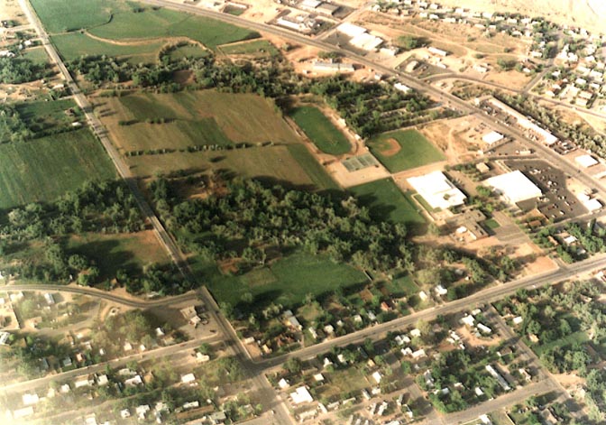
If you know Moab, look closely and you can figure this one out, and contemplate how much has changed. The highway at the top of the picture, curving to the left, is US 191. I’m guessing this is about 1992 because the McDonalds, at the junction of Main and Kane Creek Blvd. is already up and running. The road running from the upper left corner to the bottom center is 400 East. Look closelt to find Milt’s Stop n’ Eat and the Corner Market. The horse pasture across from Dave’s is s till there. And the new high school hadn’t begun construction either. Fourth East still looked and felt like a country lane.
By the middle of the 2000s, change was coming rapidly to Moab and Spanish Valley. We had seen the “Coming Soon” sign for Rim Village” a year or so earlier, but had not expected it to be as big as it turned out to be. It was the beginning of many changed that were “bigger than expected.” And way more expensive.
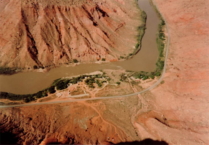
THE RIVER CORRIDOR
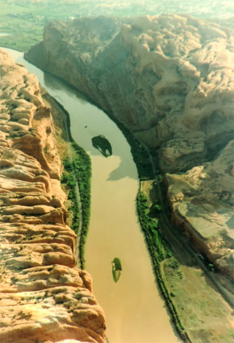
This is looking downstream from near the Portal. On the right is the Potash Road; on the left is what we once called The Egg Ranch Road. Miller’s Grocery had its own “indoor” egg ranch. A blasted out chamber in the sandstone provided most of Moab’s eggs. That was a long time ago. Now, I believe that green wide patch on the left side of the river and just right of the road is the site of Moab’s latest High End Residential Obscenity.
Few ever notice the cut or the tunnel, but whether you like it or not, it is impressive to remember what humans can accomplish with enough dynamite and heavy equipment.
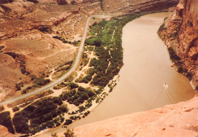
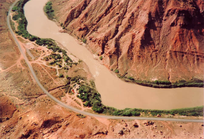
To orient yourself, this is upstream from the bridge, less than a mile. The elevated bikeway now follows the river near the top of the photo and resumes just after the bottom left of this image. Most of the unofficial campsites in the tamarisk are closed. And in fact, much of the tamarisk itself is gone, since the introduction of the tammie eating beetle.
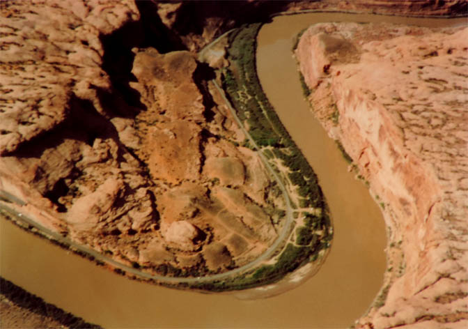
This was an established but unofficial campground for decades before the BLM built hardened campsites and pay stations. It was known as Moose Park to most locals and hopefully, the old sandstone picnic tables are still there. But by the late 1980s, it was getting busy. Below is another view from a different angle.
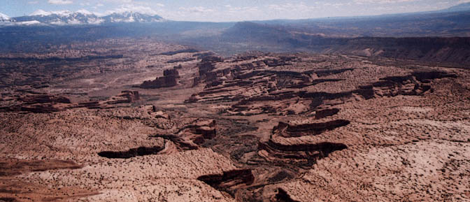
ARCHES NATIONAL PARK
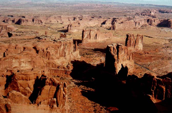
This is probably one view that hasn’t changed much, with one exception — the traffic. This photograph is from the late 1970s, when Arches averaged about 325,000 visitors a year. The number now approaches 2 million.
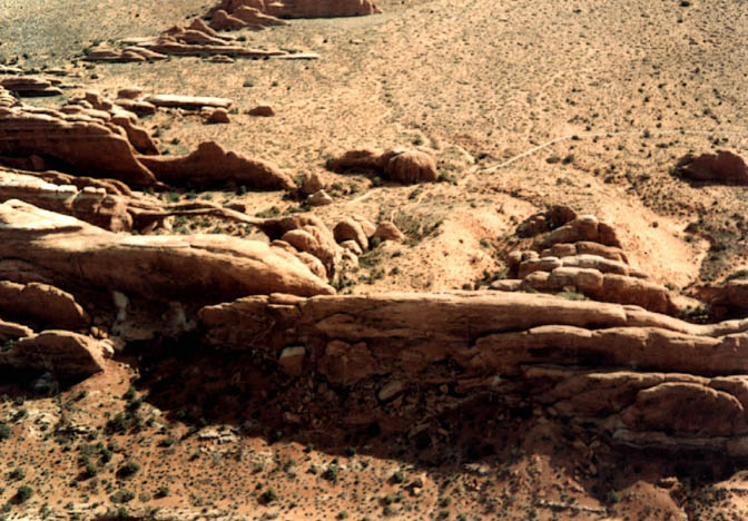
The road to the viewpoint was still dirt when this photo was taken in the late 80s. At the time, the view point climbed the ridge to the south of delicate Arch to the parking lot. That was closed when the road was paved. Now the parking lot is near the junction with the four wheel drive road to Dry Mesa and Cache Valley.
Looking south toward the Moab Valley and the La Sal Mountains. From the early 1980s
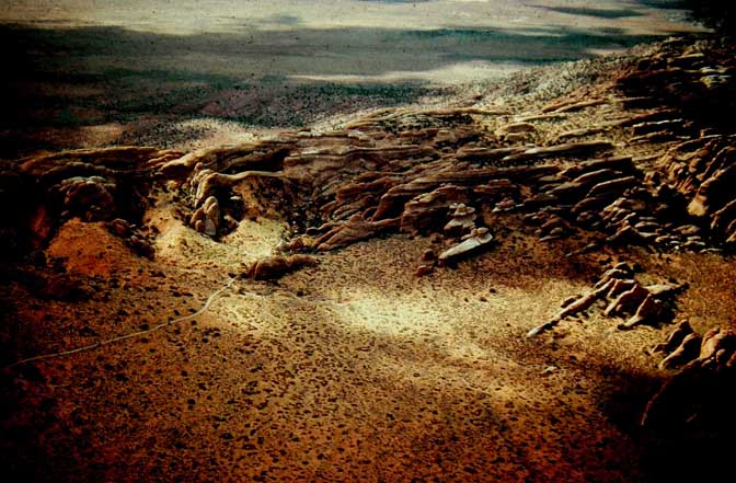
A beautiful stormy day at Arches. The clouds were moving so rapidly, the views changed by the moment. At left center is Landscape Arch and the main trail.
We were flying the spine of the Devils Garden, just to the west of Landscape Arch and caught this view of it as we headed northwest.
(Two Years Before Charlie Steen & the Uranium Boom
COMING IN A FEW WEEKS…PART 2: Lake Powell, Glen Canyon, Hanksville, Gateway, and a few surprises.
Jim Stiles is the publisher and editor of The Zephyr. Still “hopelessly clinging to the past since 1989.” Though he spent 40 years living in the canyon country of southeast Utah, Stiles now resides with two cats, Rambo & Rascal, on the Great Plains. Coldwater, Kansas is a tiny farm and ranch community, where there are no tourists.
He can be reached via facebook. Messenger, or by email: cczephyr@gmail.com

“We never understood…until it was too late.”
TO COMMENT ON THIS POST, PLEASE SCROLL TO THE BOTTOM OF THIS PAGE


And I encourage you to “like” & “share” individual posts.
Why they can’t just leave the site alone is beyond me,
but that’s what Facebook likes to do.
ALSO NOTE: I post old photographs and stories from our 25 year old archives every day. Pictures from Herb Ringer, Edna Fridley, Charles Kreischer.. even a few old photos from my Dad. So if you want to stay caught up on our historic photo collections,
be sure to “follow” us on Facebook…Thanks…Jim
https://www.facebook.com/FansoftheCanyonCountryZephyr/

$55 Each or Two for $100 (Free Shipping.)
https://www.facebook.com/profile.php?id=100086441524150


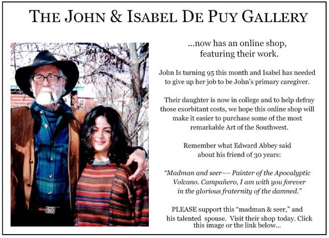
More than six years ago, The Zephyr, me & four other individuals were sued for defamation by the former Moab City Manager. Faced with mounting legal bills, my dear friends John and Isabel De Puy donated one of John’s paintings to be auctioned.
ALL the proceeds went to our defense.
Thanks to them, our bills were almost completely covered.
Now I’d like to return the favor. Check out the link below and their online shop… JS
https://www.depuygallery.com/


And check out this post about Mazza & our friend Ali Sabbah,
and the greatest of culinary honors:
https://www.saltlakemagazine.com/mazza-salt-lake-city/


https://www.canyoncountryzephyr.com/
Really cool photos, especially the ones of Arches and the river. Thanks for sharing. (By the way, the link seemed broken from my mobile. I had to do an online search to find these.)
Love the Merle Haggard song!!!
Love the old views.
I was only there in 2018 and 2019 but I can see some familiar scenes.
Marvelous images. The dates give them a nutty flavor, with a smidge of lostness in the marinade. That last one from 1950 gave me a chill. The word Change did not used to affect me the way it does now. Brrrr. Thank you Jim, and old NPS, and Paul, for the treats. (Even though, unlike Jim, I am a creature who prefers to crawl about the surface of the earth as deliberately as I can get away with. Feet, not wings. Snout down.)
Great photos and historical context, Jim! I wonder if the tamarisk eradication is having the desired effect?
Thank you for this. It is so enjoyable to gaze through whenever I feel the need to. We’ve been going to Moab since about ’78. Was just there over Christmas and again a couple of weeks ago. So wonderful to be there before the spring break invades.
Thanks Jim good stuff as always.
Rest In Peace Jim. It’s hard reading what turns out to be your last piece in the old Z. I will miss you. Thanks for all the years of your hard work. M
It’s the end of an era. There is one less voice crying in the wilderness and hopelessly clinging to the past. For decades, I figured someday I’d write to him and tell him how much we have in common and suggest maybe sometime we could meet up for a beer and bitchfest. Now it’s too late. Shitfire. I too ask what becomes of this priceless treasure, the recorded history, the insights, the 30+ years of work. Maybe the heartbreak of Moab was more than he could handle, so he went home to be with Dog. And Abbey. To that great secret canyon in the sky, where there are no tourists, no fun-hogs, no real estate developers, and no goddamn internet to ruin all the great places. So, when and where is the wake?
Slickrock Slim
Fantastic pictures!! Love Southern Utah!
So very, very sad and bummed that this was Jim’s final article. Ironically, it is very fitting for the mission and legacy of the Zephyr…
I did wonder why the emails had stopped. RIP fella x.
RIP Jim Stiles. You left your mark on Moab. I’ll miss your posts.